Area Overview for NR9 5AE
Photos of NR9 5AE

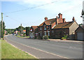


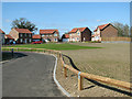


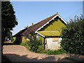


16 photos from this area
Area Information
Key information about the NR9 5AE including its size, population, and administrative classification.
- Area Type
- Postcode
- Area Size
- 8.2 hectares
- Population
- 1462
- Population Density
- 51 people/km²
House Prices in NR9 5AE
51
Properties
£206,207
Average Sold Price
£18,600
Lowest Price
£320,000
Highest Price
Showing 51 properties
| Address | Type | Beds | Baths | Last Sale Price | Last Sale Date | |
|---|---|---|---|---|---|---|
| 45 Fakenham Road, Great Witchingham, NR9 5AE | Semi-detached | 4 | 2 | £265,000 | Aug 2025 | |
| 68 Fakenham Road, Great Witchingham, NR9 5AE | Semi-detached | 3 | 3 | £300,000 | Jun 2025 | |
| 47 Fakenham Road, Great Witchingham, NR9 5AE | Semi-detached | 2 | 1 | £200,000 | Feb 2024 | |
| 39 Fakenham Road, Great Witchingham, NR9 5AE | Semi-detached | 3 | 2 | £280,000 | Aug 2023 | |
| 49 Fakenham Road, Great Witchingham, NR9 5AE | house | - | - | £320,000 | Feb 2022 | |
| 70 Fakenham Road, Great Witchingham, NR9 5AE | Bungalow | - | - | £267,500 | Apr 2021 | |
| 51 Fakenham Road, Great Witchingham, NR9 5AE | Cottage | 4 | 2 | £226,500 | Apr 2021 | |
| 77 Fakenham Road, Great Witchingham, NR9 5AE | house | - | - | £255,000 | Mar 2021 | |
| 37 Fakenham Road, Great Witchingham, NR9 5AE | Terraced | 3 | 1 | £305,000 | Aug 2020 | |
| 88 Fakenham Road, Great Witchingham, NR9 5AE | house | - | - | £205,000 | Feb 2020 |
Page 1 of 6
Energy Efficiency in NR9 5AE
Amenities
Schools
| Rank | School | Type | Entry gender | Ages |
|---|
Explore more schools in this area
Go to Schools tabDemographics
Household Size
Two person
most common
Accommodation Type
Houses
most common
Tenure
75
majority
Ethnic Group
White
most common
Religion
N/A
most common
Household Composition
N/A
most common
Age
47
median
Adults (30-64 years)
most common
Household Deprivation
N/A
with no deprivation
NS-SEC
35
in Lower managerial occupations
Explore more demographic insights in this area
Go to Demographics tabPlanning
Planning Constraints
- Flood RiskPremium
- Ramsar Wetland SitesPremium
- Area of Outstanding Natural BeautyPremium
- Protected Nature ReservePremium
- Protected WoodlandPremium