Area Overview for NR9 4QH
Photos of NR9 4QH
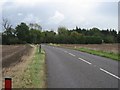
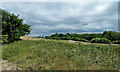
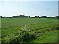
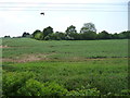
16 photos from this area
Area Information
Key information about the NR9 4QH including its size, population, and administrative classification.
- Area Type
- Postcode
- Area Size
- 61.0 hectares
- Population
- 1583
- Population Density
- 63 people/km²
House Prices in NR9 4QH
14
Properties
£341,667
Average Sold Price
£150,000
Lowest Price
£525,000
Highest Price
Showing 14 properties
| Address | Type | Beds | Baths | Last Sale Price | Last Sale Date | |
|---|---|---|---|---|---|---|
| Thuxton Grange, Dereham Road, Garvestone, NR9 4QH | Detached | 5 | 2 | £525,000 | Jan 2021 | |
| Horseshoe Cottage, Dereham Road, Garvestone, NR9 4QH | Semi-detached | 3 | 1 | £150,000 | Jan 2020 | |
| Highview House, Dereham Road, Garvestone, NR9 4QH | Detached | 4 | 3 | £350,000 | Jun 2019 | |
| Mobile Home, Ling Farm, The Lings, Garvestone, NR9 4QH | Mobile Home | - | - | - | - | |
| 3 Seamans Cottages, Dereham Road, Garvestone, NR9 4QH | Semi-detached | - | - | - | - | |
| 4 Seamans Cottages, Dereham Road, Garvestone, NR9 4QH | Semi-detached | - | - | - | - | |
| 5 Seamans Cottages, Dereham Road, Garvestone, NR9 4QH | Detached | - | - | - | - | |
| Re Woods Cabinet Maker, Workshop, Dereham Road, Garvestone, NR9 4QH | Industrial | - | - | - | - | |
| Lings Farm West, The Lings, Garvestone, NR9 4QH | Detached | - | - | - | - | |
| Thuxton House, The Lings, Garvestone, NR9 4QH | Detached | - | - | - | - |
Page 1 of 2
Energy Efficiency in NR9 4QH
Amenities
Schools
| Rank | School | Type | Entry gender | Ages |
|---|
Explore more schools in this area
Go to Schools tabDemographics
Household Size
Two person
most common
Accommodation Type
Houses
most common
Tenure
79
majority
Ethnic Group
White
most common
Religion
N/A
most common
Household Composition
N/A
most common
Age
47
median
Adults (30-64 years)
most common
Household Deprivation
N/A
with no deprivation
NS-SEC
36
in Lower managerial occupations
Explore more demographic insights in this area
Go to Demographics tabPlanning
Planning Constraints
- Flood RiskPremium
- Ramsar Wetland SitesPremium
- Area of Outstanding Natural BeautyPremium
- Protected Nature ReservePremium
- Protected WoodlandPremium