Area Overview for NR9 3LB
Photos of NR9 3LB
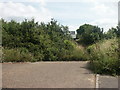
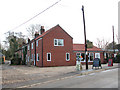
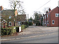
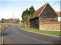


69 photos from this area
Area Information
Key information about the NR9 3LB including its size, population, and administrative classification.
- Area Type
- Postcode
- Area Size
- 1.1 hectares
- Population
- 2194
- Population Density
- 178 people/km²
House Prices in NR9 3LB
16
Properties
£125,833
Average Sold Price
£60,000
Lowest Price
£235,000
Highest Price
Showing 16 properties
| Address | Type | Beds | Baths | Last Sale Price | Last Sale Date | |
|---|---|---|---|---|---|---|
| 125 School Lane, Little Melton, NR9 3LB | Semi-detached | 3 | 1 | £235,000 | Aug 2017 | |
| 123 School Lane, Little Melton, NR9 3LB | Semi-detached | - | - | £82,500 | Jun 1998 | |
| 127 School Lane, Little Melton, NR9 3LB | Detached | 1 | 2 | £60,000 | Mar 1996 | |
| Pain Experts, Office 1, Oak Lodge Business Centre, 129 School Lane, Little Melton, NR9 3LB | Office | - | - | - | - | |
| Byte, Office 12, Oak Lodge Business Centre, 129 School Lane, Little Melton, NR9 3LB | Office | - | - | - | - | |
| Compleat Software, Office 15, Oak Lodge Business Centre, 129 School Lane, Little Melton, NR9 3LB | Office | - | - | - | - | |
| Complete Financial Centre, Office 8, Oak Lodge Business Centre, 129 School Lane, Little Melton, NR9 3LB | Office | - | - | - | - | |
| Fairhead Bradford, Office 4, Oak Lodge Business Centre, 129 School Lane, Little Melton, NR9 3LB | Office | - | - | - | - | |
| Compleat Software, Office 19, Oak Lodge Business Centre, 129 School Lane, Little Melton, NR9 3LB | Office | - | - | - | - | |
| Diamond Skincare, Office 14, Oak Lodge Business Centre, 129 School Lane, Little Melton, NR9 3LB | Office | - | - | - | - |
Page 1 of 2
Energy Efficiency in NR9 3LB
Amenities
Schools
| Rank | School | Type | Entry gender | Ages |
|---|
Explore more schools in this area
Go to Schools tabDemographics
Household Size
Two person
most common
Accommodation Type
Houses
most common
Tenure
76
majority
Ethnic Group
White
most common
Religion
N/A
most common
Household Composition
N/A
most common
Age
47
median
Adults (30-64 years)
most common
Household Deprivation
N/A
with no deprivation
NS-SEC
47
in Lower managerial occupations
Explore more demographic insights in this area
Go to Demographics tabPlanning
Planning Constraints
- Flood RiskPremium
- Ramsar Wetland SitesPremium
- Area of Outstanding Natural BeautyPremium
- Protected Nature ReservePremium
- Protected WoodlandPremium