Area Overview for NR9 3HB
Photos of NR9 3HB
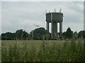
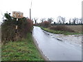
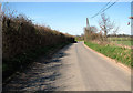
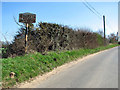
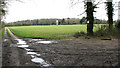
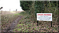
27 photos from this area
Area Information
Key information about the NR9 3HB including its size, population, and administrative classification.
- Area Type
- Postcode
- Area Size
- 4.6 hectares
- Population
- 1772
- Population Density
- 583 people/km²
House Prices in NR9 3HB
48
Properties
£287,146
Average Sold Price
£27,000
Lowest Price
£620,000
Highest Price
Showing 48 properties
| Address | Type | Beds | Baths | Last Sale Price | Last Sale Date | |
|---|---|---|---|---|---|---|
| 74 Great Melton Road, Hethersett, NR9 3HB | Detached | 4 | 2 | £420,000 | Apr 2025 | |
| 68 Great Melton Road, Hethersett, NR9 3HB | Detached | 4 | 2 | £620,000 | Mar 2025 | |
| 78 Great Melton Road, Hethersett, NR9 3HB | Detached | 4 | - | £330,000 | Oct 2024 | |
| 96 Great Melton Road, Hethersett, NR9 3HB | house | - | - | £350,000 | Jan 2024 | |
| 90 Great Melton Road, Hethersett, NR9 3HB | Detached | 4 | 2 | £447,000 | Mar 2023 | |
| 72 Great Melton Road, Hethersett, NR9 3HB | Detached | 3 | 2 | £394,500 | Dec 2021 | |
| 61 Great Melton Road, Hethersett, NR9 3HB | Bungalow | 4 | - | £350,000 | Jun 2021 | |
| 97 Great Melton Road, Hethersett, NR9 3HB | Bungalow | - | - | £325,000 | Apr 2021 | |
| 86 Great Melton Road, Hethersett, NR9 3HB | Terraced | 2 | 1 | £270,000 | Oct 2018 | |
| 92 Great Melton Road, Hethersett, NR9 3HB | Detached | 5 | 3 | £435,000 | Apr 2018 |
Page 1 of 5
Energy Efficiency in NR9 3HB
Amenities
Schools
| Rank | School | Type | Entry gender | Ages |
|---|
Explore more schools in this area
Go to Schools tabDemographics
Household Size
Two person
most common
Accommodation Type
Houses
most common
Tenure
83
majority
Ethnic Group
White
most common
Religion
N/A
most common
Household Composition
N/A
most common
Age
47
median
Adults (30-64 years)
most common
Household Deprivation
N/A
with no deprivation
NS-SEC
40
in Lower managerial occupations
Explore more demographic insights in this area
Go to Demographics tabPlanning
Planning Constraints
- Flood RiskPremium
- Ramsar Wetland SitesPremium
- Area of Outstanding Natural BeautyPremium
- Protected Nature ReservePremium
- Protected WoodlandPremium