Area Overview for NR9 3EB
Photos of NR9 3EB
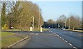
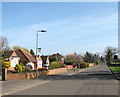
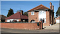
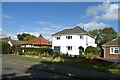
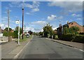
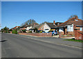
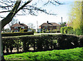
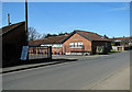
31 photos from this area
Area Information
Key information about the NR9 3EB including its size, population, and administrative classification.
- Area Type
- Postcode
- Area Size
- 3.1 hectares
- Population
- 1021
- Population Density
- 3241 people/km²
House Prices in NR9 3EB
49
Properties
£193,429
Average Sold Price
£65,000
Lowest Price
£240,000
Highest Price
Showing 49 properties
| Address | Type | Beds | Baths | Last Sale Price | Last Sale Date | |
|---|---|---|---|---|---|---|
| 20 South Croft, Hethersett, NR9 3EB | Terraced | 2 | 1 | £240,000 | May 2025 | |
| 14 South Croft, Hethersett, NR9 3EB | Semi-detached | 2 | 1 | £235,000 | Nov 2019 | |
| 5 South Croft, Hethersett, NR9 3EB | Semi-detached | 3 | 1 | £230,000 | Aug 2019 | |
| Phoenix House, 2A South Croft, Hethersett, NR9 3EB | Bungalow | 4 | 2 | £215,000 | Nov 2015 | |
| 29 South Croft, Hethersett, NR9 3EB | Bungalow | 3 | - | £186,000 | Dec 2010 | |
| 1 South Croft, Hethersett, NR9 3EB | Bungalow | 4 | - | £183,000 | Dec 2004 | |
| 30 South Croft, Hethersett, NR9 3EB | house | - | - | £65,000 | May 2000 | |
| 50 South Croft, Hethersett, NR9 3EB | Bungalow | 2 | 1 | - | - | |
| 3A South Croft, Hethersett, NR9 3EB | Semi-detached | 3 | 1 | - | - | |
| 19 South Croft, Hethersett, NR9 3EB | Bungalow | - | - | - | - |
Page 1 of 5
Energy Efficiency in NR9 3EB
Amenities
Schools
| Rank | School | Type | Entry gender | Ages |
|---|
Explore more schools in this area
Go to Schools tabDemographics
Household Size
One person
most common
Accommodation Type
Houses
most common
Tenure
56
majority
Ethnic Group
White
most common
Religion
N/A
most common
Household Composition
N/A
most common
Age
47
median
Elderly (65+ years)
most common
Household Deprivation
N/A
with no deprivation
NS-SEC
27
in Lower managerial occupations
Explore more demographic insights in this area
Go to Demographics tabPlanning
Planning Constraints
- Flood RiskPremium
- Ramsar Wetland SitesPremium
- Area of Outstanding Natural BeautyPremium
- Protected Nature ReservePremium
- Protected WoodlandPremium