Area Overview for NR8 6SG
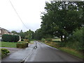
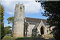
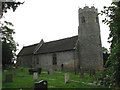
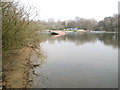
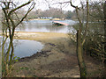
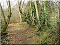
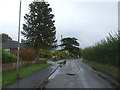
Photos of NR8 6SG

Area Information
Living in NR8 6SG means residing in a compact residential cluster defined by a specific postcode. This small area covers 8.5 hectares and is home to 1525 residents. The concentration of people results in a density of 1139 individuals per square kilometre, creating a closely knit environment without the sprawl of larger developments. You will find this location situated within England, offering a specific slice of domestic life characterised by its modest size relative to its population. The community is established enough to support shared local norms yet small enough that neighbours often operate within a familiar radius. Daily life revolves around the immediate surroundings of this postcode, where the physical footprint directly influences social interaction and local governance. The area functions as a distinct unit within the broader regional landscape, providing a stable setting for those who prioritise a defined home territory over expansive suburbs.
- Area Type
- Postcode
- Area Size
- 8.5 hectares
- Population
- 1525
- Population Density
- 1139 people/km²
You will encounter a property market in NR8 6SG that is overwhelmingly dominated by owner-occupied homes. With a home ownership rate of 91 per cent, the local housing stock is not geared towards the short-term rental sector. Instead, the area consists primarily of houses, which aligns with the high percentage of residents who purchased their properties rather than renting. This structure means that buyers looking for homes in NR8 6SG are joining a community where people tend to stay put and invest in their residences. The low presence of rental properties suggests a quieter market dynamic compared to student hubs or commuter towns with high turnover. When considering living in NR8 6SG, you are entering an environment where property values are likely influenced by owners maintaining their estates rather than transient landlords. The predominance of houses over flats or other accommodation types further narrows the search for potential buyers, appealing specifically to those seeking detached or semi-detached living spaces rather than urban-style apartments.
House Prices in NR8 6SG
Showing 20 properties
| Address | Type | Beds | Baths | Last Sale Price | Last Sale Date | |
|---|---|---|---|---|---|---|
| 167 Taverham Road, Taverham, NR8 6SG | house | - | - | £625,000 | Mar 2022 | |
| 107 Taverham Road, Taverham, NR8 6SG | Bungalow | 3 | - | £565,000 | Nov 2021 | |
| Ile Ayo, 149 Taverham Road, Taverham, NR8 6SG | Detached | 6 | 1 | £570,000 | Aug 2020 | |
| 117 Taverham Road, Taverham, NR8 6SG | Bungalow | - | - | £305,000 | Jul 2016 | |
| 119 Taverham Road, Taverham, NR8 6SG | Bungalow | - | - | £249,995 | Feb 2014 | |
| 111 Taverham Road, Taverham, NR8 6SG | house | 4 | - | £645,000 | Aug 2011 | |
| 115 Taverham Road, Taverham, NR8 6SG | Detached | - | - | £335,000 | Feb 2007 | |
| 129 Taverham Road, Taverham, NR8 6SG | Detached | - | - | £240,000 | Oct 2001 | |
| 169 Taverham Road, Taverham, NR8 6SG | Detached | - | - | £153,000 | Aug 1996 | |
| 113 Taverham Road, Taverham, NR8 6SG | Detached | 4 | 2 | - | - |
Energy Efficiency in NR8 6SG
Your lifestyle in NR8 6SG is bolstered by convenient access to key amenities within a short practical distance. Retail options are plentiful, with five notable shops nearby. You can visit Tesco Drayton, Tesco Taverham, or Tesco Thorpe Mariott for regular shopping trips without needing to travel far. These Tesco outlets serve the immediate retail needs of residents for groceries and daily essentials. Transport links further support an active lifestyle, with Norwich Railway Station and Norwich International Airport both accessible from this location. These facilities provide easy access to wider regional networks and international travel. The combination of multiple supermarket choices and major transport hubs creates a convenient environment where daily errands and occasional trips are manageable without long commutes. Living in NR8 6SG means you have the major retailers like Tesco and significant transport nodes like the airport at your fingertips. This accessibility ensures that despite being a small residential cluster, you are not isolated from the wider economy or transport network.
Amenities
Schools
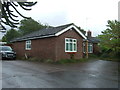
Families living in or considering NR8 6SG have access to quality education options immediately nearby. Ghost Hill Infant & Nursery School serves as a primary educational institution in the vicinity. Just across the same postcode boundary exists Ghost Hill Infant and Nursery School, which operates as an academy. Most notably, this academy holds an outstanding Ofsted rating, a significant indicator of educational excellence for parents researching schools near NR8 6SG. The presence of two institutions with similar names suggests a dedicated cluster of early years education. The mix of a standard primary school and an academy provides families with choices within the early childhood and primary education stages. This concentration of rated schools means you do not need to look far beyond your local area to find reputable learning environments for your children. The outstanding rating attaching to one of the schools is a concrete fact that supports the area's appeal to families prioritising academic standards alongside location.
| Rank | School | Type | Entry gender | Ages |
|---|
Explore more schools in this area
Go to Schools tabDemographics
The community in NR8 6SG is shaped by a mature demographic profile with a median age of 47 years. The most common age range consists of adults between 30 and 64 years, indicating that the neighbourhood attracts established individuals and families rather than children or teenagers. This age distribution suggests a stable population where long-term residents have likely put down deep roots in the local housing stock. Home ownership stands at an impressive 91 per cent, reflecting a robust level of financial stability among the populace. This high rate contrasts sharply with rental-dependent areas, pointing to a community where people own their residences rather than lease them. The predominant ethnic group is White, which defines the cultural makeup of the area according to current records. Accommodation is comprised almost entirely of houses, meaning you will not find modern apartment blocks or high-rise flats within this specific cluster. These figures paint a picture of a settled, owner-occupied neighbourhood where demographic trends favour stability and home ownership over renting or transient living arrangements.
Household Size
Accommodation Type
Tenure
Ethnic Group
Religion
Household Composition
Age
Household Deprivation
NS-SEC
Explore more demographic insights in this area
Go to Demographics tabPlanning
Planning Constraints
- Flood RiskPremium
- Ramsar Wetland SitesPremium
- Area of Outstanding Natural BeautyPremium
- Protected Nature ReservePremium
- Protected WoodlandPremium