Area Overview for NR8 6RX
Photos of NR8 6RX
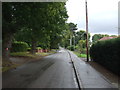
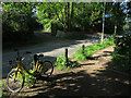
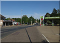
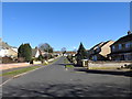
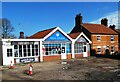


35 photos from this area
Area Information
Key information about the NR8 6RX including its size, population, and administrative classification.
- Area Type
- Postcode
- Area Size
- 4309 m²
- Population
- 1308
- Population Density
- 841 people/km²
House Prices in NR8 6RX
9
Properties
£194,993
Average Sold Price
£35,000
Lowest Price
£325,000
Highest Price
Showing 9 properties
| Address | Type | Beds | Baths | Last Sale Price | Last Sale Date | |
|---|---|---|---|---|---|---|
| 10 Taverham Road, Drayton, NR8 6RX | Detached | 4 | 2 | £300,000 | Jan 2025 | |
| 14 Taverham Road, Drayton, NR8 6RX | house | - | - | £230,000 | Jul 2024 | |
| 8 Taverham Road, Drayton, NR8 6RX | Terraced | 3 | 1 | £325,000 | Oct 2023 | |
| 12 Taverham Road, Drayton, NR8 6RX | house | - | - | £235,000 | Jul 2022 | |
| 16 Taverham Road, Drayton, NR8 6RX | house | 2 | - | £175,000 | Jan 2016 | |
| The Old Post Office, 18 Taverham Road, Drayton, NR8 6RX | Terraced | - | - | £64,950 | Jun 1998 | |
| 20 Taverham Road, Drayton, NR8 6RX | Terraced | - | - | £35,000 | Oct 1996 | |
| 10A Taverham Road, Drayton, NR8 6RX | Detached | 3 | 1 | - | - | |
| 10B Taverham Road, Drayton, NR8 6RX | Bungalow | - | - | - | - |
Energy Efficiency in NR8 6RX
Amenities
Schools
| Rank | School | Type | Entry gender | Ages |
|---|
Explore more schools in this area
Go to Schools tabDemographics
Household Size
Two person
most common
Accommodation Type
Houses
most common
Tenure
85
majority
Ethnic Group
White
most common
Religion
N/A
most common
Household Composition
N/A
most common
Age
47
median
Elderly (65+ years)
most common
Household Deprivation
N/A
with no deprivation
NS-SEC
39
in Lower managerial occupations
Explore more demographic insights in this area
Go to Demographics tabPlanning
Planning Constraints
- Flood RiskPremium
- Ramsar Wetland SitesPremium
- Area of Outstanding Natural BeautyPremium
- Protected Nature ReservePremium
- Protected WoodlandPremium