Area Overview for NR8 5FP
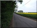
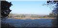
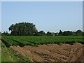
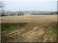
Photos of NR8 5FP
Area Information
Living in NR8 5FP means residing within a defined residential cluster in Norfolk that covers just 3.7 hectares. This small footprint supports a population of 1519 people, creating a compact environment where neighbours are often close by. The area sits within the NR8 postcode district, offering a sense of proximity that defines daily life for its residents. Because the land is limited, development is naturally constrained, preserving the character of a small neighbourhood rather than expanding into a sprawling suburb. You will find homes here are primarily detached or semi-detached properties, typical of clusters in this part of England. The community exists alongside larger towns, meaning you enjoy the convenience of nearby services without being miles from your front door. Daily routines are shaped by this density; a short walk or drive takes you to essential facilities. The size of the area ensures that noise and activity levels remain manageable compared to larger urban centres. For buyers seeking a foothold in the locality, NR8 5FP offers a snapshot of what life is like for the majority of households in the immediate vicinity. It is a place where scale matters, and the layout supports a quiet existence despite being connected to wider transport networks.
- Area Type
- Postcode
- Area Size
- 3.7 hectares
- Population
- 1519
- Population Density
- 919 people/km²
The housing stock in NR8 5FP is defined by high household ownership, with 73 percent of residents owning their homes. This figure places the area firmly in the owner-occupied category rather than a rental market. The predominant accommodation type is houses, meaning you will rarely see purpose-built flats or terraced units designed for high-density living. This mix suggests that properties are detached or semi-detached, suitable for families who have grown settled in the neighbourhood. The small area size of 3.7 hectares limits the volume of available properties, making specific listings rare for those not actively looking. Buyers seeking investment properties should note the strong prevalence of owner-occupiers, indicating demand driven by residents rather than investors. The scarcity of rental turnover reinforces the stability of the market. When you consider homes in NR8 5FP, you are entering a market where sellers are likely to be current owners rather than landlords. This creates a different negotiation dynamic compared to areas with high short-term tenancies. The data confirms that the local stock is geared towards permanent living arrangements. Consequently, prices and values are influenced by willingness to move permanently rather than short-term yield potential.
House Prices in NR8 5FP
Showing 51 properties
| Address | Type | Beds | Baths | Last Sale Price | Last Sale Date | |
|---|---|---|---|---|---|---|
| 31 Pochard Street, Costessey, NR8 5FP | Semi-detached | 3 | 2 | £250,000 | Aug 2025 | |
| 46 Pochard Street, Costessey, NR8 5FP | Detached | 5 | 4 | £409,000 | Jan 2025 | |
| 11 Pochard Street, Costessey, NR8 5FP | Detached | 3 | 1 | £265,000 | Dec 2024 | |
| 33 Pochard Street, Costessey, NR8 5FP | house | 1 | 1 | £150,000 | Oct 2024 | |
| 25 Pochard Street, Costessey, NR8 5FP | Mobile Home | 1 | 1 | £160,000 | Apr 2024 | |
| 26 Pochard Street, Costessey, NR8 5FP | Semi-detached | 3 | 2 | £275,000 | Sep 2023 | |
| 28 Pochard Street, Costessey, NR8 5FP | Semi-detached | 3 | 2 | £247,500 | May 2023 | |
| 24 Pochard Street, Costessey, NR8 5FP | Semi-detached | 3 | 2 | £262,500 | Oct 2022 | |
| 1 Pochard Street, Costessey, NR8 5FP | Terraced | 3 | 3 | £270,000 | Aug 2022 | |
| 47 Pochard Street, Costessey, NR8 5FP | house | - | - | £220,000 | Nov 2021 |
Energy Efficiency in NR8 5FP
Daily life in NR8 5FP benefits from practical amenities located within a short travel distance. Retail options include the Co-op Queen's, Aldi William, and M&S Longwater, providing essential shopping without the need for long commutes. If you need groceries, clothing, or general household goods, these three venues are your nearest options. They are located in surrounding villages and town centres, making them easily reachable. For travel to the wider region, Norwich International Airport is a notable neighbour, located nearby for quick access. This proximity is valuable if you travel frequently for work or leisure. Norwich Railway Station is also within practical reach, offering rail links to major cities and regional destinations. You do not face isolation from national transport networks. The combination of local shops and major transport hubs creates a functional lifestyle. You can manage your chores at the Co-op or Aldi, then switch to working or commuting via the train or airport. This balance of local convenience and regional access defines the character of living in NR8 5FP. Amenities are sufficient to support daily needs without requiring excessive travel time.
Amenities
Schools
For families living in NR8 5FP, educational choices revolve around a specific local institution. St Augustine's Catholic Primary School is located in Costessey and serves as the nearest educational facility. This school is registered as a primary institution, catering to young children living in the immediate vicinity. Because the data lists this name twice, it confirms its status as a key provision for the local young population. There are no secondary schools or further education colleges listed for this specific postcode in the provided data. This absence indicates that older children must travel outside NR8 5FP to access secondary education. The primary school option offers a Catholic education, which may appeal to families seeking religious instruction. You would need to check transport routes to Costessey if your children require primary education. The lack of diverse school types means the community relies heavily on this single primary provider for early learning. Families with teenagers will look beyond the immediate neighbourhood boundaries. While St Augustine's offers a solid foundation, the absence of listed secondary options highlights the area's residential rather than educational hub status.
| Rank | School | Type | Entry gender | Ages |
|---|
Explore more schools in this area
Go to Schools tabDemographics
The community in NR8 5FP reflects a settled population with a median age of 47 years. Adults between the ages of 30 and 64 constitute the most common age range, indicating a neighbourhood dominated by established families and long-term residents. This age profile suggests stability, with fewer young people entering the market for the first time. Home ownership is the norm, with 73 percent of households owning their property outright or with a mortgage. Rental living is less prevalent here than in nearby urban centres. The accommodation type is overwhelmingly houses, which aligns with the higher age demographic and ownership figures. Ethnic diversity is low, as White residents form the predominant group within the population. There are no significant minority communities present in the statistical breakdown of this specific postcode. The lack of mixed-age data other than the broad adult category points to a generation that has remained in the area for decades. This demographic consistency influences local businesses and social clubs, which cater to middle-aged adults rather than young families or students. When you live here, you join a group that values stability and community cohesion over the transient nature found in student hubs or retirement estates. The data confirms a population that has put down roots rather than moving through temporarily.
Household Size
Accommodation Type
Tenure
Ethnic Group
Religion
Household Composition
Age
Household Deprivation
NS-SEC
Explore more demographic insights in this area
Go to Demographics tabPlanning
Planning Constraints
- Flood RiskPremium
- Ramsar Wetland SitesPremium
- Area of Outstanding Natural BeautyPremium
- Protected Nature ReservePremium
- Protected WoodlandPremium