Area Overview for NR8 5EX
Photos of NR8 5EX
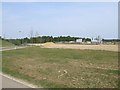
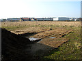
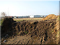
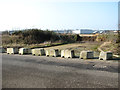


16 photos from this area
Area Information
Key information about the NR8 5EX including its size, population, and administrative classification.
- Area Type
- Postcode
- Area Size
- 10.8 hectares
- Population
- 1487
- Population Density
- 626 people/km²
House Prices in NR8 5EX
40
Properties
£205,134
Average Sold Price
£90,000
Lowest Price
£375,000
Highest Price
Showing 40 properties
| Address | Type | Beds | Baths | Last Sale Price | Last Sale Date | |
|---|---|---|---|---|---|---|
| 14 Rose Avenue, Costessey, NR8 5EX | Terraced | 3 | 3 | £240,000 | Oct 2025 | |
| 74 Rose Avenue, Costessey, NR8 5EX | Semi-detached | 2 | 1 | £210,000 | Jun 2025 | |
| 20 Rose Avenue, Costessey, NR8 5EX | house | 3 | 2 | £227,500 | Mar 2025 | |
| 24 Rose Avenue, Costessey, NR8 5EX | Semi-detached | 3 | 2 | £231,000 | Sep 2024 | |
| 18 Rose Avenue, Costessey, NR8 5EX | Semi-detached | 3 | 2 | £253,000 | Mar 2024 | |
| 78 Rose Avenue, Costessey, NR8 5EX | Terraced | 2 | 1 | £200,000 | Jan 2024 | |
| 60 Rose Avenue, Costessey, NR8 5EX | Semi-detached | 3 | 2 | £220,000 | Sep 2023 | |
| 22 Rose Avenue, Costessey, NR8 5EX | Semi-detached | 3 | 2 | £224,360 | Jun 2023 | |
| 40 Rose Avenue, Costessey, NR8 5EX | Detached | 4 | 1 | £375,000 | Jan 2023 | |
| 48 Rose Avenue, Costessey, NR8 5EX | Terraced | 3 | 1 | £236,000 | Dec 2022 |
Page 1 of 4
Energy Efficiency in NR8 5EX
Amenities
Schools
| Rank | School | Type | Entry gender | Ages |
|---|
Explore more schools in this area
Go to Schools tabDemographics
Household Size
Family (3-5 people)
most common
Accommodation Type
Houses
most common
Tenure
74
majority
Ethnic Group
White
most common
Religion
N/A
most common
Household Composition
N/A
most common
Age
47
median
Adults (30-64 years)
most common
Household Deprivation
N/A
with no deprivation
NS-SEC
47
in Lower managerial occupations
Explore more demographic insights in this area
Go to Demographics tabPlanning
Planning Constraints
- Flood RiskPremium
- Ramsar Wetland SitesPremium
- Area of Outstanding Natural BeautyPremium
- Protected Nature ReservePremium
- Protected WoodlandPremium