Area Overview for NR7 8DL
Photos of NR7 8DL


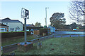
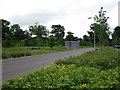
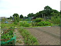

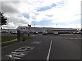
23 photos from this area
Area Information
Key information about the NR7 8DL including its size, population, and administrative classification.
- Area Type
- Postcode
- Area Size
- 8.7 hectares
- Population
- 1106
- Population Density
- 562 people/km²
House Prices in NR7 8DL
56
Properties
£201,894
Average Sold Price
£34,875
Lowest Price
£390,000
Highest Price
Showing 56 properties
| Address | Type | Beds | Baths | Last Sale Price | Last Sale Date | |
|---|---|---|---|---|---|---|
| 94 Saint Marys Grove, Sprowston, NR7 8DL | Detached | 4 | 2 | £390,000 | Feb 2025 | |
| 113 Saint Marys Grove, Sprowston, NR7 8DL | house | 4 | 2 | £370,000 | Dec 2024 | |
| 54 Saint Marys Grove, Sprowston, NR7 8DL | Semi-detached | 2 | 1 | £235,000 | Dec 2024 | |
| 101 Saint Marys Grove, Sprowston, NR7 8DL | Detached | 3 | 2 | £265,000 | Nov 2023 | |
| 95 Saint Marys Grove, Sprowston, NR7 8DL | Semi-detached | 2 | 1 | £263,000 | May 2023 | |
| 125 Saint Marys Grove, Sprowston, NR7 8DL | house | - | - | £280,000 | Nov 2022 | |
| 131 Saint Marys Grove, Sprowston, NR7 8DL | Detached | 3 | 2 | £350,000 | Sep 2022 | |
| 115 Saint Marys Grove, Sprowston, NR7 8DL | house | 4 | 2 | £360,000 | Jul 2022 | |
| 30 Saint Marys Grove, Sprowston, NR7 8DL | house | - | - | £288,500 | May 2021 | |
| 58 Saint Marys Grove, Sprowston, NR7 8DL | Semi-detached | 2 | - | £220,000 | Jan 2021 |
Page 1 of 6
Energy Efficiency in NR7 8DL
Amenities
Schools
| Rank | School | Type | Entry gender | Ages |
|---|
Explore more schools in this area
Go to Schools tabDemographics
Household Size
Two person
most common
Accommodation Type
Houses
most common
Tenure
88
majority
Ethnic Group
White
most common
Religion
N/A
most common
Household Composition
N/A
most common
Age
47
median
Adults (30-64 years)
most common
Household Deprivation
N/A
with no deprivation
NS-SEC
33
in Lower managerial occupations
Explore more demographic insights in this area
Go to Demographics tabPlanning
Planning Constraints
- Flood RiskPremium
- Ramsar Wetland SitesPremium
- Area of Outstanding Natural BeautyPremium
- Protected Nature ReservePremium
- Protected WoodlandPremium