Area Overview for NR7 0UT
Photos of NR7 0UT
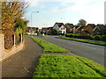
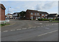
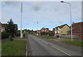

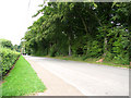
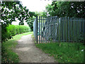
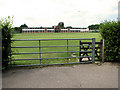
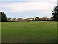

9 photos from this area
Area Information
Key information about the NR7 0UT including its size, population, and administrative classification.
- Area Type
- Postcode
- Area Size
- 4.3 hectares
- Population
- 1697
- Population Density
- 4086 people/km²
House Prices in NR7 0UT
29
Properties
£198,854
Average Sold Price
£87,500
Lowest Price
£406,000
Highest Price
Showing 29 properties
| Address | Type | Beds | Baths | Last Sale Price | Last Sale Date | |
|---|---|---|---|---|---|---|
| 12 Hampden Drive, Thorpe St Andrew, NR7 0UT | house | 3 | - | £350,000 | Jun 2023 | |
| 20 Hampden Drive, Thorpe St Andrew, NR7 0UT | house | 4 | - | £406,000 | Jun 2021 | |
| The Norfolk Wherry, 14 Hampden Drive, Thorpe St Andrew, NR7 0UT | Detached | 5 | 2 | £400,000 | Sep 2020 | |
| 1 Hampden Drive, Thorpe St Andrew, NR7 0UT | Detached | 4 | 2 | £292,000 | Mar 2017 | |
| 7 Hampden Drive, Thorpe St Andrew, NR7 0UT | Detached | 4 | - | £312,000 | Jul 2016 | |
| 6 Hampden Drive, Thorpe St Andrew, NR7 0UT | house | - | - | £257,000 | Mar 2015 | |
| 15 Hampden Drive, Thorpe St Andrew, NR7 0UT | house | 4 | - | £226,000 | Dec 2011 | |
| 30 Hampden Drive, Thorpe St Andrew, NR7 0UT | house | 4 | - | £235,000 | Apr 2011 | |
| 29 Hampden Drive, Thorpe St Andrew, NR7 0UT | Detached | 4 | 2 | £260,000 | Oct 2010 | |
| 23 Hampden Drive, Thorpe St Andrew, NR7 0UT | Detached | 4 | 3 | £250,000 | Oct 2010 |
Page 1 of 3
Energy Efficiency in NR7 0UT
Amenities
Schools
| Rank | School | Type | Entry gender | Ages |
|---|
Explore more schools in this area
Go to Schools tabDemographics
Household Size
Two person
most common
Accommodation Type
Houses
most common
Tenure
87
majority
Ethnic Group
White
most common
Religion
N/A
most common
Household Composition
N/A
most common
Age
47
median
Adults (30-64 years)
most common
Household Deprivation
N/A
with no deprivation
NS-SEC
47
in Lower managerial occupations
Explore more demographic insights in this area
Go to Demographics tabPlanning
Planning Constraints
- Flood RiskPremium
- Ramsar Wetland SitesPremium
- Area of Outstanding Natural BeautyPremium
- Protected Nature ReservePremium
- Protected WoodlandPremium