Area Overview for NR7 0UG
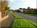
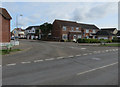
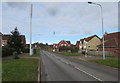
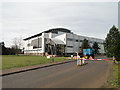
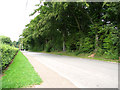
Photos of NR7 0UG
Area Information
NR7 0UG is a small residential cluster covering just 1.3 hectares in Norfolk, England. This compact postcode area contains 1,818 residents, resulting in a population density of 1,449 people per square kilometre. You will find houses as the predominant accommodation type here, catering primarily to families and long-term residents. Living in NR7 0UG means experiencing a tightly knit neighbourhood where daily life moves at a steady, familiar pace. The area sits approximately halfway between the main settlement of Norwich and the coastal village of Wroxham, offering a quiet retreat from the city without being entirely isolated. Because the area is small, the sense of community is likely to be strong, with neighbours knowing each other well. You are within practical reach of significant transportation hubs, including Norwich Railway Station and Salhouse Railway Station, which provide access to the wider region. The nearest airport is Norwich International Airport, ensuring connectivity for business or leisure travel. Nestled in this location, the environment combines the convenience of nearby retail options with the peace of a low-density living space. This setting is ideal for those seeking a home in a specific postcode area that balances proximity to amenities with a calm domestic atmosphere.
- Area Type
- Postcode
- Area Size
- 1.3 hectares
- Population
- 1818
- Population Density
- 1449 people/km²
Buying a home in NR7 0UG offers entry into a market defined by stability and tradition. With 72% of the residents being homeowners, the local property market leans heavily towards owner-occupation rather than the rental sector. This statistic signals that the area attracts buyers who intend to stay for the long term, filtering out transient residents and investors looking for quick flips. The accommodation type is exclusively houses, so if you are browsing for flats or apartments, you will not find them within this specific postcode area. The housing stock in NR7 0UG reflects the preferences of a mature demographic, where families and established residents have chosen to settle. This environment creates a competitive but relatively stable market. Prospective buyers looking for security will find that the high ownership rate reduces the likelihood of neighbor changes or rental turnover issues. The compact size of the area, covering only 1.3 hectares, means there is a limited supply of homes available. To find the right property, you must act promptly when something hits the market. Residents have invested in this specific cluster, building a community around the unique character of these houses rather than generic estate developments.
House Prices in NR7 0UG
Showing 27 properties
| Address | Type | Beds | Baths | Last Sale Price | Last Sale Date | |
|---|---|---|---|---|---|---|
| 14 Eastern Close, Thorpe St Andrew, NR7 0UG | Semi-detached | 3 | 1 | £260,000 | Mar 2023 | |
| 17 Eastern Close, Thorpe St Andrew, NR7 0UG | Semi-detached | 3 | 1 | £285,000 | Nov 2021 | |
| 8 Eastern Close, Thorpe St Andrew, NR7 0UG | Bungalow | 2 | 1 | £210,000 | Apr 2018 | |
| 12 Eastern Close, Thorpe St Andrew, NR7 0UG | Bungalow | 2 | 1 | £240,000 | Sep 2017 | |
| 29 Eastern Close, Thorpe St Andrew, NR7 0UG | Bungalow | 2 | 1 | £275,000 | Jul 2017 | |
| 27 Eastern Close, Thorpe St Andrew, NR7 0UG | Bungalow | - | - | £180,000 | Jan 2016 | |
| 5 Eastern Close, Thorpe St Andrew, NR7 0UG | Bungalow | 3 | - | £193,500 | Apr 2015 | |
| 20 Eastern Close, Thorpe St Andrew, NR7 0UG | Semi-detached | 2 | - | £175,000 | Mar 2015 | |
| 10 Eastern Close, Thorpe St Andrew, NR7 0UG | Bungalow | 2 | - | £175,500 | Mar 2014 | |
| 1 Eastern Close, Thorpe St Andrew, NR7 0UG | Bungalow | - | - | £153,000 | Sep 2013 |
Energy Efficiency in NR7 0UG
Residents of NR7 0UG enjoy access to a range of amenities within practical reach. For your daily shopping needs, you can visit Sainsburys Pound, the East of England Co-operative Co, and Makro Norwich, which are all identified as notable retail options. These venues handle everything from supermarket groceries to bulk buying for larger households. If you require public transport, five railway stations are nearby, including Norwich Railway Station and Salhouse Railway Station, facilitating easy journeys to other parts of the region. For those who prefer flying, Norwich International Airport is accessible from this postcode area. There is also a metro connection available via Wroxham, adding variety to your travel choices. The presence of these amenities means you do not need to travel far for essential services. You can stock up on supplies at local supermarkets or commute to work using the rail network without leaving the county. This convenience adds a layer of practical ease to your life in NR7 0UG. While the area itself is small, the surrounding network of shops and stations ensures you have everything you need nearby.
Amenities
Schools
If you are considering living in NR7 0UG with children, your options for education are well established. The primary choice for local schooling is Dussindale Primary School, which is located directly adjacent to the area. This institution holds an Ofsted rating of good, indicating a standard of education that meets the required benchmarks for quality and completeness. As this is a primary school, you will not find secondary schools listed among the immediate neighbours for this specific postcode. This educational landscape means that once your child completes primary education at Dussindale, you will need to look beyond the immediate 1.3 hectares for secondary placement. The concentration of a single good-rated primary school suggests that the local community places a high value on foundational education. For families relocating to NR7 0UG, the guarantee of a good-rated primary school nearby is a significant advantage. It reduces the anxiety often associated with school placements and ensures your child starts their academic journey in a supervised and rated environment. The simplicity of the local school mix allows you to focus on settling into the neighbourhood without navigating a complex array of educational choices at the entry level.
| Rank | School | Type | Entry gender | Ages |
|---|
Explore more schools in this area
Go to Schools tabDemographics
The community within NR7 0UG is mature and established. Adults aged between 30 and 64 years represent the most common age range, while the median age for residents sits at 47 years. This demographic profile suggests a population dominated by families and professionals past their early twenties. You will encounter a predominantly white ethnic group, reflecting the general character of many smaller, traditional British neighbourhoods. Home ownership is a defining feature of life here, with 72% of residents owning their homes outright or with a mortgage. This high rate of ownership indicates financial stability and a long-term commitment to the area. The remaining 28% likely consist of long-term renters or those still paying off mortgages after decades of residence. Houses make up the primary accommodation type, meaning you will not find high-rise apartments or modern conversion blocks dominating the streets. This settled population prefers the stability that comes with owning property in a known neighbourhood. The demographic makeup creates a quiet, dependable environment where residents have likely put down roots and prioritise stability over transient living arrangements.
Household Size
Accommodation Type
Tenure
Ethnic Group
Religion
Household Composition
Age
Household Deprivation
NS-SEC
Explore more demographic insights in this area
Go to Demographics tabPlanning
Planning Constraints
- Flood RiskPremium
- Ramsar Wetland SitesPremium
- Area of Outstanding Natural BeautyPremium
- Protected Nature ReservePremium
- Protected WoodlandPremium