Area Overview for NR6 7LH
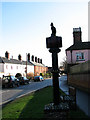
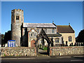
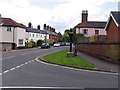
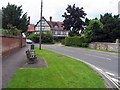
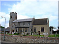
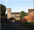
Photos of NR6 7LH
Area Information
Living in NR6 7LH offers a distinct experience defined by its compact size and established character. This specific postcode covers just 5,315 square metres, creating a tight-knit residential cluster where neighbours are close by. You will find a total population of 1,466 residents sharing this space, which results in an extremely high population density of 275,842 people per square kilometre. Such concentration suggests a settled, leafy environment rather than a sprawling suburb. The location sits in England, providing a foundation for a stable community life. Daily existence here revolves around a small footprint where every stretch of pavement serves multiple households. This density means you are never far from a local service or a neighbour to know. The community profile for NR6 7LH reflects a mature and settled population. The median age across the area is 47 years, indicating that most residents are well into mid-life. Adults between the ages of 30 and 64 years form the most common age range, suggesting a workforce that balances career stability with family life. Almost nine out of ten people, accounting for 86% of the population, own their homes outright. This high ownership rate signals a neighbourhood where families have put down roots and plan to stay for the long term. Houses are the predominant accommodation type, aligning with the need for space that matches the age profile of the population. The area is predominantly White, reflecting a traditional village character. This demographic consistency offers a sense of continuity and familiar surroundings for anyone moving to find homes in this specific postcode. The housing market within NR6 7LH is defined by stability and ownership. With a home-ownership rate of 86%, the area is rarely a renters' market. This statistic indicates that prospective buyers will compete against seasoned owners rather than competing with landlords. The overwhelming presence of houses as the main accommodation type means you will not find flats or apartments dominating the streets. This housing stock suits the older demographic found here, offering space and gardens usually absent in smaller urban dwellings. For anyone looking at this small residential cluster, the lack of private rental sector dominance means prices tend to reflect long-term value rather than short-term yields. Buyers seeking a neighbourhood where residents stay put will find the conditions right here. The market dynamics mirror the homeownership figure, ensuring that ownership remains the primary mode of occupation for most residents in this specific location. Families looking at NR6 7LH have access to specific educational institutions just outside the immediate residential cluster. St Christopher's School operates as an independent school, providing an educational option outside the state system. Nearby, residents can also access Hall School, which functions as a special needs establishment. This mix of an independent college and a special school serves different educational requirements but does not offer a standard comprehensive or primary education within the immediate vicinity. Parents considering schools near NR6 7LH must look beyond the immediate postcode for standard infant or junior education. The presence of these two specific schools indicates a community that values diverse educational pathways. Homebuyers restricted to this area will need to commute further for mainstream state schooling if their children do not fit the profile for these local establishments. Digital connectivity for residents of NR6 7LH is robust and supports modern working patterns. The fixed broadband quality score reaches 90 out of 100, classifying the connection as excellent. This high standard ensures you can work from home without interruption or lag. Mobile network quality scores 81 out of 100, which also represents excellent coverage for personal devices. Whether you are streaming content, holding video calls, or updating documents, the infrastructure supports heavy usage. For anyone intending to work remotely while living in this postcode, these connectivity figures remove common concerns about digital isolation. The strong mobile signal complements the fast broadband, creating a reliable digital environment. Residents of NR6 7LH benefit from a practical range of amenities within easy reach. You will find five retail outlets nearby, including notable names such as Morrisons Old, East of England Co-operative Co, and Tesco Norwich. These supermarkets provide the essential grocery shopping required for daily life. Travel connections include four rail stations, with Norwich Railway Station, Salhouse Railway Station, and Brundall Gardens Railway Station serving the broader network. Norwich International Airport remains accessible for those needing air travel. Additionally, transportation links extend to Wroxham, which offers metro-style connectivity options. This combination of retail and transport hubs ensures that daily errands and longer commutes are manageable. The location balances the convenience of urban services with the quiet of a residential cluster. Safety and environmental conditions in NR6 7LH present very low risk profiles across the board. The crime risk assessment registers a level of PASS with a score of 92 out of 100. A score this high, where higher numbers indicate lower risk in this context, confirms that this area has below-average crime rates. You can expect a safer neighbourhood compared to the wider national average. Flood risk also registers a PASS level with a score of 0, indicating low flood risk coverage and no immediate threat from water. Environmental planning constraints are equally clear; there is no Ramsar wetland coverage, no Area of Outstanding Natural Beauty coverage, and no protected nature reserve or woodland covering the area. These reassurances mean planning applications or building works are unlikely to face significant ecological hurdles. The area avoids areas of natural beauty restrictions while maintaining a safe environment for daily living. What is the community feel like in NR6 7LH?The community consists of 1,466 residents spread across 5,315 square metres, creating a high-density, close-knit environment. With 86% of homes owned outright and a median age of 47, the area feels established and stable rather than transient. Who typically lives in NR6 7LH?The most common age range for residents here is adults between 30 and 64 years. The population is predominantly White, and the majority occupy houses rather than flats, fitting a demographic that values space and ownership. What schools are available near NR6 7LH?There are two main schools listed: St Christopher's School, which is an independent institution, and Hall School, a special needs establishment. Families seeking standard primary or secondary state schooling may need to look slightly further afield. How is transport and connectivity for this postcode?Digital infrastructure is excellent, with a broadband quality score of 90 and a mobile coverage score of 81. Transport links include four rail stations like Norwich Railway Station and access to Norwich International Airport. Is NR6 7LH safe to live in regarding crime and environment?Safety scores are very high with a crime risk level of 92 out of 100. Environmental risks are negligible, showing zero scores for flood risk and no restrictions from protected nature reserves or areas of outstanding natural beauty.
- Area Type
- Postcode
- Area Size
- 5315 m²
- Population
- 1466
- Population Density
- 1735 people/km²
The housing market within NR6 7LH is defined by stability and ownership. With a home-ownership rate of 86%, the area is rarely a renters' market. This statistic indicates that prospective buyers will compete against seasoned owners rather than competing with landlords. The overwhelming presence of houses as the main accommodation type means you will not find flats or apartments dominating the streets. This housing stock suits the older demographic found here, offering space and gardens usually absent in smaller urban dwellings. For anyone looking at this small residential cluster, the lack of private rental sector dominance means prices tend to reflect long-term value rather than short-term yields. Buyers seeking a neighbourhood where residents stay put will find the conditions right here. The market dynamics mirror the homeownership figure, ensuring that ownership remains the primary mode of occupation for most residents in this specific location. Families looking at NR6 7LH have access to specific educational institutions just outside the immediate residential cluster. St Christopher's School operates as an independent school, providing an educational option outside the state system. Nearby, residents can also access Hall School, which functions as a special needs establishment. This mix of an independent college and a special school serves different educational requirements but does not offer a standard comprehensive or primary education within the immediate vicinity. Parents considering schools near NR6 7LH must look beyond the immediate postcode for standard infant or junior education. The presence of these two specific schools indicates a community that values diverse educational pathways. Homebuyers restricted to this area will need to commute further for mainstream state schooling if their children do not fit the profile for these local establishments. Digital connectivity for residents of NR6 7LH is robust and supports modern working patterns. The fixed broadband quality score reaches 90 out of 100, classifying the connection as excellent. This high standard ensures you can work from home without interruption or lag. Mobile network quality scores 81 out of 100, which also represents excellent coverage for personal devices. Whether you are streaming content, holding video calls, or updating documents, the infrastructure supports heavy usage. For anyone intending to work remotely while living in this postcode, these connectivity figures remove common concerns about digital isolation. The strong mobile signal complements the fast broadband, creating a reliable digital environment. Residents of NR6 7LH benefit from a practical range of amenities within easy reach. You will find five retail outlets nearby, including notable names such as Morrisons Old, East of England Co-operative Co, and Tesco Norwich. These supermarkets provide the essential grocery shopping required for daily life. Travel connections include four rail stations, with Norwich Railway Station, Salhouse Railway Station, and Brundall Gardens Railway Station serving the broader network. Norwich International Airport remains accessible for those needing air travel. Additionally, transportation links extend to Wroxham, which offers metro-style connectivity options. This combination of retail and transport hubs ensures that daily errands and longer commutes are manageable. The location balances the convenience of urban services with the quiet of a residential cluster. Safety and environmental conditions in NR6 7LH present very low risk profiles across the board. The crime risk assessment registers a level of PASS with a score of 92 out of 100. A score this high, where higher numbers indicate lower risk in this context, confirms that this area has below-average crime rates. You can expect a safer neighbourhood compared to the wider national average. Flood risk also registers a PASS level with a score of 0, indicating low flood risk coverage and no immediate threat from water. Environmental planning constraints are equally clear; there is no Ramsar wetland coverage, no Area of Outstanding Natural Beauty coverage, and no protected nature reserve or woodland covering the area. These reassurances mean planning applications or building works are unlikely to face significant ecological hurdles. The area avoids areas of natural beauty restrictions while maintaining a safe environment for daily living. What is the community feel like in NR6 7LH?The community consists of 1,466 residents spread across 5,315 square metres, creating a high-density, close-knit environment. With 86% of homes owned outright and a median age of 47, the area feels established and stable rather than transient. Who typically lives in NR6 7LH?The most common age range for residents here is adults between 30 and 64 years. The population is predominantly White, and the majority occupy houses rather than flats, fitting a demographic that values space and ownership. What schools are available near NR6 7LH?There are two main schools listed: St Christopher's School, which is an independent institution, and Hall School, a special needs establishment. Families seeking standard primary or secondary state schooling may need to look slightly further afield. How is transport and connectivity for this postcode?Digital infrastructure is excellent, with a broadband quality score of 90 and a mobile coverage score of 81. Transport links include four rail stations like Norwich Railway Station and access to Norwich International Airport. Is NR6 7LH safe to live in regarding crime and environment?Safety scores are very high with a crime risk level of 92 out of 100. Environmental risks are negligible, showing zero scores for flood risk and no restrictions from protected nature reserves or areas of outstanding natural beauty.
House Prices in NR6 7LH
Showing 9 properties
| Address | Type | Beds | Baths | Last Sale Price | Last Sale Date | |
|---|---|---|---|---|---|---|
| 33 Burma Road, Old Catton, NR6 7LH | Semi-detached | 4 | 1 | £385,000 | Mar 2023 | |
| 44 Burma Road, Sprowston, NR6 7LH | Detached | 3 | 2 | £325,000 | Nov 2018 | |
| 39 Burma Road, Old Catton, NR6 7LH | Semi-detached | 3 | 2 | £285,000 | Dec 2017 | |
| 35 Burma Road, Old Catton, NR6 7LH | Semi-detached | 4 | 2 | £320,000 | May 2017 | |
| 39A Burma Road, Old Catton, NR6 7LH | house | - | - | £122,500 | Mar 2007 | |
| 37 Burma Road, Old Catton, NR6 7LH | house | 3 | - | £190,000 | Jan 2006 | |
| 31 Burma Road, Old Catton, NR6 7LH | Semi-detached | - | - | £58,500 | Jun 1998 | |
| 41 Burma Road, Sprowston, NR6 7LH | Detached | - | - | - | - | |
| 29 Burma Road, Old Catton, NR6 7LH | Semi-detached | - | - | - | - |
Energy Efficiency in NR6 7LH
Residents of NR6 7LH benefit from a practical range of amenities within easy reach. You will find five retail outlets nearby, including notable names such as Morrisons Old, East of England Co-operative Co, and Tesco Norwich. These supermarkets provide the essential grocery shopping required for daily life. Travel connections include four rail stations, with Norwich Railway Station, Salhouse Railway Station, and Brundall Gardens Railway Station serving the broader network. Norwich International Airport remains accessible for those needing air travel. Additionally, transportation links extend to Wroxham, which offers metro-style connectivity options. This combination of retail and transport hubs ensures that daily errands and longer commutes are manageable. The location balances the convenience of urban services with the quiet of a residential cluster. Safety and environmental conditions in NR6 7LH present very low risk profiles across the board. The crime risk assessment registers a level of PASS with a score of 92 out of 100. A score this high, where higher numbers indicate lower risk in this context, confirms that this area has below-average crime rates. You can expect a safer neighbourhood compared to the wider national average. Flood risk also registers a PASS level with a score of 0, indicating low flood risk coverage and no immediate threat from water. Environmental planning constraints are equally clear; there is no Ramsar wetland coverage, no Area of Outstanding Natural Beauty coverage, and no protected nature reserve or woodland covering the area. These reassurances mean planning applications or building works are unlikely to face significant ecological hurdles. The area avoids areas of natural beauty restrictions while maintaining a safe environment for daily living. What is the community feel like in NR6 7LH?The community consists of 1,466 residents spread across 5,315 square metres, creating a high-density, close-knit environment. With 86% of homes owned outright and a median age of 47, the area feels established and stable rather than transient. Who typically lives in NR6 7LH?The most common age range for residents here is adults between 30 and 64 years. The population is predominantly White, and the majority occupy houses rather than flats, fitting a demographic that values space and ownership. What schools are available near NR6 7LH?There are two main schools listed: St Christopher's School, which is an independent institution, and Hall School, a special needs establishment. Families seeking standard primary or secondary state schooling may need to look slightly further afield. How is transport and connectivity for this postcode?Digital infrastructure is excellent, with a broadband quality score of 90 and a mobile coverage score of 81. Transport links include four rail stations like Norwich Railway Station and access to Norwich International Airport. Is NR6 7LH safe to live in regarding crime and environment?Safety scores are very high with a crime risk level of 92 out of 100. Environmental risks are negligible, showing zero scores for flood risk and no restrictions from protected nature reserves or areas of outstanding natural beauty.
Amenities
Schools
Families looking at NR6 7LH have access to specific educational institutions just outside the immediate residential cluster. St Christopher's School operates as an independent school, providing an educational option outside the state system. Nearby, residents can also access Hall School, which functions as a special needs establishment. This mix of an independent college and a special school serves different educational requirements but does not offer a standard comprehensive or primary education within the immediate vicinity. Parents considering schools near NR6 7LH must look beyond the immediate postcode for standard infant or junior education. The presence of these two specific schools indicates a community that values diverse educational pathways. Homebuyers restricted to this area will need to commute further for mainstream state schooling if their children do not fit the profile for these local establishments. Digital connectivity for residents of NR6 7LH is robust and supports modern working patterns. The fixed broadband quality score reaches 90 out of 100, classifying the connection as excellent. This high standard ensures you can work from home without interruption or lag. Mobile network quality scores 81 out of 100, which also represents excellent coverage for personal devices. Whether you are streaming content, holding video calls, or updating documents, the infrastructure supports heavy usage. For anyone intending to work remotely while living in this postcode, these connectivity figures remove common concerns about digital isolation. The strong mobile signal complements the fast broadband, creating a reliable digital environment. Residents of NR6 7LH benefit from a practical range of amenities within easy reach. You will find five retail outlets nearby, including notable names such as Morrisons Old, East of England Co-operative Co, and Tesco Norwich. These supermarkets provide the essential grocery shopping required for daily life. Travel connections include four rail stations, with Norwich Railway Station, Salhouse Railway Station, and Brundall Gardens Railway Station serving the broader network. Norwich International Airport remains accessible for those needing air travel. Additionally, transportation links extend to Wroxham, which offers metro-style connectivity options. This combination of retail and transport hubs ensures that daily errands and longer commutes are manageable. The location balances the convenience of urban services with the quiet of a residential cluster. Safety and environmental conditions in NR6 7LH present very low risk profiles across the board. The crime risk assessment registers a level of PASS with a score of 92 out of 100. A score this high, where higher numbers indicate lower risk in this context, confirms that this area has below-average crime rates. You can expect a safer neighbourhood compared to the wider national average. Flood risk also registers a PASS level with a score of 0, indicating low flood risk coverage and no immediate threat from water. Environmental planning constraints are equally clear; there is no Ramsar wetland coverage, no Area of Outstanding Natural Beauty coverage, and no protected nature reserve or woodland covering the area. These reassurances mean planning applications or building works are unlikely to face significant ecological hurdles. The area avoids areas of natural beauty restrictions while maintaining a safe environment for daily living. What is the community feel like in NR6 7LH?The community consists of 1,466 residents spread across 5,315 square metres, creating a high-density, close-knit environment. With 86% of homes owned outright and a median age of 47, the area feels established and stable rather than transient. Who typically lives in NR6 7LH?The most common age range for residents here is adults between 30 and 64 years. The population is predominantly White, and the majority occupy houses rather than flats, fitting a demographic that values space and ownership. What schools are available near NR6 7LH?There are two main schools listed: St Christopher's School, which is an independent institution, and Hall School, a special needs establishment. Families seeking standard primary or secondary state schooling may need to look slightly further afield. How is transport and connectivity for this postcode?Digital infrastructure is excellent, with a broadband quality score of 90 and a mobile coverage score of 81. Transport links include four rail stations like Norwich Railway Station and access to Norwich International Airport. Is NR6 7LH safe to live in regarding crime and environment?Safety scores are very high with a crime risk level of 92 out of 100. Environmental risks are negligible, showing zero scores for flood risk and no restrictions from protected nature reserves or areas of outstanding natural beauty.
| Rank | School | Type | Entry gender | Ages |
|---|
Explore more schools in this area
Go to Schools tabDemographics
The community profile for NR6 7LH reflects a mature and settled population. The median age across the area is 47 years, indicating that most residents are well into mid-life. Adults between the ages of 30 and 64 years form the most common age range, suggesting a workforce that balances career stability with family life. Almost nine out of ten people, accounting for 86% of the population, own their homes outright. This high ownership rate signals a neighbourhood where families have put down roots and plan to stay for the long term. Houses are the predominant accommodation type, aligning with the need for space that matches the age profile of the population. The area is predominantly White, reflecting a traditional village character. This demographic consistency offers a sense of continuity and familiar surroundings for anyone moving to find homes in this specific postcode. The housing market within NR6 7LH is defined by stability and ownership. With a home-ownership rate of 86%, the area is rarely a renters' market. This statistic indicates that prospective buyers will compete against seasoned owners rather than competing with landlords. The overwhelming presence of houses as the main accommodation type means you will not find flats or apartments dominating the streets. This housing stock suits the older demographic found here, offering space and gardens usually absent in smaller urban dwellings. For anyone looking at this small residential cluster, the lack of private rental sector dominance means prices tend to reflect long-term value rather than short-term yields. Buyers seeking a neighbourhood where residents stay put will find the conditions right here. The market dynamics mirror the homeownership figure, ensuring that ownership remains the primary mode of occupation for most residents in this specific location. Families looking at NR6 7LH have access to specific educational institutions just outside the immediate residential cluster. St Christopher's School operates as an independent school, providing an educational option outside the state system. Nearby, residents can also access Hall School, which functions as a special needs establishment. This mix of an independent college and a special school serves different educational requirements but does not offer a standard comprehensive or primary education within the immediate vicinity. Parents considering schools near NR6 7LH must look beyond the immediate postcode for standard infant or junior education. The presence of these two specific schools indicates a community that values diverse educational pathways. Homebuyers restricted to this area will need to commute further for mainstream state schooling if their children do not fit the profile for these local establishments. Digital connectivity for residents of NR6 7LH is robust and supports modern working patterns. The fixed broadband quality score reaches 90 out of 100, classifying the connection as excellent. This high standard ensures you can work from home without interruption or lag. Mobile network quality scores 81 out of 100, which also represents excellent coverage for personal devices. Whether you are streaming content, holding video calls, or updating documents, the infrastructure supports heavy usage. For anyone intending to work remotely while living in this postcode, these connectivity figures remove common concerns about digital isolation. The strong mobile signal complements the fast broadband, creating a reliable digital environment. Residents of NR6 7LH benefit from a practical range of amenities within easy reach. You will find five retail outlets nearby, including notable names such as Morrisons Old, East of England Co-operative Co, and Tesco Norwich. These supermarkets provide the essential grocery shopping required for daily life. Travel connections include four rail stations, with Norwich Railway Station, Salhouse Railway Station, and Brundall Gardens Railway Station serving the broader network. Norwich International Airport remains accessible for those needing air travel. Additionally, transportation links extend to Wroxham, which offers metro-style connectivity options. This combination of retail and transport hubs ensures that daily errands and longer commutes are manageable. The location balances the convenience of urban services with the quiet of a residential cluster. Safety and environmental conditions in NR6 7LH present very low risk profiles across the board. The crime risk assessment registers a level of PASS with a score of 92 out of 100. A score this high, where higher numbers indicate lower risk in this context, confirms that this area has below-average crime rates. You can expect a safer neighbourhood compared to the wider national average. Flood risk also registers a PASS level with a score of 0, indicating low flood risk coverage and no immediate threat from water. Environmental planning constraints are equally clear; there is no Ramsar wetland coverage, no Area of Outstanding Natural Beauty coverage, and no protected nature reserve or woodland covering the area. These reassurances mean planning applications or building works are unlikely to face significant ecological hurdles. The area avoids areas of natural beauty restrictions while maintaining a safe environment for daily living. What is the community feel like in NR6 7LH?The community consists of 1,466 residents spread across 5,315 square metres, creating a high-density, close-knit environment. With 86% of homes owned outright and a median age of 47, the area feels established and stable rather than transient. Who typically lives in NR6 7LH?The most common age range for residents here is adults between 30 and 64 years. The population is predominantly White, and the majority occupy houses rather than flats, fitting a demographic that values space and ownership. What schools are available near NR6 7LH?There are two main schools listed: St Christopher's School, which is an independent institution, and Hall School, a special needs establishment. Families seeking standard primary or secondary state schooling may need to look slightly further afield. How is transport and connectivity for this postcode?Digital infrastructure is excellent, with a broadband quality score of 90 and a mobile coverage score of 81. Transport links include four rail stations like Norwich Railway Station and access to Norwich International Airport. Is NR6 7LH safe to live in regarding crime and environment?Safety scores are very high with a crime risk level of 92 out of 100. Environmental risks are negligible, showing zero scores for flood risk and no restrictions from protected nature reserves or areas of outstanding natural beauty.
Household Size
Accommodation Type
Tenure
Ethnic Group
Religion
Household Composition
Age
Household Deprivation
NS-SEC
Explore more demographic insights in this area
Go to Demographics tabPlanning
Planning Constraints
- Flood RiskPremium
- Ramsar Wetland SitesPremium
- Area of Outstanding Natural BeautyPremium
- Protected Nature ReservePremium
- Protected WoodlandPremium