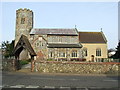
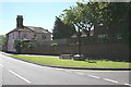
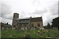
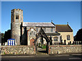
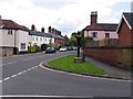
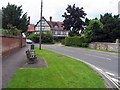
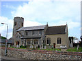
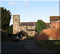
Area Overview for NR6 7JT
Photos of NR6 7JT


Area Information
Living in NR6 7JT offers a specific residential experience within a small, defined postcode cluster covering just 1366 square metres. This tightly bounded area contrasts sharply with wider rural definitions due to its very high population density of 1823493 people per square kilometre. Despite these unusual statistics for such a small footprint, the site supports a population of 2491 individuals. You are entering a defined space where daily life is concentrated within a limited geographic radius. The neighbourhood functions as a concentrated residential cluster rather than a sprawling development. This density shapes the rhythm of the neighbourhood, meaning residents share close proximity with hundreds of others in a compact setting. You move through a space where every square metre is accounted for, yet the total area remains small enough to maintain a sense of contained locality. This makes NR6 7JT a distinct choice for those seeking a specific postcode rather than a broad neighbourhood umbrella. The area serves as a precise entry point into the wider NR6 locality, offering a defined slice of property opportunities.
- Area Type
- Postcode
- Area Size
- 1366 m²
- Population
- 2491
- Population Density
- 2541 people/km²
The property market in NR6 7JT is defined by a strong preference for detached or semi-detached houses. With 61 per cent of residents being homeowners, the area is primarily an owner-occupied market rather than a rental hub. This high ownership rate implies that you will encounter a stock of properties where values have been carefully managed by long-term owners. The dominance of houses over flats or purpose-built flats creates a specific character for the housing stock in this postcode. You are likely to find substantial homes suited to families or individuals seeking privacy and space. The small size of the area at 1366 square metres means supply is limited, which often strengthens the bargaining position of existing homeowners. Potential buyers should understand that they are entering a market where properties are held for the long term, reducing the turnover typical of buy-to-let heavy areas. This stability is evident in the high percentage of resident owners who have put down roots in NR6 7JT. The market reflects a desire for permanent housing solutions rather than temporary accommodation arrangements.
House Prices in NR6 7JT
Showing 3 properties
| Address | Type | Beds | Baths | Last Sale Price | Last Sale Date | |
|---|---|---|---|---|---|---|
| 4 Dunwood Drive, Old Catton, NR6 7JT | Terraced | 3 | 1 | £163,500 | May 2016 | |
| 2 Dunwood Drive, Old Catton, NR6 7JT | house | - | - | - | - | |
| 6 Dunwood Drive, Old Catton, NR6 7JT | house | - | - | - | - |
Energy Efficiency in NR6 7JT
Living in NR6 7JT provides convenient access to a range of practical amenities within easy reach. Retail choices include Morrisons Old, Tesco Norwich, and the East of England Co-operative Co, ensuring you have well-stocked supermarkets nearby without excessive travel. Transport links are robust, with access to Norwich Railway Station, Salhouse Railway Station, and Hoveton & Wroxham Railway Station. These hubs facilitate straightforward journeys into urban centres or coastal towns depending on your destination. Norwich International Airport offers flight connectivity for longer travels, making this postcode a viable base for business travellers or those visiting family abroad. Wroxham provides metro-style transit options, adding flexibility to your daily movement across the wider region. You can shop, travel, and attend events with minimal planning, as key facilities are integrated into your daily route. The proximity to these specific venues means you do not need to drive far for essential weekly runs. This accessibility defines the practical lifestyle available to you within the NR6 7JT area.
Amenities
Schools
Education options for families living in NR6 7JT are focused on local provision, with White Woman Lane Junior School standing as the primary nearby option. This school holds an outstanding Ofsted rating, a significant asset for parents prioritising educational quality for children aged 7 to 11. The presence of an outstanding-rated primary school directly influences the appeal of NR6 7JT for those wishing to settle their children in the area early on. No secondary schools are listed in the immediate data for this specific cluster, meaning families will likely need to consider transport options to secondary education beyond the immediate neighbourhood. The outstanding rating of White Woman Lane Junior School provides a strong foundation for early education without the need to commute far. This specific educational asset is the key academic feature for the NR6 7JT postcode. You should verify transport links to secondary institutions if you have older children, as the current data only highlights this one primary school with exceptional standards.
| Rank | School | Type | Entry gender | Ages |
|---|
Explore more schools in this area
Go to Schools tabDemographics
The community in NR6 7JT is characterised by a mature resident base with a median age of 47 years. Most households consist of adults within the 30-64 year range, indicating a stable class of homeowners rather than transient young renters. Sixty-one per cent of residents own their homes, a figure that significantly exceeds national averages for owner-occupancy. This high level of ownership suggests a deeply entrenched community where people have made long-term investments in the area. Houses form the dominant accommodation type, reflecting a preference for standalone living over flats or apartments common in high-density urban sites. The demographic makeup is predominantly White, aligning with broader regional trends in Suffolk. Deprivation levels in this specific postcode are not detailed in the available records, so the focus remains on the clear picture of stability provided by the high ownership rate. You are looking at a neighbourhood where families and established residents form the core demographic profile. The age profile supports a quiet, family-oriented environment where the primary residents are settled professionals or retired individuals.
Household Size
Accommodation Type
Tenure
Ethnic Group
Religion
Household Composition
Age
Household Deprivation
NS-SEC
Explore more demographic insights in this area
Go to Demographics tabPlanning
Planning Constraints
- Flood RiskPremium
- Ramsar Wetland SitesPremium
- Area of Outstanding Natural BeautyPremium
- Protected Nature ReservePremium
- Protected WoodlandPremium