Area Overview for NR6 6UP
Photos of NR6 6UP


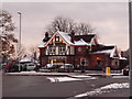
16 photos from this area
Area Information
Key information about the NR6 6UP including its size, population, and administrative classification.
- Area Type
- Postcode
- Area Size
- 2.6 hectares
- Population
- 1381
- Population Density
- 3047 people/km²
House Prices in NR6 6UP
36
Properties
£197,226
Average Sold Price
£50,000
Lowest Price
£532,500
Highest Price
Showing 36 properties
| Address | Type | Beds | Baths | Last Sale Price | Last Sale Date | |
|---|---|---|---|---|---|---|
| 15 Firs Road, Hellesdon, NR6 6UP | Detached | 3 | 1 | £265,000 | Mar 2025 | |
| 20 Firs Road, Hellesdon, NR6 6UP | Bungalow | 3 | 1 | £312,500 | Jan 2025 | |
| 53 Firs Road, Hellesdon, NR6 6UP | Bungalow | 2 | 1 | £250,000 | Oct 2024 | |
| 55 Firs Road, Hellesdon, NR6 6UP | Bungalow | - | - | £230,000 | Sep 2021 | |
| 16 Firs Road, Hellesdon, NR6 6UP | Bungalow | 3 | - | £197,000 | May 2021 | |
| 43 Firs Road, Hellesdon, NR6 6UP | Bungalow | 3 | - | £257,000 | Feb 2021 | |
| 61 Firs Road, Hellesdon, NR6 6UP | Bungalow | 2 | 1 | £300,000 | Nov 2020 | |
| 51 Firs Road, Hellesdon, NR6 6UP | Bungalow | 3 | 1 | £210,000 | Nov 2019 | |
| 5 Firs Road, Hellesdon, NR6 6UP | Bungalow | 4 | 3 | £532,500 | Sep 2019 | |
| 12 Firs Road, Hellesdon, NR6 6UP | Bungalow | 3 | 1 | £255,000 | Aug 2017 |
Page 1 of 4
Energy Efficiency in NR6 6UP
Amenities
Schools
| Rank | School | Type | Entry gender | Ages |
|---|
Explore more schools in this area
Go to Schools tabDemographics
Household Size
Two person
most common
Accommodation Type
Houses
most common
Tenure
90
majority
Ethnic Group
White
most common
Religion
N/A
most common
Household Composition
N/A
most common
Age
47
median
Adults (30-64 years)
most common
Household Deprivation
N/A
with no deprivation
NS-SEC
26
in Lower managerial occupations
Explore more demographic insights in this area
Go to Demographics tabPlanning
Planning Constraints
- Flood RiskPremium
- Ramsar Wetland SitesPremium
- Area of Outstanding Natural BeautyPremium
- Protected Nature ReservePremium
- Protected WoodlandPremium