Area Overview for NR6 5NE
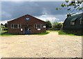
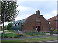
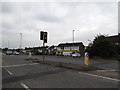
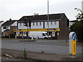
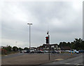
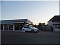
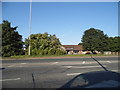
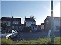
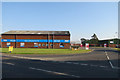
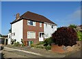
Photos of NR6 5NE


Area Information
NR6 5NE is a compact residential cluster defined by a specific postcode covering just 2,925 square metres. The location houses a population of 1,334 people, resulting in an extremely high population density of 456,026 people per square kilometre. Despite these tight figures, life here centres on established residential housing rather than dense urban sprawl. The area sits within England and serves as a settled home for a significant portion of the local catchment. Residents find themselves in a space where domestic quietness coexists with close proximity to major local hubs. The neighbourhood maintains a clear residential identity while remaining connected to wider infrastructure in Norwich. Buying a home in this postcode means entering a small, distinct community with its own defined boundaries and immediate surroundings.
- Area Type
- Postcode
- Area Size
- 2925 m²
- Population
- 1334
- Population Density
- 4316 people/km²
Homes in NR6 5NE form part of a local market characterised by traditional family living rather than student rentals or temporary housing. The accommodation type is dominated by houses, providing substantial living space for families and those seeking detached or semi-detached environments. With 77% of households indicating home ownership, this postcode represents a stable owner-occupied market rather than a high-volume rental sector. This dynamic means buyer competition often focuses on specific properties rather than a fluid monthly turnover of tenants. The small area size and concentrated population support a predictable housing environment where local knowledge regarding property values is widespread. Buyers looking at this location should expect a market driven by owner-sellers and established estates. The housing stock supports stable families who value permanence and ownership over the flexibility of the private rental sector.
House Prices in NR6 5NE
Showing 5 properties
| Address | Type | Beds | Baths | Last Sale Price | Last Sale Date | |
|---|---|---|---|---|---|---|
| 8 Middletons Lane, Hellesdon, NR6 5NE | house | - | - | £165,000 | May 2014 | |
| 6 Middletons Lane, Hellesdon, NR6 5NE | Semi-detached | 3 | 1 | £175,000 | Feb 2008 | |
| 4 Middletons Lane, Hellesdon, NR6 5NE | Semi-detached | - | - | £242,500 | Jan 2008 | |
| 2 Middletons Lane, Hellesdon, NR6 5NE | Semi-detached | - | - | £103,500 | Aug 2001 | |
| 2A Middletons Lane, Hellesdon, NR6 5NE | Detached | - | - | - | - |
Energy Efficiency in NR6 5NE
Daily life in NR6 5NE benefits from direct access to several key amenities within practical reach. Residents can shop at nearby venues including Tesco Norwich, the East of England Co-operative Co, and another branch of the East of England Co-operative Co. These five retail outlets provide essential groceries and household necessities without requiring long travel distances. For commuting, two railway stations serve the area, specifically Norwich Railway Station and Salhouse Railway Station. Additionally, one airport location is accessible to residents, identified as Norwich International Airport. This travel network connects the local community to wider national routes efficiently. The combination of retail, rail, and air links ensures that lifestyle needs are met through local convenience while maintaining easy access to broader travel options.
Amenities
Schools
Families considering schools near NR6 5NE have access to Arden Grove Infant and Nursery School. This establishment operates as a primary school and holds an Outstanding Ofsted rating under its academy designation. The presence of a school with the highest possible rating indicates a strong educational environment for young children. Living in this area grants proximity to a school that has demonstrated high standards in its most recent assessment. The specific location of Arden Grove Infant and Nursery School offers local families a reliable choice for early years and primary education. There are no other schools listed within the immediate data for this postcode, meaning parents rely primarily on this named institution for educational needs. The Outstanding rating provides a clear metric for parental satisfaction and institutional performance.
| Rank | School | Type | Entry gender | Ages |
|---|
Explore more schools in this area
Go to Schools tabDemographics
The community profile in NR6 5NE reflects a mature population with a median age of 47 years. Adults aged between 30 and 64 years represent the most common age range within the area. Home ownership stands at a strong 77%, indicating that the majority of households own their properties outright or with a mortgage. This high level of tenure stability suggests a settled community where residents have invested long-term in their local environment. The area primarily accommodates houses, which aligns with the higher proportion of owner-occupiers compared to rental markets. The predominant ethnic group is White, forming the cultural backbone of the neighbourhood demographics. These figures paint a picture of a stable, established community where long-term residents are the norm rather than transient occupants.
Household Size
Accommodation Type
Tenure
Ethnic Group
Religion
Household Composition
Age
Household Deprivation
NS-SEC
Explore more demographic insights in this area
Go to Demographics tabPlanning
Planning Constraints
- Flood RiskPremium
- Ramsar Wetland SitesPremium
- Area of Outstanding Natural BeautyPremium
- Protected Nature ReservePremium
- Protected WoodlandPremium