Area Overview for NR6 5FG
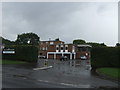
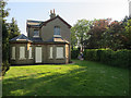
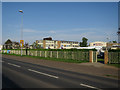
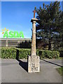
Photos of NR6 5FG


Area Information
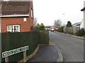
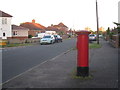
Living in NR6 5FG offers a distinct experience characterised by high density within a compact footprint. This specific postcode covers a small residential cluster spanning just 1.3 hectares yet hosting a population of 1888 people. The resulting population density reaches 147,375 people per square kilometre, which creates a relatively crowded living environment compared to wider rural climates. Residents here navigate a shared space where proximity to neighbours is a defining feature of daily life. The area functions as a concentrated pocket within the wider Norwich region, balancing suburban convenience with close quarters. You will find yourself part of a community where traditional home ownership dominates, yet the physical layout remains tightly knit. This specific postcode serves as a practical residence for those seeking a grounded, location-specific home base. The sheer concentration of households in such a small area means local infrastructure and services must cater to a significant number of people per square metre. Living in NR6 5FG presents a clear reality of dense residential living where the character of the neighbourhood is shaped by this intense population distribution.
- Area Type
- Postcode
- Area Size
- 1.3 hectares
- Population
- 1888
- Population Density
- 2233 people/km²
The property market in NR6 5FG is defined by a near-total shift towards owner occupancy, with 91% of residents holding titles to their homes. This statistic creates a landscape where buyers confront established, private estates rather than a high volume of rental units waiting for tenants. The accommodation type listed is strictly Houses, meaning you will not find mixed-use sites or apartment blocks within this specific postcode cluster. Every property falls under the category of a house, which dictates the style of building and the potential for modification or extension. The high ownership rate of 91% suggests that the housing stock consists of families and individuals who have remained in their locations for extended periods. This long tenure often means the environmental condition of homes is well-maintained but may require updates from former owners. There is little speculation about massive new flats entering this 1.3 hectare footprint. When viewing homes in NR6 5FG, you are looking at a consistent market of house-based living where the primary transaction type is the sale between individuals. This uniformity in accommodation type simplifies the search for buyers who specifically require detached or semi-detached structures. The market behaviour here reflects a desire for purchase over lease, driven by the deep roots of the current population.
House Prices in NR6 5FG
Showing 12 properties
| Address | Type | Beds | Baths | Last Sale Price | Last Sale Date | |
|---|---|---|---|---|---|---|
| 5 Ash Close, Hellesdon, NR6 5FG | Retail | 3 | 1 | £258,300 | Mar 2022 | |
| 2 Ash Close, Hellesdon, NR6 5FG | house | - | - | £278,000 | Oct 2021 | |
| 1 Ash Close, Hellesdon, NR6 5FG | house | - | - | £251,000 | Mar 2020 | |
| 10 Ash Close, Hellesdon, NR6 5FG | house | - | - | £305,995 | Dec 2019 | |
| 11 Ash Close, Hellesdon, NR6 5FG | house | - | - | £205,995 | Dec 2019 | |
| 8 Ash Close, Hellesdon, NR6 5FG | house | - | - | £379,995 | Dec 2019 | |
| 9 Ash Close, Hellesdon, NR6 5FG | house | - | - | £199,995 | Dec 2019 | |
| 6 Ash Close, Hellesdon, NR6 5FG | house | - | - | £359,995 | Dec 2019 | |
| 4 Ash Close, Hellesdon, NR6 5FG | house | - | - | £312,995 | Dec 2019 | |
| 12 Ash Close, Hellesdon, NR6 5FG | house | - | - | £297,995 | Dec 2019 |
Energy Efficiency in NR6 5FG
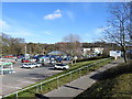
Daily life in NR6 5FG benefits from a range of amenities within practical reach, including retail giants and transport hubs. Residents have access to five key retail locations, with notable venues such as Asda Norwich, M & S Sweet Briar Norwich SF, and Cook Norwich offering everyday shopping conveniences. These stores provide a consolidated option for groceries and household needs without the necessity of long travel. For travellers, the area is near Norwich International Airport, providing air connections to destinations across the UK and Europe. Rail connectivity is supported by two stations, Norwich Railway Station and Salhouse Railway Station, allowing access to the wider national rail network. You can choose between the major station at Norwich or the alternative at Salhouse depending on your route requirements. The presence of these specific venues means you do not need to look far for essentials or transport links. The proximity to these named facilities integrates the local cluster seamlessly into the broader infrastructure of Norfolk. Living in this postcode means having these specific shops and stations as immediate neighbours in your daily routine. The combination of superstores and railheads creates a practical lifestyle where work, leisure, and travel are all accessible with minimal effort.
Amenities
Schools
| Rank | School | Type | Entry gender | Ages |
|---|
Explore more schools in this area
Go to Schools tabDemographics
The community within NR6 5FG reflects a mature and established demographic profile with a median age of 47 years. Adults aged between 30 and 64 years form the most common age range, indicating a population that has settled into long-term roots rather than being dominated by students or recent newcomers. This age distribution suggests a stable neighbourhood where families andempty nesters reside with permanence. Home ownership stands at an exceptional 91%, creating a predominantly owner-occupied estate where residents likely invest heavily in their properties and local improvements. This high rate of ownership typically correlates with community stability and a lower turnover of households. The accommodation type is exclusively houses, removing the variability found in mixed-market estates that combine flats and terraced housing. Ethnically, the predominant group is White, which shapes the cultural fabric of this specific postcode. You are entering a mature market where long-term residents maintain a strong presence. The demographic data paints a picture of a settled, middle-aged population living in houses with a very strong sense of tenure. This environment suits buyers who value stability and a community defined by established homeownership rather than transient renting or new developments.
Household Size
Accommodation Type
Tenure
Ethnic Group
Religion
Household Composition
Age
Household Deprivation
NS-SEC
Explore more demographic insights in this area
Go to Demographics tabPlanning
Planning Constraints
- Flood RiskPremium
- Ramsar Wetland SitesPremium
- Area of Outstanding Natural BeautyPremium
- Protected Nature ReservePremium
- Protected WoodlandPremium