Area Overview for NR6 5ET
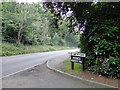
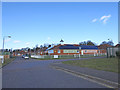
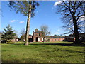
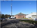
Photos of NR6 5ET


Area Information
NR6 5ET occupies a specific residential cluster covering 2,676 square metres within Norfolk. This compact area serves a population of 1,572 residents, creating a tightly knit neighbourhood where daily interactions are common among neighbours. The location functions as a quiet residential hub almost entirely dedicated to housing, with no industrial or commercial zones within the immediate boundaries. Life here is defined by proximity rather than sprawl, making transport links and local amenities vital for daily convenience. Residents rely heavily on nearby facilities for shopping, travel, and leisure because the postcode itself contains only homes. The small footprint means that turning circles and parking can be challenges, yet it also offers a sense of space away from the wider city bustle. You will find yourself surrounded by houses rather than shops or offices, which shapes how the community operates. This area represents a slice of the wider Norwich landscape where home ownership is the norm and the pace of life is generally measured in neighbourhood withdrawals rather than urban urgency.
- Area Type
- Postcode
- Area Size
- 2676 m²
- Population
- 1572
- Population Density
- 837 people/km²
The property market in NR6 5ET is overwhelmingly owner-occupied, with houses accounting for 75 per cent of home ownership rates. This high percentage suggests that the stocks are stable and that most residents have purchased properties for the long term rather than renting short-term rentals. The dominant accommodation type is the house, which dictates the architectural character and street layouts you will encounter if you drive through the area. Because you are looking at a small residential cluster of just 2,676 square metres, supply is limited and competition for available houses may be fierce. The market here is not driven by student lets or young professionals seeking city bargains; instead, it reflects buyers seeking family homes in established neighbourhoods. Investors might find fewer rental opportunities compared to a typical high-rise district because the 75 per cent ownership figure indicates a classic council-bought or privately bought environment. When you view a home in NR6 5ET, you are likely entering a property that has housed the same family for many years, adding a layer of community history to any sale.
House Prices in NR6 5ET
Showing 1 properties
| Address | Type | Beds | Baths | Last Sale Price | Last Sale Date | |
|---|---|---|---|---|---|---|
| The Robins, Hospital Lane, Hellesdon, NR6 5ET | Detached | - | - | - | - |
Energy Efficiency in NR6 5ET
Your daily life in NR6 5ET revolves around a short drive to essential services like Cook Norwich, M&S Sweet Briar Norwich SF, and Asda Norwich. These retail outlets provide your weekly groceries and household essentials, ensuring that routine shopping trips remain efficient and convenient. You have access to two railway stations, namely Norwich Railway Station and Salhouse Railway Station, which offer connectivity to wider Norfolk and beyond. Norwich International Airport is situated within practical reach, making business travel or holidays accessible with a quick journey. Despite the size of the area being only 2,676 square metres, the concentration of these amenities within proximity creates a functional residential zone. You will not find multiple pubs, cinemas, or large leisure centres inside the postcode itself, so all cultural or entertainment activities require a short excursion to nearby towns. This layout prioritises the home as the central living space while keeping major errands and travel within easy striking distance.
Amenities
Schools
| Rank | School | Type | Entry gender | Ages |
|---|
Explore more schools in this area
Go to Schools tabDemographics
The community in NR6 5ET centres on adults aged between 30 and 64 years, who form the most common age group. The median age for residents is 47, indicating a population that has moved beyond their early career years and into stability. You will find that 75 per cent of people in this area own their homes, meaning the neighbourhood has a strong sense of permanence rather than transient renting. The prevailing accommodation type consists of houses, reflecting a preference for detached or semi-detached living over apartments or flats. Diversity in the area is predominantly White, which mirrors the broader demographic trends of many English villages and suburban clusters. The population density stands at 837 people per square kilometre, a figure that suggests a moderately packed environment without the crush of a major city centre. These statistics paint a picture of a settled community where families with children and empty nesters likely dominate the street scene.
Household Size
Accommodation Type
Tenure
Ethnic Group
Religion
Household Composition
Age
Household Deprivation
NS-SEC
Explore more demographic insights in this area
Go to Demographics tabPlanning
Planning Constraints
- Flood RiskPremium
- Ramsar Wetland SitesPremium
- Area of Outstanding Natural BeautyPremium
- Protected Nature ReservePremium
- Protected WoodlandPremium