Area Overview for NR6 5BT
Photos of NR6 5BT
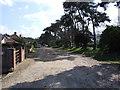
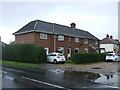
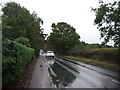
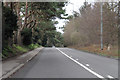
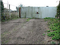
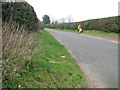
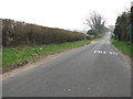
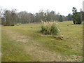
12 photos from this area
Area Information
Key information about the NR6 5BT including its size, population, and administrative classification.
- Area Type
- Postcode
- Area Size
- 1.0 hectares
- Population
- 1396
- Population Density
- 2357 people/km²
House Prices in NR6 5BT
7
Properties
£267,000
Average Sold Price
£124,000
Lowest Price
£370,000
Highest Price
Showing 7 properties
| Address | Type | Beds | Baths | Last Sale Price | Last Sale Date | |
|---|---|---|---|---|---|---|
| 243 Drayton High Road, Hellesdon, NR6 5BT | Retail | 3 | 1 | £358,000 | Sep 2022 | |
| 237 Drayton High Road, Drayton, NR6 5BT | Detached | 4 | - | £310,000 | Aug 2014 | |
| 245 Drayton High Road, Hellesdon, NR6 5BT | Detached | 5 | 2 | £370,000 | Jun 2012 | |
| 239 Drayton High Road, Drayton, NR6 5BT | Detached | - | - | £173,000 | Nov 2011 | |
| 247 Drayton High Road, Hellesdon, NR6 5BT | Bungalow | 6 | 2 | £124,000 | Jul 2001 | |
| Annexe, 245 Drayton High Road, Hellesdon, NR6 5BT | Detached | - | - | - | - | |
| 241 Drayton High Road, Hellesdon, NR6 5BT | Detached | - | - | - | - |
Energy Efficiency in NR6 5BT
Amenities
Schools
| Rank | School | Type | Entry gender | Ages |
|---|
Explore more schools in this area
Go to Schools tabDemographics
Household Size
Two person
most common
Accommodation Type
Houses
most common
Tenure
81
majority
Ethnic Group
White
most common
Religion
N/A
most common
Household Composition
N/A
most common
Age
47
median
Adults (30-64 years)
most common
Household Deprivation
N/A
with no deprivation
NS-SEC
22
in Lower managerial occupations
Explore more demographic insights in this area
Go to Demographics tabPlanning
Planning Constraints
- Flood RiskPremium
- Ramsar Wetland SitesPremium
- Area of Outstanding Natural BeautyPremium
- Protected Nature ReservePremium
- Protected WoodlandPremium