Area Overview for NR5 8QE
Photos of NR5 8QE


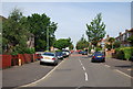
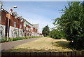
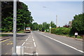
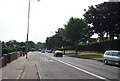
73 photos from this area
Area Information
Key information about the NR5 8QE including its size, population, and administrative classification.
- Area Type
- Postcode
- Area Size
- 1.8 hectares
- Population
- 1981
- Population Density
- 2521 people/km²
House Prices in NR5 8QE
18
Properties
£246,563
Average Sold Price
£127,000
Lowest Price
£450,000
Highest Price
Showing 18 properties
| Address | Type | Beds | Baths | Last Sale Price | Last Sale Date | |
|---|---|---|---|---|---|---|
| 366 Dereham Road, Norwich, NR5 8QE | Semi-detached | 3 | 2 | £450,000 | Aug 2022 | |
| 364 Dereham Road, Norwich, NR5 8QE | Detached | 4 | 2 | £330,000 | Jun 2021 | |
| 382 Dereham Road, Norwich, NR5 8QE | Semi-detached | 3 | 1 | £208,000 | Feb 2020 | |
| 356 Dereham Road, Norwich, NR5 8QE | Detached | 3 | 1 | £242,500 | Nov 2018 | |
| 368 Dereham Road, Norwich, NR5 8QE | Detached | 4 | 1 | £239,000 | Jul 2017 | |
| 362 Dereham Road, Norwich, NR5 8QE | Detached | 4 | - | £239,000 | Oct 2013 | |
| 374 Dereham Road, Norwich, NR5 8QE | Detached | 3 | 1 | £137,000 | Jan 2004 | |
| 360 Dereham Road, Norwich, NR5 8QE | Detached | - | - | £127,000 | Nov 2002 | |
| 378C Dereham Road, Norwich, NR5 8QE | Detached | 3 | 2 | - | - | |
| 358 Dereham Road, Norwich, NR5 8QE | house | 3 | 1 | - | - |
Page 1 of 2
Energy Efficiency in NR5 8QE
Amenities
Schools
| Rank | School | Type | Entry gender | Ages |
|---|
Explore more schools in this area
Go to Schools tabDemographics
Household Size
Family (3-5 people)
most common
Accommodation Type
Houses
most common
Tenure
49
majority
Ethnic Group
White
most common
Religion
N/A
most common
Household Composition
N/A
most common
Age
47
median
Adults (30-64 years)
most common
Household Deprivation
N/A
with no deprivation
NS-SEC
27
in Lower managerial occupations
Explore more demographic insights in this area
Go to Demographics tabPlanning
Planning Constraints
- Flood RiskPremium
- Ramsar Wetland SitesPremium
- Area of Outstanding Natural BeautyPremium
- Protected Nature ReservePremium
- Protected WoodlandPremium