Area Overview for NR5 0NW
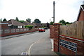
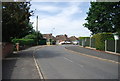
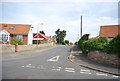
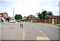
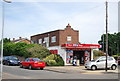
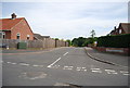
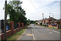
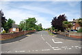
Photos of NR5 0NW
Area Information
Living in NR5 0NW offers a quiet residential experience within a compact 1.2-hectare cluster. This specific postcode serves a small population of 2,031 people, creating a close-knit community where neighbours often know each other by name. You will find a predominantly settled environment where daily life moves at a gentle pace compared to the city centre. The area sits entirely within the NR5 postcode area of Norfolk, England, providing access to the wider region while maintaining a distinct local identity. Residents value the small-scale nature of their immediate surroundings, which minimises through-traffic and noise from major thoroughfares. This postcode represents a specific residential niche rather than a sprawling district, meaning your view is likely limited to adjacent gardens and local streets rather than distant city skylines. The concentration of homes creates an intimate setting where privacy and community neighbourliness often coexist. For those seeking a edge-of-town feel in Norfolk, this location delivers exactly that profile without the chaos of larger towns. Your home here is part of a tight geographical unit, fostering a sense of belonging that is common in villages but rare in modern urban sprawl.
- Area Type
- Postcode
- Area Size
- 1.2 hectares
- Population
- 2031
- Population Density
- 2742 people/km²
The property market in NR5 0NW is characterised almost exclusively by houses rather than flats or shared ownership schemes. This evidence points to a market where traditional housing stocks dominate the local landscape. With 91% of the population owning their homes, the area functions as a deep owner-occupied community rather than a rental market. This high ownership rate often correlates with lower tenant turnover and greater investment in local properties. If you are considering buying homes in NR5 0NW, expect to engage with private estate agents selling individual properties to individual buyers. The small area size of 1.2 hectares limits the total number of transactions compared to larger districts, which can keep local property values distinct from wider regional trends. The absence of multiple apartment blocks or student flats means the housing stock is likely tailored to families or older couples seeking a house garden. This stability offers security for investors, as the demographic profile shows most occupants are long-term residents rather than short-term renters. Buying here means entering an established market where the vast majority of sellers are owners looking to move upmarket or downscale.
House Prices in NR5 0NW
Showing 20 properties
| Address | Type | Beds | Baths | Last Sale Price | Last Sale Date | |
|---|---|---|---|---|---|---|
| 6 Hill Road, Costessey, NR5 0NW | Semi-detached | 3 | - | £282,750 | Sep 2021 | |
| 13 Hill Road, Costessey, NR5 0NW | Detached | 5 | 1 | £460,000 | Feb 2020 | |
| 9 Hill Road, Costessey, NR5 0NW | Bungalow | 3 | 1 | £285,000 | Mar 2018 | |
| 16 Hill Road, Costessey, NR5 0NW | Bungalow | 2 | - | £235,000 | Feb 2017 | |
| 4 Hill Road, Costessey, NR5 0NW | Bungalow | 3 | 1 | £164,000 | Aug 2015 | |
| 14 Hill Road, Costessey, NR5 0NW | Bungalow | 2 | 1 | £200,000 | Feb 2015 | |
| 5 Hill Road, Costessey, NR5 0NW | Detached | - | - | £120,000 | Sep 2014 | |
| 1 Hill Road, Costessey, NR5 0NW | Semi-detached | 3 | - | £175,000 | Nov 2013 | |
| 22 Hill Road, Costessey, NR5 0NW | Bungalow | 3 | - | £229,995 | Sep 2006 | |
| 10 Hill Road, Costessey, NR5 0NW | Detached | - | - | £128,500 | Nov 2000 |
Energy Efficiency in NR5 0NW
Daily life in NR5 0NW is supported by a curated selection of amenities within practical reach. You have access to major retail parks including East of England Co-operative Co, Asda Norwich, and Aldi Earlham. These supermarkets form the backbone of daily shopping needs, offering groceries, household goods, and pharmacies. For leisure and travel, Norwich Railway Station provides rail links to London and beyond, while Norwich International Airport handles commercial and leisure flights. The availability of these transport hubs means you can easily combine local convenience with wider regional travel. Although the area is small, the proximity to these significant commercial and transport sites reduces the need for long-distance drives just to complete essential tasks. You will find that your weekly shop, your daily commute to work, and your occasional holiday travel are all logistically simple from this postcode. The layout ensures that essential services are not far away, balancing the quiet of home with the utility of a nearby town centre.
Amenities
Schools
| Rank | School | Type | Entry gender | Ages |
|---|
Explore more schools in this area
Go to Schools tabDemographics
The community in NR5 0NW is defined by a mature demographic profile with a median age of 47 years. Most residents fall into the adult age range between 30 and 64 years, suggesting a population that has established careers and families. This age distribution indicates a neighbourhood of stability rather than transient housing. Homeownership is extremely high at 91%, meaning nearly every person living here owns their property outright or with a mortgage. This statistic highlights that the area is not a student town or a retirement village but a family and professional hub. The predominant accommodation type consists of houses, with very few apartments or flats recorded in this specific cluster. You will not find the high-rise living density associated with larger urban centres. While White residents form the predominant ethnic group, the specific data does not break down minority populations beyond this general descriptor. Deprivation data is not provided in the available records, but the high ownership rate and house-centric housing stock usually correlate with stable neighbourhoods. The demographic makeup suggests a community where long-term residents outnumber newcomers, creating a steady social fabric for those looking to settle down in Norfolk.
Household Size
Accommodation Type
Tenure
Ethnic Group
Religion
Household Composition
Age
Household Deprivation
NS-SEC
Explore more demographic insights in this area
Go to Demographics tabPlanning
Planning Constraints
- Flood RiskPremium
- Ramsar Wetland SitesPremium
- Area of Outstanding Natural BeautyPremium
- Protected Nature ReservePremium
- Protected WoodlandPremium