Area Overview for NR5 0LZ
Photos of NR5 0LZ
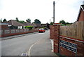
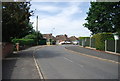
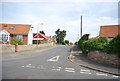
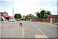
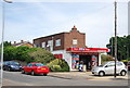
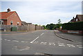
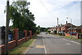
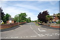
35 photos from this area
Area Information
Key information about the NR5 0LZ including its size, population, and administrative classification.
- Area Type
- Postcode
- Area Size
- 1.2 hectares
- Population
- 2031
- Population Density
- 2742 people/km²
House Prices in NR5 0LZ
20
Properties
£191,779
Average Sold Price
£39,000
Lowest Price
£285,000
Highest Price
Showing 20 properties
| Address | Type | Beds | Baths | Last Sale Price | Last Sale Date | |
|---|---|---|---|---|---|---|
| 42 Hill Road, Costessey, NR5 0LZ | Chalet | 2 | 2 | £278,000 | Jul 2023 | |
| 68 Hill Road, Costessey, NR5 0LZ | Bungalow | - | - | £212,500 | Jul 2019 | |
| 66 Hill Road, Costessey, NR5 0LZ | Bungalow | 3 | 1 | £285,000 | Sep 2018 | |
| 40 Hill Road, Costessey, NR5 0LZ | Bungalow | 4 | - | £260,000 | Jan 2016 | |
| 50 Hill Road, Costessey, NR5 0LZ | house | - | - | £200,000 | Jan 2009 | |
| 36 Hill Road, Costessey, NR5 0LZ | Semi-detached | - | - | £67,950 | Jun 2001 | |
| 56 Hill Road, Costessey, NR5 0LZ | Detached | - | - | £39,000 | Nov 1995 | |
| 54 Hill Road, Costessey, NR5 0LZ | Detached | 4 | 1 | - | - | |
| 72 Hill Road, Costessey, NR5 0LZ | house | 2 | - | - | - | |
| 64A Hill Road, Costessey, NR5 0LZ | Detached | - | - | - | - |
Page 1 of 2
Energy Efficiency in NR5 0LZ
Amenities
Schools
| Rank | School | Type | Entry gender | Ages |
|---|
Explore more schools in this area
Go to Schools tabDemographics
Household Size
Two person
most common
Accommodation Type
Houses
most common
Tenure
91
majority
Ethnic Group
White
most common
Religion
N/A
most common
Household Composition
N/A
most common
Age
47
median
Adults (30-64 years)
most common
Household Deprivation
N/A
with no deprivation
NS-SEC
30
in Lower managerial occupations
Explore more demographic insights in this area
Go to Demographics tabPlanning
Planning Constraints
- Flood RiskPremium
- Ramsar Wetland SitesPremium
- Area of Outstanding Natural BeautyPremium
- Protected Nature ReservePremium
- Protected WoodlandPremium