Area Overview for NR5 0ES
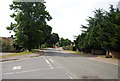
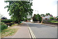
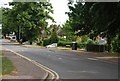
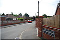
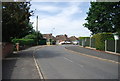
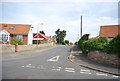
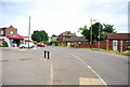
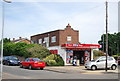
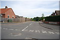
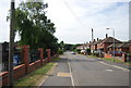
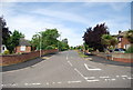
Photos of NR5 0ES

Area Information
Living in NR5 0ES means residing in a compact residential cluster that spans just 2.4 hectares. This small postcode area is home to 2,031 people, creating a tightly knit community where neighbours are likely to know each other. The sheer density of 85,543 people per square kilometre suggests a vibrant, close-knit environment where local interactions are frequent and immediate. You will find that daily life here is defined by proximity, with essential services and a sense of community easily within walking distance. The area represents a specific slice of Norfolk life, distinct from larger urban sprawls. It offers a高密度的 living experience without the anonymity of big cities. Residents appreciate the convenience of having everything nearby while maintaining a distinct residential character. The population size is small enough to foster familiarity, yet large enough to support a variety of household needs. This balance makes NR5 0ES attractive for those seeking a settled life where the immediate surroundings feel manageable and secure. The area's identity is rooted in its residential purpose, serving as a stable anchor for families and individuals who prioritise community over isolation.
- Area Type
- Postcode
- Area Size
- 2.4 hectares
- Population
- 2031
- Population Density
- 2742 people/km²
The housing stock in NR5 0ES is overwhelmingly characterised by houses, catering primarily to owner-occupiers rather than investors or renters. With a home ownership level of 91%, the area functions as a established residential zone where most residents have purchased their properties outright or through mortgages secured years ago. This stands in stark contrast to urban areas where rental properties often dominate the market landscape. For buyers looking at homes in NR5 0ES, this means you are entering a market defined by stability and long-term residency. The dominance of houses aligns with the demographic profile of adults aged 30 to 64, suggesting a preference for detached or semi-detached living over flats. You will not find purpose-built rental schemes or high-density apartments as a significant part of the available stock. The very small area size of 2.4 hectares further limits the scope for large-scale new developments, reinforcing the established nature of the housing. Prospective buyers can expect to find properties that have been lived in by families for extended periods. The market reflects a desire for space and privacy, typical of house-based living. Understanding this mix helps you navigate the local market with the expectation of finding a quiet, owner-occupied residence rather than a transient rental property.
House Prices in NR5 0ES
Showing 38 properties
| Address | Type | Beds | Baths | Last Sale Price | Last Sale Date | |
|---|---|---|---|---|---|---|
| 47 Crown Road, Costessey, NR5 0ES | house | - | - | £187,500 | Mar 2025 | |
| 45 Crown Road, Costessey, NR5 0ES | Bungalow | 3 | 2 | £260,000 | Mar 2024 | |
| 32 Crown Road, Costessey, NR5 0ES | Bungalow | 2 | - | £200,000 | Sep 2021 | |
| 59 Crown Road, Costessey, NR5 0ES | Detached | 4 | 1 | £240,000 | Jan 2021 | |
| 36 Crown Road, Costessey, NR5 0ES | Bungalow | 4 | - | £215,000 | Nov 2020 | |
| 73 Crown Road, Costessey, NR5 0ES | Bungalow | 3 | - | £212,000 | Sep 2017 | |
| 30 Crown Road, Costessey, NR5 0ES | Semi-detached | 2 | - | £175,000 | Apr 2017 | |
| 37 Crown Road, Costessey, NR5 0ES | Bungalow | 4 | 1 | £229,000 | Mar 2016 | |
| 46 Crown Road, Costessey, NR5 0ES | Chalet | 4 | - | £247,000 | May 2015 | |
| 69 Crown Road, Costessey, NR5 0ES | Bungalow | 3 | 2 | £225,000 | Dec 2014 |
Energy Efficiency in NR5 0ES
Your daily life in NR5 0ES benefits from a cluster of practical amenities within easy reach. Residents have access to five key retail locations, including the East of England Co-operative Co, Aldi Earlham, and Morrisons Daily. These venues provide everything from essential groceries to household necessities without the need for lengthy travel. For larger shopping trips, the area is well-positioned relative to Norwich Railway Station, which serves as a central hub for regional travel. Additionally, Norwich International Airport is nearby, offering convenient departures for holidays or business trips without leaving the broader vicinity. While the immediate surroundings focus on residential needs, the presence of these specific retailers means you can manage most errands locally. The availability of a Co-operative and major chains like Aldi and Morrisons ensures competitive pricing and variety for food shopping. Transport links do not include specific local parks or leisure centres in the immediate data, but the proximity to Norwich facilities means you have easy access to larger parks and entertainment venues. The lifestyle here is defined by convenience and the ability to run errands quickly from your home. The mix of local shops and regional airports creates a balanced routine where you can live quietly yet move freely when necessary. The specific names of the shops suggest a well-supported daily life for residents of this postcode.
Amenities
Schools
| Rank | School | Type | Entry gender | Ages |
|---|
Explore more schools in this area
Go to Schools tabDemographics
The community in NR5 0ES is dominated by adults aged between 30 and 64 years. This demographic skew is confirmed by the median age of 47, which indicates a mature population largely comprised of working-age families or established individuals. You are significantly more likely to purchase a home than rent, with home ownership rates standing at an impressive 91*. This high level of stability suggests a community where residents have long-term roots and commitment to the locality. The predominant accommodation type consists of houses, reflecting the family-oriented nature of the neighbourhood. Ethnically, the area is primarily White, consistent with broader trends in rural and semi-rural England. The absence of rental pressure contributes to a cohesive social fabric where lifelong neighbours are common. This demographic profile creates a predictable environment with shared values regarding family life and home maintenance. The age distribution means that local schools cater primarily to children of school age and teenagers, rather than a mix of young children and elderly residents. This focus on the adult population shapes the local culture towards stability and continuity. The high homeownership rate also implies lower turnover, meaning you are more likely to find a community ready to engage with new neighbours.
Household Size
Accommodation Type
Tenure
Ethnic Group
Religion
Household Composition
Age
Household Deprivation
NS-SEC
Explore more demographic insights in this area
Go to Demographics tabPlanning
Planning Constraints
- Flood RiskPremium
- Ramsar Wetland SitesPremium
- Area of Outstanding Natural BeautyPremium
- Protected Nature ReservePremium
- Protected WoodlandPremium