Area Overview for NR5 0DF
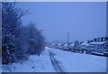
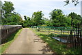
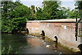
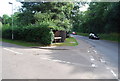
Photos of NR5 0DF


Area Information
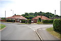
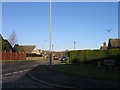
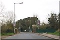
Living in NR5 0DF offers a quiet residential experience within a compact cluster of just 1.6 hectares. This specific postcode area is home to 1,642 people, creating a tight-knit local environment where neighbours are likely to know one another. The high population density equates to approximately 102,750 people per square kilometre, which indicates a concentrated settlement pattern typical of established residential pockets in the Norfolk region. For those seeking a settled community away from the hustle of larger towns, NR5 0DF provides a focused living space. You are situated in a region that balances privacy with reasonable access to broader facilities. The area is defined by its small footprint rather than extensive tracts of land, meaning you will be surrounded by residential properties. This layout suits individuals who prefer a distinct neighbourhood identity over sprawling suburban developments. Daily life here revolves around proximity to essential services while maintaining a sense of seclusion within your own garden or lane.
- Area Type
- Postcode
- Area Size
- 1.6 hectares
- Population
- 1642
- Population Density
- 2547 people/km²
Homes in NR5 0DF represent a straightforward chapter of the property market due to the dominance of single-occupancy living. With 86% of residents owning their homes, the immediate surroundings are largely comprised of owner-occupied dwellings rather than rental properties. Houses are the standard accommodation type here, meaning you will find a collection of detached or semi-detached properties suited to families or retirees. This post code covers a small residential cluster of 1.6 hectares, limiting the total number of available homes in the immediate vicinity. Consequently, competition for specific properties may be intense given the limited supply relative to demand. The high ownership percentage also suggests that many sellers have lived in their homes for many years, potentially resulting in properties with significant upgrades or maintenance needs. Buyers looking at this area should expect a market where pricing reflects long-term value and practical living spaces rather than speculative investment builds.
House Prices in NR5 0DF
Showing 30 properties
| Address | Type | Beds | Baths | Last Sale Price | Last Sale Date | |
|---|---|---|---|---|---|---|
| 29 Oval Road, Costessey, NR5 0DF | Bungalow | - | - | £235,580 | Jan 2023 | |
| 34 Oval Road, Costessey, NR5 0DF | Semi-detached | 4 | - | £240,000 | Aug 2019 | |
| 33 Oval Road, Costessey, NR5 0DF | Bungalow | 3 | 1 | £225,000 | Jul 2018 | |
| 20 Oval Road, Costessey, NR5 0DF | Semi-detached | 2 | 1 | £178,500 | Mar 2018 | |
| 23 Oval Road, Costessey, NR5 0DF | Semi-detached | 2 | 1 | £210,000 | Nov 2017 | |
| 35 Oval Road, Costessey, NR5 0DF | Semi-detached | 2 | 1 | £217,500 | Aug 2017 | |
| 38 Oval Road, Costessey, NR5 0DF | Bungalow | - | - | £150,000 | Aug 2015 | |
| 30 Oval Road, Costessey, NR5 0DF | Semi-detached | 2 | - | £165,000 | Feb 2014 | |
| 21 Oval Road, Costessey, NR5 0DF | Semi-detached | - | - | £139,000 | Aug 2013 | |
| 28 Oval Road, Costessey, NR5 0DF | Bungalow | 3 | - | £139,000 | Dec 2011 |
Energy Efficiency in NR5 0DF
Daily life in NR5 0DF benefits from a selection of retail and leisure outlets within easy reach. Local shopping is well served by five retail venues, including the East of England Co-operative Co, Aldi Earlham, and Morrisons Daily. These supermarkets provide the essentials for weekly shop ethics and convenience without the need for lengthy trips to larger towns. For travel, Norwich Railway Station offers rail connections, while Norwich International Airport provides access to domestic and international flights. While NR5 0DF itself is a quiet residential zone, these amenities are conveniently located nearby. The character of the lifestyle here is defined by this practical proximity to major high streets and transport nodes. You are not isolated; however, you are not in a busy city centre either. The presence of these specific named venues ensures that your daily errands are covered efficiently, blending the quietude of a neighbourhood with the utility of a nearby town.
Amenities
Schools
Families seeking education for their children in NR5 0DF have access to several specific institutions nearby. Costessey Infant School operates as both a standard primary school and an academy, offering early education options for young residents. For children with special educational needs or support, Banks House School is available and holds an Outstanding Ofsted rating. This top-tier rating signifies a high standard of provision and care, which is a significant practical advantage for families considering this location. The presence of a special school alongside a primary institution means parents have a range of educational pathways within close reach. When choosing schools near NR5 0DF, you can rely on the specific profiles of these names rather than unnamed facilities. The mix of academy and traditional primary status provides flexibility for pupils during transitions.
| Rank | School | Type | Entry gender | Ages |
|---|
Explore more schools in this area
Go to Schools tabDemographics
The community profile of NR5 0DF is dominated by established residents, with a median age of 47 years. Adults between the ages of 30 and 64 form the most common age range, suggesting a population of families with grown children or downsizers seeking stability. Home ownership stands at a robust 86%, indicating that the vast majority of residents have purchased their properties rather than renting. This high ownership rate reflects long-term settlement and financial investment in the locality. Houses constitute the primary accommodation type, aligning with the preference of the demographic for traditional family homes. The predominant ethnic group is White, mirroring the broader historical makeup of many areas in East Anglia. With such a strong owner-occupier base, the atmosphere remains relatively consistent year-round, without fluctuations driven by transient tenant movements. This stability means you can expect a settled community where local knowledge and investment are high, fostering a environment where residents often stay for decades.
Household Size
Accommodation Type
Tenure
Ethnic Group
Religion
Household Composition
Age
Household Deprivation
NS-SEC
Explore more demographic insights in this area
Go to Demographics tabPlanning
Planning Constraints
- Flood RiskPremium
- Ramsar Wetland SitesPremium
- Area of Outstanding Natural BeautyPremium
- Protected Nature ReservePremium
- Protected WoodlandPremium