Area Overview for NR5 0AL
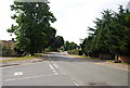
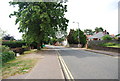
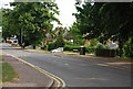
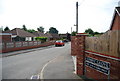
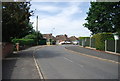
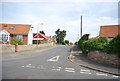
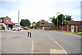
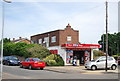
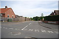
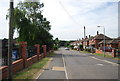
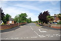
Photos of NR5 0AL

Area Information
Living in NR5 0AL means residing in a very specific residential cluster defined by its unique postcode. This small area covers a ground size of 6,443 square metres and houses a population of 2,031 people. The density is extremely high, reaching 315,225 people per square kilometre, which suggests tightly packed housing within this boundary. You will find a community that feels established and settled rather than newly developed. The location is situated in England, offering a clear residential footprint for those seeking a defined home environment. Prospective buyers looking at homes in NR5 0AL encounter a postcode that represents a precise residential unit rather than a broad district. Daily life here revolves around this concentrated community presence. The area functions as a contained residential zone where neighbours are likely to know one another due to the compact nature of the postcodes. This structure creates a distinct living environment separate from wider neighbourhoods, providing a clear address identity for every resident.
- Area Type
- Postcode
- Area Size
- 6443 m²
- Population
- 2031
- Population Density
- 2742 people/km²
Homes in NR5 0AL are defined by a overwhelmingly owner-occupied market structure. The data reveals a remarkable 91 per cent home ownership level, which starkly contrasts with the prevailing rental markets found in many other UK postcodes. This figure indicates that speculative buying and short-term renting are rare occurrences in this specific area. The accommodation type data confirms that houses form the primary housing stock, serving this dedicated owner base. You will find few purpose-built rental flats or HMOs compared to the substantial number of family homes. This market character means buyers treating NR5 0AL encounter a stable environment where properties are intended for permanent living. The high ownership percentage often correlates with lower tenant turnover and better maintained housing standards. For someone considering purchasing a property, the local market offers a secure environment with minimal investment risk from rental voids. The housing stock is tailored to families and long-term residents who value the security of home ownership. This local real estate landscape functions distinctively from the wider regional market where rental demand is more common.
House Prices in NR5 0AL
Showing 16 properties
| Address | Type | Beds | Baths | Last Sale Price | Last Sale Date | |
|---|---|---|---|---|---|---|
| 4 De Grey Close, Costessey, NR5 0AL | Detached | 4 | 2 | £400,000 | May 2024 | |
| 8 De Grey Close, Costessey, NR5 0AL | house | - | - | £280,000 | Mar 2021 | |
| 10 De Grey Close, Costessey, NR5 0AL | Detached | 3 | 2 | £275,000 | Jul 2020 | |
| 1 De Grey Close, Costessey, NR5 0AL | house | - | - | £209,195 | Apr 2017 | |
| 3 De Grey Close, Costessey, NR5 0AL | Detached | 3 | 2 | £187,500 | Aug 2013 | |
| 2 De Grey Close, Costessey, NR5 0AL | house | - | - | - | - | |
| 6 De Grey Close, Costessey, NR5 0AL | house | - | - | - | - | |
| 4 Alice Baker Close, Costessey, NR5 0AL | undefined | - | - | - | - | |
| 9 Alice Baker Close, Costessey, NR5 0AL | undefined | - | - | - | - | |
| 3 Alice Baker Close, Costessey, NR5 0AL | undefined | - | - | - | - |
Energy Efficiency in NR5 0AL
Residents of NR5 0AL benefit from a range of amenities within practical reach of their homes. Retail options include East of England Co-operative Co, Aldi Earlham, and Morrisons Daily, providing convenience for daily shopping needs. These supermarkets offer essential groceries and household items without requiring long journeys. For air travel, Norwich International Airport is nearby, though this serves mostly as a transit point rather than a leisure destination. Rail connectivity is supported by Norwich Railway Station, which acts as a key transport artery. The area maintains a lifestyle focused on practical convenience rather than extensive leisure facilities within the immediate boundary. Daily life revolves around accessing these major retail chains and transport links. You can manage your weekly shopping at Aldi Earlham or Morrisons Daily with minimal travel time. The presence of East of England Co-operative Co adds a local element to the commercial offerings. This cluster supports a functional lifestyle where essential services are accessible. The amenities listed represent the core services defining life here without excess.
Amenities
Schools
| Rank | School | Type | Entry gender | Ages |
|---|
Explore more schools in this area
Go to Schools tabDemographics
The community in NR5 0AL is dominated by adults, with most residents falling into the 30 to 64 years age range. The median age for the population is 47 years, indicating a mature demographic profile. Family life here is stable, as evidenced by a home ownership rate of 91 per cent. This high figure shows that the vast majority of households own their properties outright or under mortgage, suggesting long-term stability. The most common accommodation type consists of houses, aligning with the homeowner demographic. Diversity data points to White as the predominant ethnic group within this specific postcode. There is little indication of a multi-ethnic mix in this immediate cluster. The population composition reflects a traditional British neighbourhood where established families have settled. Living in NR5 0AL means joining a community where the age structure is heavily weighted towards working-age adults and retirees. This stability contributes to a predictable social environment for new residents seeking a quiet, established setting.
Household Size
Accommodation Type
Tenure
Ethnic Group
Religion
Household Composition
Age
Household Deprivation
NS-SEC
Explore more demographic insights in this area
Go to Demographics tabPlanning
Planning Constraints
- Flood RiskPremium
- Ramsar Wetland SitesPremium
- Area of Outstanding Natural BeautyPremium
- Protected Nature ReservePremium
- Protected WoodlandPremium