Area Overview for NR5 0AA
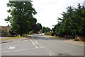
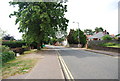
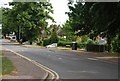
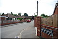
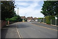
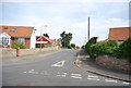
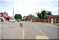
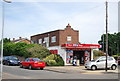
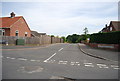
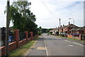
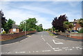
Photos of NR5 0AA

Area Information
Living in NR5 0AA defines life in a compact residential cluster set within a defined postcode area covering 3,115 square metres. This small community holds a population of 2,031 people, creating a tight-knit environment where residents know each other by name. The density reaches 652,110 people per square kilometre, reflecting the concentrated nature of this specific UK location. Residents here enjoy the quiet stability of a neighbourhood where local businesses and public transport hubs are within practical reach. The setting offers a focused living experience away from the sprawling urban sprawl found in larger metropolitan zones. You will find that daily routines are straightforward, with essential services located nearby and no major planning constraints like protected riversides or woodlands affecting development. The absence of Ramsar wetland sites, Areas of Outstanding Natural Beauty, or protected nature reserves means zoning remains flexible. This makes NR5 0AA a distinct choice for those prioritising a clearly defined postcode boundary for their address. The area provides a stable backdrop for family life without the chaos of high-density cities.
- Area Type
- Postcode
- Area Size
- 3115 m²
- Population
- 2031
- Population Density
- 2742 people/km²
The property market for homes in NR5 0AA is overwhelmingly characterised by owner-occupation rather than the rental sector. With 91% of the population owning their homes, the housing stock is dominated by individuals who have purchased their properties over the years. This statistic indicates that the local market relies heavily on second-hand transactions among residents rather than a high turnover of new landlords or corporate tenancies. The accommodation type in this postcode area consists primarily of houses, which points towards a traditional street layout of detached or semi-detached properties. You will find fewer purpose-built flats or housing associations compared to urban districts. This profile suggests that buyers looking for established homes in NR5 0AA are entering a market with low vacancy rates. The small area size of 3,115 square metres limits the total number of available properties, meaning competition can be stiff when a suitable house comes to the market. New builds are unlikely to be common here due to the small footprint and lack of planning constraints like AONBs that would restrict construction.
House Prices in NR5 0AA
Showing 5 properties
| Address | Type | Beds | Baths | Last Sale Price | Last Sale Date | |
|---|---|---|---|---|---|---|
| 97 Norwich Road, Costessey, NR5 0AA | Semi-detached | 4 | 3 | £265,000 | Jul 2021 | |
| 91 Norwich Road, Costessey, NR5 0AA | house | - | - | £438,000 | Aug 2019 | |
| 95 Norwich Road, Costessey, NR5 0AA | Bungalow | - | - | £226,000 | Feb 2010 | |
| 99 Norwich Road, Costessey, NR5 0AA | Terraced | 4 | 2 | £35,000 | Sep 1996 | |
| 93 Norwich Road, Costessey, NR5 0AA | Detached | - | - | £65,000 | Aug 1995 |
Energy Efficiency in NR5 0AA
Lifestyle in NR5 0AA is defined by immediate access to essential retail and transport hubs. Within practical reach, you will find five major sources of weekly shopping including East of England Co-operative Co, Aldi Earlham, and Morrisons Daily. These venues are sufficient for all grocery and household needs. For leisure and travel, Norwich Railway Station offers direct train connections, while Norwich International Airport is located nearby for flight bookings. Residents do not need to travel far to complete their daily errands. The absence of protected nature reserves or AONBs means that open spaces are managed for community use rather than strict conservation. You can visit local parks without navigating restricted access paths. The neighbourhood balances convenience with a lack of large-scale commercial developments, keeping the streets focused on residential tranquility. If you move to NR5 0AA, your shopping trips can still be mostly local, yet you retain easy access to broader regional facilities.
Amenities
Schools
| Rank | School | Type | Entry gender | Ages |
|---|
Explore more schools in this area
Go to Schools tabDemographics
The community in NR5 0AA reflects a mature population with a median age of 47 years. Most residents fall into the adult age range of 30 to 64 years, suggesting an established demographic rather than a youthful population. A full 91% of households own their homes, indicating that the area has been settled for a long time and residents are not transient tenants. This high level of ownership often correlates with stability within the local schooling system and community institutions. Houses remain the predominant accommodation type, meaning you will find several-bedroom family properties rather than converted flats or shared houses. The predominant ethnic group is White, which shapes the cultural character of the neighbourhood in specific ways. There are no statistics provided for deprivation levels in this dataset, so you should rely on the crime data for your primary safety assessment. When you move to NR5 0AA, you are joining a group of homeowners who have put down roots. The population density suggests a shared sense of place, though the total population count of 2,031 keeps noise levels manageable.
Household Size
Accommodation Type
Tenure
Ethnic Group
Religion
Household Composition
Age
Household Deprivation
NS-SEC
Explore more demographic insights in this area
Go to Demographics tabPlanning
Planning Constraints
- Flood RiskPremium
- Ramsar Wetland SitesPremium
- Area of Outstanding Natural BeautyPremium
- Protected Nature ReservePremium
- Protected WoodlandPremium