Area Overview for NR4 7HB
Photos of NR4 7HB

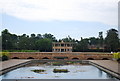
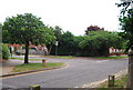
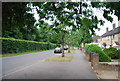
100 photos from this area
Area Information
Key information about the NR4 7HB including its size, population, and administrative classification.
- Area Type
- Postcode
- Area Size
- 7069 m²
- Population
- 1628
- Population Density
- 5966 people/km²
House Prices in NR4 7HB
14
Properties
£204,820
Average Sold Price
£67,000
Lowest Price
£350,000
Highest Price
Showing 14 properties
| Address | Type | Beds | Baths | Last Sale Price | Last Sale Date | |
|---|---|---|---|---|---|---|
| 98 Colman Road, Norwich, NR4 7HB | Semi-detached | 4 | 2 | £307,200 | Aug 2024 | |
| 114 Colman Road, Norwich, NR4 7HB | Semi-detached | 3 | 1 | £265,000 | Feb 2024 | |
| 122 Colman Road, Norwich, NR4 7HB | Semi-detached | 4 | 1 | £350,000 | Aug 2023 | |
| 108 Colman Road, Norwich, NR4 7HB | Semi-detached | 4 | 4 | £297,500 | Jan 2018 | |
| 104 Colman Road, Norwich, NR4 7HB | Semi-detached | 3 | - | £218,000 | Sep 2014 | |
| 124 Colman Road, Norwich, NR4 7HB | Semi-detached | 3 | - | £168,000 | May 2013 | |
| 116 Colman Road, Norwich, NR4 7HB | Detached | 3 | 2 | £196,500 | Jul 2012 | |
| 102 Colman Road, Norwich, NR4 7HB | Detached | - | - | £97,000 | Dec 2000 | |
| 106 Colman Road, Norwich, NR4 7HB | Semi-detached | - | - | £82,000 | May 2000 | |
| 110 Colman Road, Norwich, NR4 7HB | house | - | - | £67,000 | Jul 1999 |
Page 1 of 2
Energy Efficiency in NR4 7HB
Amenities
Schools
| Rank | School | Type | Entry gender | Ages |
|---|
Explore more schools in this area
Go to Schools tabDemographics
Household Size
Family (3-5 people)
most common
Accommodation Type
Houses
most common
Tenure
48
majority
Ethnic Group
White
most common
Religion
N/A
most common
Household Composition
N/A
most common
Age
47
median
Adults (30-64 years)
most common
Household Deprivation
N/A
with no deprivation
NS-SEC
29
in Lower managerial occupations
Explore more demographic insights in this area
Go to Demographics tabPlanning
Planning Constraints
- Flood RiskPremium
- Ramsar Wetland SitesPremium
- Area of Outstanding Natural BeautyPremium
- Protected Nature ReservePremium
- Protected WoodlandPremium