Area Overview for NR4 6HD
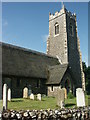
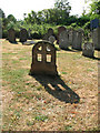
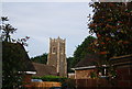
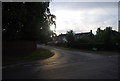
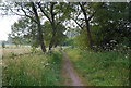
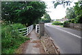
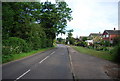
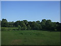
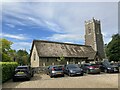
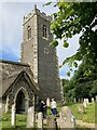
Photos of NR4 6HD
Area Information
Living in NR4 6HD offers a quiet residential experience within a compact cluster covering approximately 6,081 square metres. This postcode serves a small population of 1,418 residents, creating a neighbourhood size that fosters a close-knit atmosphere. Despite the modest footprint, the area maintains a high population density of 233,183 people per square kilometre, a figure that reflects the concentrated nature of the housing stock in this specific location. You can expect a setting defined by its intimate scale rather than sprawling expanses. The environment is stable and established, suitable for those who value proximity to services without the compromise of a large, anonymous town centre. Daily life here revolves around the immediate surroundings of this residential pocket, where the lack of major planning constraints ensures the character remains consistent. The area includes houses as the primary accommodation type, providing a traditional setting for occupants. With a low flood risk and no protected nature reserves or woodland affecting the land, the physical environment is generally secure for building and living. This makes NR4 6HD a practical choice for buyers seeking a grounded, non-negligent location. The community operates without the burden of significant environmental restrictions common in rural or environmentally sensitive zones. Residents benefit from a setting that is safe from flooding, free from Ramsar wetland site constraints, and untouched by Areas of Outstanding Natural Beauty regulations. This clarity regarding land status removes uncertainty for potential purchasers looking for a straightforward residential plot.
- Area Type
- Postcode
- Area Size
- 6081 m²
- Population
- 1418
- Population Density
- 1546 people/km²
The property market in NR4 6HD is characterised by extreme stability due to the ownership structure of the residents. With 90% home ownership, this is overwhelmingly an owner-occupied area rather than a rental market. This high rate of equity implies that the local housing stock is composed of established dwellings, likely filled by families or individuals intending to stay long-term. The accommodation type is strictly houses, meaning you will not find purpose-built flats or apartments within this specific postcode boundary. This homogeneity shapes the visual character of the area and dictates the pace of transactions. For buyers seeking homes in NR4 6HD, the environment offers certainty regarding neighbour tenure and community continuity. The small size of the local cluster, covering just 6,081 square metres, limits the volume of available properties but increases the likelihood of a curated selection of dwellings. Because the population is concentrated at 1,418 people within such a small area, the market moves differently than in larger towns with mixed tenure rates. A sale here involves fewer immediate neighbours but potentially more intense interest from those specifically seeking this established owner-occupier dynamic. The fact that the area passes all planning constraint assessments, including flood risk and protected site checks, adds a layer of security to the asset value. There are no hidden risks attached to the land status to dampen buyer confidence. Consequently, the market remains robust for those who can access the specific houses available in this high-density, owner-focused environment.
House Prices in NR4 6HD
Showing 14 properties
| Address | Type | Beds | Baths | Last Sale Price | Last Sale Date | |
|---|---|---|---|---|---|---|
| 10 Buckland Rise, Norwich, NR4 6HD | Semi-detached | 3 | 1 | £330,000 | Dec 2024 | |
| 7 Buckland Rise, Norwich, NR4 6HD | Detached | 3 | 1 | £400,000 | Jun 2024 | |
| 12 Buckland Rise, Norwich, NR4 6HD | Semi-detached | 3 | 2 | £330,000 | Nov 2023 | |
| 3 Buckland Rise, Norwich, NR4 6HD | house | - | - | £300,000 | May 2023 | |
| 9 Buckland Rise, Norwich, NR4 6HD | house | - | - | £360,000 | Dec 2022 | |
| 11 Buckland Rise, Norwich, NR4 6HD | house | 3 | 1 | £300,000 | Jan 2019 | |
| 4 Buckland Rise, Norwich, NR4 6HD | house | - | - | £215,000 | Jan 2014 | |
| 5 Buckland Rise, Norwich, NR4 6HD | Detached | 3 | - | £218,000 | Oct 2013 | |
| 16 Buckland Rise, Norwich, NR4 6HD | Semi-detached | 3 | 1 | £181,000 | Oct 2010 | |
| 14 Buckland Rise, Norwich, NR4 6HD | Semi-detached | - | - | - | - |
Energy Efficiency in NR4 6HD
Daily life for residents of NR4 6HD is enriched by a selection of amenities located within a short practical reach. The area provides access to five notable retail locations, ensuring you have convenience stores and supermarkets nearby. You can shop at Waitrose Norwich, Morrisons Daily Norwich 78, and the East of England Co-operative Co. These venues cover diverse needs from weekly groceries to specialised goods, reducing the need for long trips to town centres. Transport options are well supported by Norwich Railway Station, which serves as a vital link to the rest of Norfolk and beyond. Additionally, Norwich International Airport is nearby, offering flexibility for frequent travellers without the hassle of arranging private transport. The convenience of these facilities means that essential errands can be completed quickly. You do not need to travel far to find a reliable well-stocked supermarket or collect a parcel from a courier. This accessibility is particularly valuable given the residential density of 233,183 people per square kilometre, where local services matter more than distant leisure complexes. While parks or specific leisure venues are not explicitly listed in the immediate amenity data, the presence of major retail chains and transport hubs creates a self-sufficient lifestyle. Residents benefit from the ability to manage daily tasks efficiently, supported by the strong digital connectivity and nearby railway and airport connections. Living in NR4 6HD offers a balanced routine where work, shopping, and travel are all easily managed from your doorstep.
Amenities
Schools
| Rank | School | Type | Entry gender | Ages |
|---|
Explore more schools in this area
Go to Schools tabDemographics
The community in NR4 6HD reflects a mature profile, with a median age of 47 years. Most residents fall within the adult age range of 30 to 64 years, indicating a predominantly established household structure rather than a student or young professional demographic. This age distribution suggests a stability that often accompanies family life or retirement planning. Home ownership defines the social fabric here, with 90% of households belonging to owners rather than tenants. This high rate of equity suggests long-term residents who are invested in the stability of the neighbourhood. The housing stock consists primarily of houses, which aligns with the ownership statistics and supports a suburban or semi-rural lifestyle for the occupants. Diversity figures indicate that the White ethnic group forms the predominant demographic within this postcode. This homogeneity often contributes to a predictable and uniform community culture. You will find a neighbourhood where most neighbours likely share similar life stages and values regarding property maintenance. The accommodation type remains consistent across the area, reinforcing the idea that the development was planned for permanent residence rather than transient living. There is no indication of transient housing or short-term lets disrupting the street scene. The combination of high ownership, mature age, and specific accommodation types creates a distinct social environment. Those considering homes in NR4 6HD should expect a traditional community where property values are anchored by owner-occupier tenure.
Household Size
Accommodation Type
Tenure
Ethnic Group
Religion
Household Composition
Age
Household Deprivation
NS-SEC
Explore more demographic insights in this area
Go to Demographics tabPlanning
Planning Constraints
- Flood RiskPremium
- Ramsar Wetland SitesPremium
- Area of Outstanding Natural BeautyPremium
- Protected Nature ReservePremium
- Protected WoodlandPremium