Area Overview for NR35 1NA
Photos of NR35 1NA
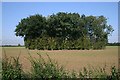
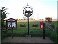
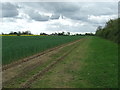
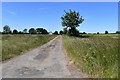
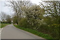
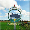
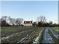
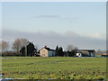
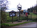
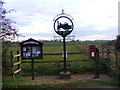
39 photos from this area
Area Information
Key information about the NR35 1NA including its size, population, and administrative classification.
- Area Type
- Postcode
- Area Size
- 1.6 km²
- Population
- 2251
- Population Density
- 30 people/km²
House Prices in NR35 1NA
21
Properties
£325,778
Average Sold Price
£75,000
Lowest Price
£610,000
Highest Price
Showing 21 properties
| Address | Type | Beds | Baths | Last Sale Price | Last Sale Date | |
|---|---|---|---|---|---|---|
| Martindale Cottage, High Street, Ilketshall St Margaret, NR35 1NA | Detached | 3 | 3 | £610,000 | Aug 2023 | |
| Tithe Farm, High Street, Ilketshall St Margaret, NR35 1NA | Farm | 3 | 1 | £530,000 | Jun 2021 | |
| Burrell House, High Street, Ilketshall St Margaret, NR35 1NA | Detached | 5 | 3 | £457,000 | Mar 2019 | |
| White House Farm Cottage, High Street, Ilketshall St Margaret, NR35 1NA | house | 3 | - | £315,000 | May 2014 | |
| Cynders, High Street, Ilketshall St Margaret, NR35 1NA | Detached | 3 | - | £167,500 | Mar 2011 | |
| Linewaith, High Street, Ilketshall St Margaret, NR35 1NA | Detached | - | - | £380,000 | Jul 2005 | |
| Edycyn, High Street, Ilketshall St Margaret, NR35 1NA | Bungalow | - | - | £75,000 | Nov 2003 | |
| Stillwaters, High Street, Ilketshall St Margaret, NR35 1NA | Bungalow | 4 | 2 | £270,000 | Jul 2003 | |
| Chestnut Tree Barn, High Street, Ilketshall St Margaret, NR35 1NA | Detached | 10 | 2 | £127,500 | May 2003 | |
| Willow Barn, High Street, Ilketshall St Margaret, NR35 1NA | house | 4 | 4 | - | - |
Page 1 of 3
Energy Efficiency in NR35 1NA
Amenities
Schools
| Rank | School | Type | Entry gender | Ages |
|---|
Explore more schools in this area
Go to Schools tabDemographics
Household Size
Two person
most common
Accommodation Type
Houses
most common
Tenure
75
majority
Ethnic Group
White
most common
Religion
N/A
most common
Household Composition
N/A
most common
Age
47
median
Adults (30-64 years)
most common
Household Deprivation
N/A
with no deprivation
NS-SEC
37
in Lower managerial occupations
Explore more demographic insights in this area
Go to Demographics tabPlanning
Planning Constraints
- Flood RiskPremium
- Ramsar Wetland SitesPremium
- Area of Outstanding Natural BeautyPremium
- Protected Nature ReservePremium
- Protected WoodlandPremium