Area Overview for NR35 1BJ
Photos of NR35 1BJ
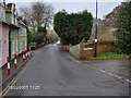
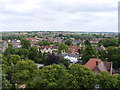
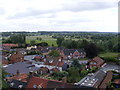
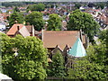
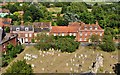
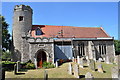
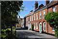
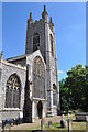
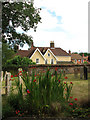
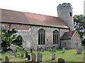
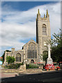
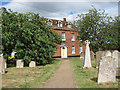
100 photos from this area
Area Information
Key information about the NR35 1BJ including its size, population, and administrative classification.
- Area Type
- Postcode
- Area Size
- 6.0 hectares
- Population
- 1682
- Population Density
- 249 people/km²
House Prices in NR35 1BJ
14
Properties
£156,100
Average Sold Price
£69,995
Lowest Price
£260,000
Highest Price
Showing 14 properties
| Address | Type | Beds | Baths | Last Sale Price | Last Sale Date | |
|---|---|---|---|---|---|---|
| 10 Rose Hall Gardens, Bungay, NR35 1BJ | Bungalow | 2 | 1 | £210,000 | Oct 2013 | |
| 7 Rose Hall Gardens, Bungay, NR35 1BJ | Bungalow | - | - | £150,000 | Jan 2012 | |
| 9 Rose Hall Gardens, Bungay, NR35 1BJ | Detached | - | - | £200,000 | Nov 2011 | |
| 12 Rose Hall Gardens, Bungay, NR35 1BJ | house | 3 | - | £165,000 | Dec 2010 | |
| 6 Rose Hall Gardens, Bungay, NR35 1BJ | Bungalow | - | - | £260,000 | Sep 2010 | |
| 14 Rose Hall Gardens, Bungay, NR35 1BJ | house | - | - | £249,000 | Aug 2004 | |
| 4 Rose Hall Gardens, Bungay, NR35 1BJ | Bungalow | - | - | £90,000 | May 2001 | |
| 11 Rose Hall Gardens, Bungay, NR35 1BJ | Detached | - | - | £89,500 | Sep 2000 | |
| 8 Rose Hall Gardens, Bungay, NR35 1BJ | Bungalow | 2 | 1 | £69,995 | Apr 1997 | |
| 3 Rose Hall Gardens, Bungay, NR35 1BJ | Detached | - | - | £77,500 | Jun 1996 |
Page 1 of 2
Energy Efficiency in NR35 1BJ
Amenities
Schools
| Rank | School | Type | Entry gender | Ages |
|---|
Explore more schools in this area
Go to Schools tabDemographics
Household Size
Two person
most common
Accommodation Type
Houses
most common
Tenure
72
majority
Ethnic Group
White
most common
Religion
N/A
most common
Household Composition
N/A
most common
Age
47
median
Adults (30-64 years)
most common
Household Deprivation
N/A
with no deprivation
NS-SEC
24
in Lower managerial occupations
Explore more demographic insights in this area
Go to Demographics tabPlanning
Planning Constraints
- Flood RiskPremium
- Ramsar Wetland SitesPremium
- Area of Outstanding Natural BeautyPremium
- Protected Nature ReservePremium
- Protected WoodlandPremium