Area Overview for NR35 1BF
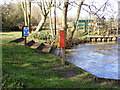
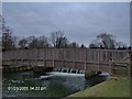
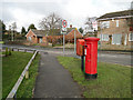
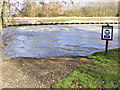
Photos of NR35 1BF
Area Information
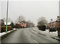
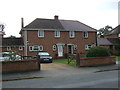
NR35 1BF represents a distinct residential cluster situated within a postcode area defined by its small scale. The area covers only 1.5 hectares, which limits the footprint of development while concentrating the local population. With a total population of 1801 people, the density stands at 716 people per square kilometre. This specific density suggests a concentrated community where neighbours are likely within close proximity. Residents experience daily life within a compact environment where the immediate surroundings dictate the rhythm of the day. Living in NR35 1BF means navigating a space that prioritises residential function over sprawling commercial expansion. The post code identifies a specific zone rather than a broad Borough, which affects local governance and service delivery. You should expect a neighbourhood feel where the boundaries are clearly defined by the narrow land parcel. The area functions as a self-contained pocket of housing. Homebuyers looking for this location will find it characterised by a tight-knit structure. The proximity of residents creates a shared community space without the extensive infrastructure of larger towns. Your connection to neighbours may be faster in this setting compared to wider areas. The physical size constrains the variety of local facilities, meaning you must rely on nearby towns for broader needs.
- Area Type
- Postcode
- Area Size
- 1.5 hectares
- Population
- 1801
- Population Density
- 716 people/km²
The housing stock in NR35 1BF consists primarily of houses. This architectural choice defines the visual character of the streets within the 1.5-hectare boundary. The market dynamics are driven by the fact that 59 per cent of residents own their homes. This high ownership rate suggests that buying a property here is the standard method of securing a residence rather than renting. You are unlikely to find a high concentration of student accommodation or short-term rental lets in this immediate cluster. The property market operates on a model where families and established households purchase directly from the open market. Homes in NR35 1BF are tailored to families or couples who intend to stay long term. The limited land area means there are few available plots for new development. Supply is restricted by the geographical constraints of the postcode. Competition may rise when a seller lists a house for sale. Buyers need to act quickly if they wish to purchase a property in this specific zone. The lack of diverse housing types means you should consider what sort of house you need before viewing. There are no apartments or flats recorded for this area type. Your search will focus exclusively on detached or semi-detached homes. The 59 per cent ownership figure reinforces that this is a stable, established market for new buyers.
House Prices in NR35 1BF
Showing 1 properties
| Address | Type | Beds | Baths | Last Sale Price | Last Sale Date | |
|---|---|---|---|---|---|---|
| Bungay Town Council Office, The Riverside Centre, Staithe Road, Bungay, NR35 1BF | Office | - | - | - | - |
Energy Efficiency in NR35 1BF
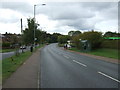
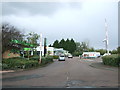
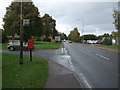
Residents of NR35 1BF rely on nearby towns for most lifestyle needs. Retail options include Co-op Bungay, The Southern Co-operative Co, and Tesco Beccles. These supermarkets provide daily essentials, groceries, and household items. You can manage weekly shopping trips without driving too far. Retail within the immediate vicinity is limited to these key names. The local shop offers convenience for spontaneous purchases. For travel, rail access is available through Beccles Railway Station, Entrance, and Brampton Railway Station. These stations connect you to wider transport networks across East Anglia. Commuting by train is a feasible option if your workplace is in London or Norwich. The rail connections reduce the need for a car for longer journeys. Daily life depends heavily on the proximity of these stations. The availability of Tesco Beccles ensures fresh food is always within reach. Co-op Bungay offers an additional layer of local retail support. The Southern Co-operative Co rounds out the shopping choices. Leisure and parks are not explicitly detailed in the nearest amenities list, so you will use adjacent green spaces or local borough facilities. Convenience is defined by these specific outlet locations.
Amenities
Schools
Families living in NR35 1BF have access to several educational institutions within practical reach. Bungay Primary School serves the local catchment as a primary school with a good Ofsted rating. St Edmund's Catholic Primary School is another option for primary education, also holding a good Ofsted rating. These two schools offer state-funded education for children in the early years. Additionally, Dunelm Independent School provides an independent educational route. The presence of two primary schools with good ratings indicates a quality foundation for young children. The independent option adds variety for parents seeking specific curricula or teaching styles. A mix of state and independent provision allows families to choose based on budget and philosophy. The schools near NR35 1BF are specifically noted for their strong performance in inspections. This environment supports families with school-age children who do not need to travel long distances daily. The proximity of these two primary schools reduces commute times for parents working locally. You should verify specific admission boundaries before making final decisions. The independent school serves a different demographic segment within the community. Overall, the教育 landscape offers solid choices without relying on distant institutions.
| Rank | School | Type | Entry gender | Ages |
|---|
Explore more schools in this area
Go to Schools tabDemographics
The community profile within NR35 1BF reflects a settled adult population. The median age is 47 years, indicating a mature demographic rather than a transient student or young professional crowd. The most common age range comprises adults between 30 and 64 years old. This group forms the backbone of the local economy and household stability. Home ownership levels sit at 59 per cent. This figure places the area firmly in the category of owner-occupied housing rather than a high-rental district. The accommodation type is predominantly houses. This structure supports a family-led community where ground-level or semi-detached living spaces dominate the skyline. The predominant ethnic group is White, which aligns with the broader demographic trends of the surrounding region. There is no indication of significant minority populations within the recorded data for this cluster. Most residents are established homeowners with a long-term commitment to the property. The age profile suggests children may be less common in school starting years, as parents are further along in their life cycle. You are entering a neighbourhood where residents view their homes as a permanent base. The stability of the owner-occupier majority influences local noise levels and community engagement patterns. Daily interactions with neighbours tend to be respectful of privacy boundaries.
Household Size
Accommodation Type
Tenure
Ethnic Group
Religion
Household Composition
Age
Household Deprivation
NS-SEC
Explore more demographic insights in this area
Go to Demographics tabPlanning
Planning Constraints
- Flood RiskPremium
- Ramsar Wetland SitesPremium
- Area of Outstanding Natural BeautyPremium
- Protected Nature ReservePremium
- Protected WoodlandPremium