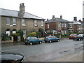
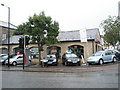
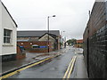
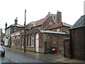
Area Overview for NR34 9TB
Photos of NR34 9TB
Area Information
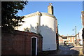
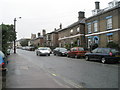
NR34 9TB represents a specific residential cluster covering just one hectare. This small area serves a population of 1,597 residents across the NR34 postcode district in England. The density here stands at 374 people per square kilometre, indicating a compact living environment typical of established settlements. You will find a community defined by its proximity to Beccles, where essential amenities and transport links are easily accessible. Living in NR34 9TB means residing in a concentrated space where daily routines connect quickly with local services. The area functions as a well-defined pocket of England, offering immediate access to the broader town without the sprawl of a larger urban fringe. Its modest size creates a setting where neighbours are often within a short walk, fostering a tight-knit atmosphere. This postcode is part of a larger network of homes that benefit from the infrastructure of nearby Beccles while maintaining a distinct identity. The physical footprint remains small, ensuring that the landscape feels manageable and familiar to those settling down here.
- Area Type
- Postcode
- Area Size
- 1.0 hectares
- Population
- 1597
- Population Density
- 374 people/km²
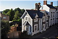
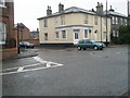
The property market in NR34 9TB is defined by a mixed landscape of ownership and occupancy. Exactly half of the homes sit with owners, while the other half remains available for rent or purchase as leaseholds. This 50 per cent split indicates that the area attracts both first-time buyers seeking to secure their own residence and investors looking for rental yields through the remaining stock. The predominant accommodation type is houses, which shapes the physical character of the suburban cluster surrounding this postcode. Buyers looking at homes in this small hectare-based area should expect a traditional residential streetscape rather than high-density developments. The lack of apartments or flats means that the housing stock caters specifically to those who prefer ground-level living or end-of-terrace properties. This concentration of house types supports a quiet neighbourhood dynamic where privacy remains a priority for current residents.
House Prices in NR34 9TB
Showing 23 properties
| Address | Type | Beds | Baths | Last Sale Price | Last Sale Date | |
|---|---|---|---|---|---|---|
| 13 Blyburgate, Beccles, NR34 9TB | Unknown | - | - | £490,000 | Jul 2025 | |
| Willows, 17 Blyburgate, Beccles, NR34 9TB | Semi-detached | 4 | 2 | £285,000 | Feb 2023 | |
| White Cottage, Blyburgate, Beccles, NR34 9TB | Terraced | - | - | £216,000 | Oct 2020 | |
| Flat 2, 23A Blyburgate, Beccles, NR34 9TB | Flat | - | - | £22,000 | Jun 2016 | |
| 20B Blyburgate, Beccles, NR34 9TB | Semi-detached | 2 | 1 | £128,500 | Apr 2012 | |
| 27-29 Blyburgate, Beccles, NR34 9TB | Semi-detached | 3 | 1 | - | - | |
| Town Cottage, 12A Blyburgate, Beccles, NR34 9TB | house | 3 | - | - | - | |
| Flat 3, 23A Blyburgate, Beccles, NR34 9TB | Flat | - | - | - | - | |
| Flat 1, 23A Blyburgate, Beccles, NR34 9TB | Flat | - | - | - | - | |
| Cowling Cottage, 20A Blyburgate, Beccles, NR34 9TB | Semi-detached | 2 | 1 | - | - |
Energy Efficiency in NR34 9TB
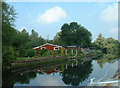
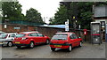
Daily life in NR34 9TB is enhanced by immediate access to a range of retail and transport amenities within practical reach. Residents have five retail options nearby, including The Southern Co-operative Co, Tesco Beccles, and Lidl Beccles, ensuring essential shopping needs are met without the need to travel far. Transport connectivity is supported by five railway stations in the vicinity, such as Brampton Railway Station and Beccles Railway Station, alongside five other transport entrances. Whether purchasing groceries or commuting to work, these facilities place you minutes from convenience. One airport, Beccles Airport, is also listed as a notable facility, providing additional regional connectivity if flights are required. Living in NR34 9TB offers the comfort of being surrounded by the commercial life of Beccles while preserving the quieter atmosphere of the residential zone. The density of these amenities ensures that weekends can be spent locally while weekdays are as efficient as those living in larger cities.
Amenities
Schools
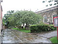
Families residing in NR34 9TB have the Ravensmere Infant School as their primary educational option nearby. This institution operates as a primary school, catering to younger children and young students in the local catchment. The presence of an infant school signals a commitment to early education within the immediate vicinity of the residential cluster. While the data lists only this specific primary provider, it serves as the backbone for the local education supply. Parents considering NR34 9TB should register with the school to align their children's education with the local curriculum. The rating for this school is a known entity within the local education framework, providing assurance regarding its standards. For older students, the list provided does not extend to secondary institutions, requiring families to consider further travel for that stage of schooling. The current provision focuses on supporting the foundational years for children growing up in this specific postcode.
| Rank | School | Type | Entry gender | Ages |
|---|
Explore more schools in this area
Go to Schools tabDemographics
The community in NR34 9TB is characterised by a median age of 47 years. The most common age range comprises adults between 30 and 64 years, reflecting a settled population rather than a transient student or youth hub. House ownership accounts for 50 per cent of the total homes, placing the ownership level at an exact midpoint between living costs and equity. This balance suggests a stable demographic where long-term residents hold a strong stake in the locality. The predominant ethnic group is White, aligning with the traditional makeup of this part of England. Housing stock consists primarily of houses, meaning flats or apartments are not the focus of this residential zone. With a density of 374 people per square kilometre, the area avoids being overly crowded, allowing families to live in single-family units. Residents benefit from a mature demography where the majority are financially established enough to contribute significantly to local tax revenues.
Household Size
Accommodation Type
Tenure
Ethnic Group
Religion
Household Composition
Age
Household Deprivation
NS-SEC
Explore more demographic insights in this area
Go to Demographics tabPlanning
Planning Constraints
- Flood RiskPremium
- Ramsar Wetland SitesPremium
- Area of Outstanding Natural BeautyPremium
- Protected Nature ReservePremium
- Protected WoodlandPremium