Area Overview for NR34 8LL
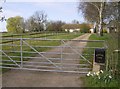
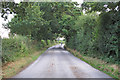
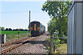
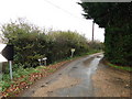
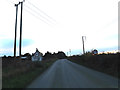
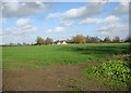
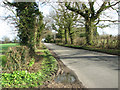
Photos of NR34 8LL

Area Information
Living in NR34 8LL offers a quiet existence within a defined residential cluster covering 54.1 hectares. This specific postcode area serves 2,108 residents, creating a low-density environment where housing stands at an average rate of 35 people per square kilometre. The setting prioritises space over urban density, making it an appealing choice for those seeking retreat from city life while maintaining practical access to essential services. Daily life here is characterised by a spacious backdrop, with the postcode acting as a focal point for a small but stable community. You will find that the area functions as a distinct neighbourhood, separate from the wider county town of Beccles, yet broadly connected through local road networks. The compact scale of the location means that residents often share a common experience of local surroundings, whether playing in the garden, walking a dog, or visiting the nearest shops. The area avoids the congestion associated with larger towns, allowing for a slower pace of life that suits many retirees and families alike.
- Area Type
- Postcode
- Area Size
- 54.1 hectares
- Population
- 2108
- Population Density
- 35 people/km²
Homes in NR34 8LL are characterised by a strong presence of residential houses, which form the predominant type of accommodation in this postcode. The market dynamics are heavily influenced by the fact that 76% of residents own their properties. This statistic establishes the area as a firmly owner-occupied zone, which typically appeals to buyers looking for stability rather than investment speculation. With nearly three-quarters of households owning their dwellings, the competition for quality properties may be steady, driven by local residents upgrading or selling. The lack of high-density apartment blocks or social housing blocks suggests a traditional housing stock likely comprising detached or semi-detached homes. Buking property in this specific cluster requires navigating a market where long-term stability is the norm. The data points to a low-density living standard, meaning buyers should expect larger plots rather than terraced rows. The nature of the housing market here is distinct from urban centres, prioritising space and ownership security over high-rise density.
House Prices in NR34 8LL
Showing 10 properties
| Address | Type | Beds | Baths | Last Sale Price | Last Sale Date | |
|---|---|---|---|---|---|---|
| Barnaby Farm, Ringsfield Road, Beccles, NR34 8LL | farmhouse | 7 | 5 | £900,000 | Oct 2018 | |
| Meadowcroft, Ringsfield Road, Beccles, NR34 8LL | Detached | - | - | £335,000 | Feb 2001 | |
| Boundary Cottage, Ringsfield Road, Ringsfield, NR34 8LL | Semi-detached | - | - | £117,000 | Apr 2000 | |
| Dowes Cottage, Ringsfield Road, Ringsfield, NR34 8LL | Semi-detached | - | - | £86,000 | Mar 1997 | |
| Homestead Farm, Ringsfield Road, Beccles, NR34 8LL | Farm | - | - | - | - | |
| Devonshire Farm, Ringsfield Road, Beccles, NR34 8LL | Farm | - | - | - | - | |
| The Homestead, Ringsfield Road, Beccles, NR34 8LL | Detached | - | - | - | - | |
| Bull Farm, Ringsfield Road, Beccles, NR34 8LL | Bungalow | - | - | - | - | |
| Holly Cottage, Ringsfield Road, Beccles, NR34 8LL | Semi-detached | - | - | - | - | |
| Woodfield, Ringsfield Road, Beccles, NR34 8LL | Semi-detached | - | - | - | - |
Energy Efficiency in NR34 8LL
Residents of NR34 8LL enjoy convenient access to a range of amenities that support daily life without requiring long journeys. Retail options include the East of England Co-operative Co and The Southern Co-operative Co, both offering essential groceries and household goods. Tesco Beccles is also within practical reach, providing a larger supermarket destination for pantry stock. Transport connectivity is well supported by five nearby railway entrances and stations, specifically Beccles Railway Station and Brampton Railway Station, facilitating travel to broader counties. Beccles Airport offers aviation services for those requiring air travel. These facilities ensure that economic and leisure travel remains straightforward. The concentration of these amenities within a short distance means you can manage weekly shopping or commute trips with minimal delay. This network of services forms the backbone of local convenience, allowing residents to live independently while accessing wider regional opportunities.
Amenities
Schools
Families in NR34 8LL benefit from proximity to several educational institutions, each catering to different needs. Ringsfield Church of England Voluntary Controlled Primary School serves young children within convenient reach, offering primary education under the Church of England voluntary controlled ethos. For independent education, Ellough School provides an alternative option for parents seeking non-maintained schooling. Additionally, Ringsfield Church of England Primary School is listed as a separate entity in the local vicinity, giving families two choices for primary education near the postcode. The mix of state and independent options means parents can select a schooling model that matches their values. Distance to these schools remains a key factor, as the area lies within a practical operating radius for these institutions. The presence of multiple primary schools indicates that the local authority plans for local intake, reducing the need for early year families to commute far for primary placement.
| Rank | School | Type | Entry gender | Ages |
|---|
Explore more schools in this area
Go to Schools tabDemographics
The community profile of NR34 8LL reflects a mature population with a median age of 47 years. Adults aged between 30 and 64 years represent the most common demographic group, suggesting a neighbourhood dominated by established households and family units. A significant 76% of residents own their homes outright or via mortgage, indicating that this is primarily an owner-occupied area rather than a rental market. This high level of tenure stability often correlates with longer-term community involvement and lower resident turnover. The local population is predominantly White, reflecting a community with a clear ethnic majority. Accommodation consists largely of houses, aligning with the preferences of this age demographic. The demographic data suggests a settled environment where families root themselves for the long term. The age profile implies that services suited to adults may be more prevalent than those targeting young adults seeking nightlife or urban amenities.
Household Size
Accommodation Type
Tenure
Ethnic Group
Religion
Household Composition
Age
Household Deprivation
NS-SEC
Explore more demographic insights in this area
Go to Demographics tabPlanning
Planning Constraints
- Flood RiskPremium
- Ramsar Wetland SitesPremium
- Area of Outstanding Natural BeautyPremium
- Protected Nature ReservePremium
- Protected WoodlandPremium