Area Overview for NR34 8JF
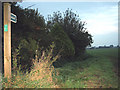
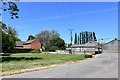
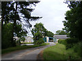
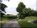
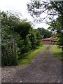
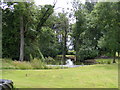
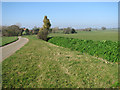
Photos of NR34 8JF

Area Information
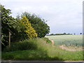
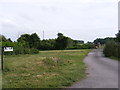
Living in NR34 8JF means residing in a small residential cluster spread across 55.6 hectares on the outskirts of East Anglia. This specific postcode covers a population of 2,251 people, creating a setting that feels detached yet connected to its local surroundings. The area is defined by its spread-out nature, with a population density of only 30 people per square kilometre. This low density ensures ample space and a quiet environment for those seeking homes away from the hustle of town centres. The community is established and mature, reflecting a long-term settlement pattern rather than rapid urban expansion. Daily life here revolves around a need for travel to broader commercial hubs, though immediate needs are met by nearby services. You will find yourselves in an open landscape where neighbours are close in distance only if you choose to venture out. The area offers a distinct alternative to high-density living, prioritising privacy and open skies. For anyone considering the space and character of this location, NR34 8JF provides a structured yet spacious environment. It is a place where the pace of life is dictated by the surrounding countryside and local traffic patterns rather than constant urban activity. This specific cluster remains a stable part of the Broads region, offering a consistent environment for families and retirees alike.
- Area Type
- Postcode
- Area Size
- 55.6 hectares
- Population
- 2251
- Population Density
- 30 people/km²
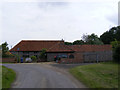
The housing market in NR34 8JF is heavily weighted towards owner-occupiers, with 75% of residents owning their homes outright or with a mortgage. This figure indicates that the local property portfolio is dominated by individuals who have invested in the area for the long term. There is minimal rental activity within this specific postcode, making it less common to find buy-to-let properties or temporary accommodations. Instead, you will encounter established homes that have remained in families for generations. Accommodation types are exclusively houses, which suits the low-density character of this 55.6-hectare cluster. You will not find flats or semi-detached developments designed for urban living. Every dwelling here is a standalone property, offering significant garden space and privacy. This homogeneity in property type means that buyers can expect a consistent standard of living space across the neighbouring streets. The market is likely characterised by steady demand from families or retirees seeking a quiet retreat. With such a high rate of home ownership, the area attracts those looking to build equity or downsize carefully. The scarcity of rental stock suggests that transaction prices are driven by owner needs and regional trends rather than investor speculation.
House Prices in NR34 8JF
Showing 3 properties
| Address | Type | Beds | Baths | Last Sale Price | Last Sale Date | |
|---|---|---|---|---|---|---|
| Formerly 2 Grove Farm Cottages, Englishes Lane, Ilketshall St Margaret, NR34 8JF | Semi-detached | - | - | - | - | |
| Grove Farm Cottage, Englishes Lane, Ilketshall St Margaret, NR34 8JF | house | - | - | - | - | |
| Grove Farm, Englishes Lane, Ilketshall St Lawrence, NR34 8JF | Detached | - | - | - | - |
Energy Efficiency in NR34 8JF
Daily life in NR34 8JF is shaped by the proximity of the Co-op Bungay, East of England Co-operative Co, and The Southern Co-operative Co. These retailers are located nearby and provide practical shopping solutions for household groceries and daily essentials. You do not need to travel far for basic provisions, as there are five notable retail points within practical reach of every home in this postcode. This shopping corridor ensures that residents can manage errands without venturing deep into the Broads or larger market towns. For those who prefer walking or cycling, public transport links are available through five notable access points surrounding Brampton Railway Station. These rail entrances facilitate easy trips to nearby towns and connectivity to the wider national network. While there are no parks or leisure centres listed directly within the immediate cluster, the five populated railway entrances and retail shops create a functional hub for the community. The lifestyle here is one of convenience mixed with rural tranquillity. You will find that your daily journeys are short and purposeful, connecting the residential cluster to the essential services of Bungay. This balance of isolation and access defines the character of living in NR34 8JF.
Amenities
Schools
Families in NR34 8JF with school-age children have access to local education through Ilketshall St Lawrence School. This institution functions as both a primary school and an academy, serving the immediate educational needs of residents in the Broads area. It is the primary educational facility listed for this postcode, meaning all local students are fed into this single point of contact. The dual classification as both a maintained primary school and an academy indicates a blend of traditional and updated administrative structures within the same campus. Unlike larger towns that offer a wide range of secondary options, this neighbourhood relies on this specific school for the early years of learning. There are no other primary or secondary schools listed in the immediate vicinity of NR34 8JF. This concentration means that school reports and Ofsted ratings for Ilketshall St Lawrence School will heavily influence local parenting choices. You must prepare for a situation where educational choices are fewer than in more urbanised postcodes. The school provides a direct link between home and learning for children living in this rural cluster. Prospective parents should review the specific performance metrics of this academy to ensure it aligns with their educational philosophy for their children.
| Rank | School | Type | Entry gender | Ages |
|---|
Explore more schools in this area
Go to Schools tabDemographics
The community within NR34 8JF is defined by a mature population, with a median age of 47 years. Most residents fall into the adult bracket between 30 and 64 years old, indicating a neighbourhood dominated by working families and established households rather than young professionals or school-aged children. This age profile suggests a community focused on stability and long-term settlement. Home ownership stands at 75%, showing that the majority of residents have purchased their properties rather than renting. This high rate of ownership is typical for areas with strong house prices and stable markets. The predominant ethnic group in this postcode is White, reflecting the established nature of this part of Suffolk. There is little recent demographic turnover, which contributes to a familiar and settled atmosphere. The local population does not include significant numbers of recent migrants or transient workers. Housing in NR34 8JF consists primarily of houses, with no high-rise blocks or converted apartments. Every claim regarding the social fabric of this area is backed by the clear data showing a traditional, owner-occupied village community. You are joining a demographic that values security and permanence. The low population density of 30 people per square kilometre further supports a lifestyle where space is prioritised over vibrancy or density.
Household Size
Accommodation Type
Tenure
Ethnic Group
Religion
Household Composition
Age
Household Deprivation
NS-SEC
Explore more demographic insights in this area
Go to Demographics tabPlanning
Planning Constraints
- Flood RiskPremium
- Ramsar Wetland SitesPremium
- Area of Outstanding Natural BeautyPremium
- Protected Nature ReservePremium
- Protected WoodlandPremium