Area Overview for NR34 8DL
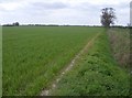
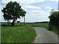
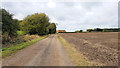
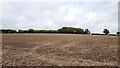
Photos of NR34 8DL

Area Information
Living in NR34 8DL offers a quiet residential experience within a compact neighbourhood spanning 1.9 square kilometres. This specific postcode area serves a small cluster of homes with a population of 2,108, resulting in a low density of just 35 people per square kilometre. The setting is distinctly calm, defined by spacious surroundings rather than urban density. You will find that daily life here revolves around the needs of established households rather than transient communities. The area functions as a peaceful backdrop for those seeking a property free from the congestion associated with larger towns. Its modest footprint limits exposure to major noise or traffic disruptions, creating an environment suitable for families or individuals who value tranquility. While the neighbourhood does not support a wide variety of internal services, its size ensures a manageable and predictable living environment. This locality represents a specific slice of the Beccles landscape, offering a sheltered space where residents enjoy a high degree of privacy and reduced interaction with heavy traffic flows.
- Area Type
- Postcode
- Area Size
- 1.9 km²
- Population
- 2108
- Population Density
- 35 people/km²
The housing market in NR34 8DL presents a clear picture for homebuyers seeking established properties. With 76% of homes occupied by owners, the area functions primarily as an owner-occupied market rather than a rental haven. This high ownership rate typically correlates with lower transient occupancy and greater community cohesion. The accommodation type is exclusively houses, meaning you will not find terrace blocks or high-rise flats within this specific postcode boundary. This focus on detached or semi-detached housing usually appeals to those prioritising space, gardens, and traditional family living arrangements. Buyers here are looking at a limited supply of specific property types, which often means homes sell to residents seeking a similar demographic profile. The small cluster structure implies that finding a variety of property styles will be challenging, but securing a house in this location offers stability and a shared homeowner culture.
House Prices in NR34 8DL
Showing 12 properties
| Address | Type | Beds | Baths | Last Sale Price | Last Sale Date | |
|---|---|---|---|---|---|---|
| Fairfields, Mill Lane, Shadingfield, NR34 8DL | Bungalow | 3 | 1 | £345,000 | Mar 2025 | |
| Mill Lodge, Mill Lane, Shadingfield, NR34 8DL | Bungalow | 3 | 1 | £390,000 | Feb 2021 | |
| Mill House Farm, Mill Lane, Shadingfield, NR34 8DL | Detached | 3 | 1 | £317,000 | Jun 2017 | |
| Millbrook, Mill Lane, Shadingfield, NR34 8DL | Bungalow | - | - | £250,000 | Nov 2009 | |
| Park Farm Bungalow, Mill Lane, Shadingfield, NR34 8DL | Detached | - | - | - | - | |
| Mobile Home At Moat Farm, Mill Lane, Shadingfield, NR34 8DL | Mobile Home | - | - | - | - | |
| West End Farm, Mill Lane, Shadingfield, NR34 8DL | Detached | 3 | 1 | - | - | |
| Moat Farmhouse, Mill Lane, Shadingfield, NR34 8DL | Detached | - | - | - | - | |
| Park Farm, Mill Lane, Shadingfield, NR34 8DL | Detached | - | - | - | - | |
| Westend Farm Cottage, Mill Lane, Shadingfield, NR34 8DL | house | - | - | - | - |
Energy Efficiency in NR34 8DL
Daily life in NR34 8DL relies on nearby amenities within practical driving or walking distance. Residents have access to five railway stations, including Brampton Railway Station, facilitating travel to larger regional hubs. For shopping necessities, five retail locations serve the cluster, such as East of England Co-operative Co, The Southern Co-operative Co, and Tesco Beccles. These supermarkets provide essential groceries and daily household goods without the need for long car journeys. Beccles Airport is also situated nearby, offering flight options for travel and logistics. This combination of rail access, major supermarkets, and private aviation infrastructure creates a convenient lifestyle base. You can manage weekly shopping and regional travel efficiently from this postcode. The presence of multiple Co-operative outlets suggests a strong local shopping presence alongside national brands like Tesco.
Amenities
Schools
Families considering NR34 8DL have access to a mix of state and independent education options. The area is near Ringsfield Church of England Voluntary Controlled Primary School and Ringsfield Church of England Primary School, both designated as primary institutions for younger children. Additionally, Ellough School operates as an independent institution, offering a private education alternative. These three schools provide the nearest educational facilities, though specific examination results or Ofsted ratings are not included in the local records. The presence of a Church of England option alongside an independent school indicates a range of educational philosophies available for consideration. Parents will evaluate these options based on curriculum style and religious ethos rather than performance metrics readily visible in public data. The independent nature of Ellough School may appeal to families seeking tailored academic approaches, while the controlled and primary status of the Ringsfield schools provides state-funded alternatives for local children.
| Rank | School | Type | Entry gender | Ages |
|---|
Explore more schools in this area
Go to Schools tabDemographics
The community character of NR34 8DL is defined by a mature demographic profile. The median age stands at 47, with the most common age range comprising adults between 30 and 64 years. This indicates a neighbourhood dominated by families with children or empty nesters rather than young professionals or retirees. Home ownership rates reach 76%, suggesting a high level of stability with residents deeply rooted in their locations. Housing stock consists almost entirely of houses, with no mention of flats or apartments within the local cluster. The area is predominantly occupied by individuals identifying as White, reflecting a traditional and established local makeup. With three-fourths of dwellings owned outright or through mortgage, this area functions as an owner-occupied stronghold. The demographic picture suggests a community focused on long-term settlement rather than short-term renting. You are entering an environment where neighbours are likely permanent fixtures rather than temporary occupants.
Household Size
Accommodation Type
Tenure
Ethnic Group
Religion
Household Composition
Age
Household Deprivation
NS-SEC
Explore more demographic insights in this area
Go to Demographics tabPlanning
Planning Constraints
- Flood RiskPremium
- Ramsar Wetland SitesPremium
- Area of Outstanding Natural BeautyPremium
- Protected Nature ReservePremium
- Protected WoodlandPremium