Area Overview for NR34 8AA
Photos of NR34 8AA
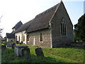
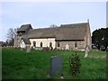
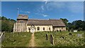
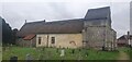
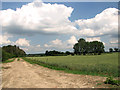
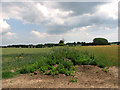
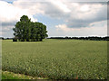
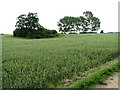
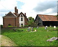
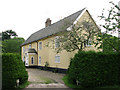
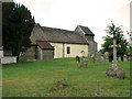
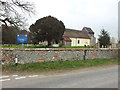
44 photos from this area
Area Information
Key information about the NR34 8AA including its size, population, and administrative classification.
- Area Type
- Postcode
- Area Size
- 22.0 hectares
- Population
- 2346
- Population Density
- 38 people/km²
House Prices in NR34 8AA
11
Properties
£137,625
Average Sold Price
£60,000
Lowest Price
£261,500
Highest Price
Showing 11 properties
| Address | Type | Beds | Baths | Last Sale Price | Last Sale Date | |
|---|---|---|---|---|---|---|
| Acorn Cottage, Wangford Road, Uggeshall, NR34 8AA | Bungalow | - | - | £261,500 | Feb 2017 | |
| St Marys, Wangford Road, Uggeshall, NR34 8AA | Detached | - | - | £99,000 | Jul 1999 | |
| Shangri-la, Wangford Road, Uggeshall, NR34 8AA | Detached | - | - | £60,000 | Dec 1996 | |
| Glebe Farm House, Wangford Road, Uggeshall, NR34 8AA | house | - | - | £130,000 | Dec 1996 | |
| 3 Wangford Road, Uggeshall, NR34 8AA | Terraced | 3 | - | - | - | |
| 1 Wangford Road, Uggeshall, NR34 8AA | house | 3 | - | - | - | |
| 2 Wangford Road, Uggeshall, NR34 8AA | house | - | - | - | - | |
| Bleach House, Wangford Road, Uggeshall, NR34 8AA | Detached | - | - | - | - | |
| Oakleaf, 4 Wangford Road, Uggeshall, NR34 8AA | Detached | - | - | - | - | |
| Seasonholme Cottage, Wangford Road, Uggeshall, NR34 8AA | Detached | - | - | - | - |
Page 1 of 2
Energy Efficiency in NR34 8AA
Amenities
Schools
| Rank | School | Type | Entry gender | Ages |
|---|
Explore more schools in this area
Go to Schools tabDemographics
Household Size
Two person
most common
Accommodation Type
Houses
most common
Tenure
68
majority
Ethnic Group
White
most common
Religion
N/A
most common
Household Composition
N/A
most common
Age
47
median
Adults (30-64 years)
most common
Household Deprivation
N/A
with no deprivation
NS-SEC
30
in Lower managerial occupations
Explore more demographic insights in this area
Go to Demographics tabPlanning
Planning Constraints
- Flood RiskPremium
- Ramsar Wetland SitesPremium
- Area of Outstanding Natural BeautyPremium
- Protected Nature ReservePremium
- Protected WoodlandPremium