Area Overview for NR34 7QT
Photos of NR34 7QT
Area Information
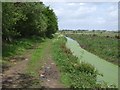
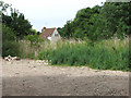
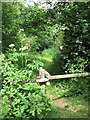
The postcode area of NR34 7QT defines a compact residential cluster covering just 1.1 hectares. You are entering a neighbourhood with exactly 1,664 residents, creating a dense but manageable settlement. This location prioritises close proximity across a very small footprint, meaning your daily life revolves around immediate surroundings rather than extensive commuting to nearby villages. The area functions as a settled residential zone where arrival and departure points are closely integrated. Living in NR34 7QT means you occupy a specific postal boundary that serves a defined population rather than a sprawling district. The small size of this cluster suggests a neighbourhood where local interactions happen within walking distance. There are no large parks or industrial zones dominating this 1.1 hectare space; instead, the focus is strictly on housing units for the 1,664 adults residing here. Your lifestyle adapts to this compact geography, where every household sits near its neighbours. This concentration creates a tight-knit environment where the local character remains consistent throughout the entire cluster. The area distinguishes itself through its limited scale, offering a distinct alternative to wider local authorities. You find yourself in a precisely measured community where boundaries are clear and the resident count is fixed.
- Area Type
- Postcode
- Area Size
- 1.1 hectares
- Population
- 1664
- Population Density
- 147 people/km²
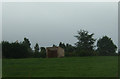
The housing market in NR34 7QT is strictly characterised by owner-occupied homes. With 87% home ownership, the area functions as a secure environment for those who have purchased their own residences. You will not encounter a significant rental sector within this specific postcode, as the accommodation types are limited exclusively to houses. This means the property market here revolves around existing stock suited for families or individuals seeking ownership. The density of 147 people per square kilometre reflects a clustering of these houses within a tiny 1.1 hectare footprint. When you search for homes in NR34 7QT, you are entering a domain where rental options are virtually non-existent. Every available property is a house, catering to the 1,664 residents who hold the title deeds to their dwellings. This high ownership rate implies that the local economy supports mortgage holders rather than landlords. The housing stock is therefore designed for long-term residence rather than short-term tenancy. For buyers looking at this small area, the implication is clear: you are joining an established group of owners who value stability. The uniformity of house types means you do not need to consider options like flats or converted buildings. The market is self-contained, serving the needs of the current adult population aged 30 to 64 who made the choice to buy rather than rent.
House Prices in NR34 7QT
Showing 5 properties
| Address | Type | Beds | Baths | Last Sale Price | Last Sale Date | |
|---|---|---|---|---|---|---|
| Marthas Cottage, The Green, Barnby, NR34 7QT | Detached | 3 | 1 | £420,000 | Jan 2018 | |
| The Old Post Office, The Green, Barnby, NR34 7QT | Bungalow | 1 | 1 | £315,000 | Oct 2015 | |
| 2 The Green, Barnby, NR34 7QT | house | - | - | £225,000 | Mar 2014 | |
| 1 The Green, Barnby, NR34 7QT | Cottage | 3 | - | £169,995 | Jan 2004 | |
| Robins Nest, The Green, Barnby, NR34 7QT | Bungalow | 1 | 1 | - | - |
Energy Efficiency in NR34 7QT
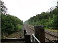
Daily life in NR34 7QT extends beyond the immediate residential cluster to amenities within practical reach. You have access to 5 retail outlets, including Tesco Oulton, Co-op Carlton, and East of England Co-operative Co. These shops are located nearby, ensuring your everyday shopping needs are met without long journeys. The area also benefits from 5 rail entrances and stations, with Oulton Broad South Railway Station being the most notable option for rail travel. Beccles Airport sits nearby, offering aviation services to regional travellers. Living in NR34 7QT integrates your daily routine with these specific venues. You can buy groceries at Tesco Oulton or manage bills at Co-op Carlton, both of which are listed as immediate amenities. The presence of multiple rail entrances suggests good access to trains, facilitating easy commutes to larger cities. The 1938 Beccles Airport remains a functional transport node accessible to those who require flight connections. While NR34 7QT is small at 1.1 hectares, your lifestyle is supported by a network of shops, parks, and transport links. You do not need to travel far for essentials, as the retail and transport amenities are clustered within reach. The combination of 5 retail points and 5 rail facilities creates a convenient network for residents. Your life in NR34 7QT balances quiet residential living with easy access to necessary services and travel options.
Amenities
Schools
Education for children in NR34 7QT relies on nearby institutions, with schools near the area providing primary education. The closest facility is Barnby and North Cove Community Primary School, which consists of two entries in the local data. This school operates as a primary institution with an Ofsted rating of good. It serves as the main educational provider for families residing in this postcode, given the lack of secondary schools listed in the immediate vicinity. Living in NR34 7QT means your children will attend Barnby and North Cove Community Primary School for their early education. The school holds a good rating, indicating a level of performance that meets the required standards for primary education in England. There are no other schools, whether primary or secondary, listed within the immediate data set for this specific cluster. Consequently, older children or teenagers living in NR34 7QT will need to travel outside this postcode to find further education options. The concentration on a single primary school highlights the residential nature of the area, catering mainly to younger families or those with secondary-aged children. The good rating of Barnby and North Cove Community Primary School offers reassurance for parents considering homes in NR34 7QT. It remains the only named educational institution available for review in this location.
| Rank | School | Type | Entry gender | Ages |
|---|
Explore more schools in this area
Go to Schools tabDemographics
The community profile of NR34 7QT centres on a mature population. The median age stands at 47 years, reflecting a household base dominated by adults between 30 and 64 years of age. You are looking at an area where families and established professionals form the core demographic rather than students or retirees living in later retirement years. This age structure indicates stability within the local housing stock. The vast majority of residents are White, which forms the predominant ethnic group across this specific postcode sector. Home ownership is the defining characteristic of this neighbourhood, with figures showing an impressive 87% ownership rate. This statistic reveals a community where residents have purchased their homes rather than renting. Such a high percentage suggests long-term investment in the property rather than transient living arrangements. The accommodation type is exclusively houses, meaning you will not find any flats or apartments within NR34 7QT. Every dwelling is a standalone house suitable for family life or larger households. This uniformity extends to the demographics, where the high ownership level aligns perfectly with the adult age profile. You can expect a neighbourhood where residents are rooted locally, having stayed through generations or acquired property as permanent residences. The lack of rental properties reinforces the stability of this 1,664-person population.
Household Size
Accommodation Type
Tenure
Ethnic Group
Religion
Household Composition
Age
Household Deprivation
NS-SEC
Explore more demographic insights in this area
Go to Demographics tabPlanning
Planning Constraints
- Flood RiskPremium
- Ramsar Wetland SitesPremium
- Area of Outstanding Natural BeautyPremium
- Protected Nature ReservePremium
- Protected WoodlandPremium