Area Overview for NR33 9RH
Photos of NR33 9RH

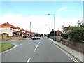
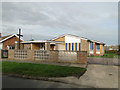
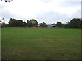
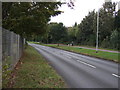
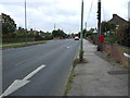
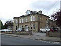
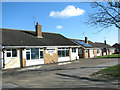
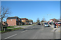
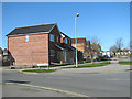
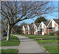
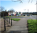
23 photos from this area
Area Information
Key information about the NR33 9RH including its size, population, and administrative classification.
- Area Type
- Postcode
- Area Size
- 7682 m²
- Population
- 1377
- Population Density
- 3762 people/km²
House Prices in NR33 9RH
16
Properties
£133,461
Average Sold Price
£36,501
Lowest Price
£205,000
Highest Price
Showing 16 properties
| Address | Type | Beds | Baths | Last Sale Price | Last Sale Date | |
|---|---|---|---|---|---|---|
| 36 Westwood Avenue, Lowestoft, NR33 9RH | Semi-detached | 2 | 1 | £202,000 | Oct 2025 | |
| 34 Westwood Avenue, Lowestoft, NR33 9RH | Semi-detached | 2 | 1 | £199,995 | Jun 2025 | |
| 22 Westwood Avenue, Lowestoft, NR33 9RH | Bungalow | - | - | £150,000 | Jan 2022 | |
| 12 Westwood Avenue, Lowestoft, NR33 9RH | Bungalow | - | - | £205,000 | Sep 2021 | |
| 42 Westwood Avenue, Lowestoft, NR33 9RH | Bungalow | - | - | £175,000 | Nov 2019 | |
| 24 Westwood Avenue, Lowestoft, NR33 9RH | Bungalow | 2 | - | £157,000 | Mar 2017 | |
| 26 Westwood Avenue, Lowestoft, NR33 9RH | Semi-detached | 2 | - | £144,000 | Jul 2016 | |
| 18 Westwood Avenue, Lowestoft, NR33 9RH | Semi-detached | 2 | - | £132,000 | Sep 2015 | |
| 40 Westwood Avenue, Lowestoft, NR33 9RH | Semi-detached | 2 | - | £125,000 | Mar 2015 | |
| 16 Westwood Avenue, Lowestoft, NR33 9RH | Bungalow | - | - | £115,000 | Nov 2011 |
Page 1 of 2
Energy Efficiency in NR33 9RH
Amenities
Schools
| Rank | School | Type | Entry gender | Ages |
|---|
Explore more schools in this area
Go to Schools tabDemographics
Household Size
Two person
most common
Accommodation Type
Houses
most common
Tenure
67
majority
Ethnic Group
White
most common
Religion
N/A
most common
Household Composition
N/A
most common
Age
47
median
Adults (30-64 years)
most common
Household Deprivation
N/A
with no deprivation
NS-SEC
19
in Lower managerial occupations
Explore more demographic insights in this area
Go to Demographics tabPlanning
Planning Constraints
- Flood RiskPremium
- Ramsar Wetland SitesPremium
- Area of Outstanding Natural BeautyPremium
- Protected Nature ReservePremium
- Protected WoodlandPremium