Area Overview for NR33 9PJ
Photos of NR33 9PJ

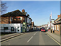
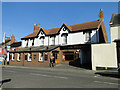
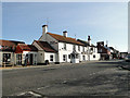
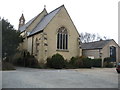
100 photos from this area
Area Information
Key information about the NR33 9PJ including its size, population, and administrative classification.
- Area Type
- Postcode
- Area Size
- 8473 m²
- Population
- 1505
- Population Density
- 177630 people/km²
House Prices in NR33 9PJ
30
Properties
£141,478
Average Sold Price
£37,000
Lowest Price
£290,000
Highest Price
Showing 30 properties
| Address | Type | Beds | Baths | Last Sale Price | Last Sale Date | |
|---|---|---|---|---|---|---|
| 78 Sycamore Avenue, Lowestoft, NR33 9PJ | Terraced | 3 | 1 | £204,000 | Oct 2023 | |
| 76 Sycamore Avenue, Lowestoft, NR33 9PJ | Terraced | 3 | 1 | £215,000 | Oct 2023 | |
| 58 Sycamore Avenue, Lowestoft, NR33 9PJ | Terraced | 3 | 1 | £210,000 | Oct 2022 | |
| 64 Sycamore Avenue, Lowestoft, NR33 9PJ | house | - | - | £165,000 | Aug 2022 | |
| 66 Sycamore Avenue, Lowestoft, NR33 9PJ | house | - | - | £175,000 | Apr 2022 | |
| 48 Sycamore Avenue, Lowestoft, NR33 9PJ | Terraced | 3 | 1 | £183,000 | Oct 2021 | |
| 54 Sycamore Avenue, Lowestoft, NR33 9PJ | house | - | - | £140,000 | Sep 2019 | |
| 82 Sycamore Avenue, Lowestoft, NR33 9PJ | Terraced | 4 | 1 | £180,000 | May 2019 | |
| 84 Sycamore Avenue, Lowestoft, NR33 9PJ | Bungalow | - | - | £290,000 | Jan 2017 | |
| 42 Sycamore Avenue, Lowestoft, NR33 9PJ | Terraced | - | - | £139,995 | Sep 2016 |
Page 1 of 3
Energy Efficiency in NR33 9PJ
Amenities
Schools
| Rank | School | Type | Entry gender | Ages |
|---|
Explore more schools in this area
Go to Schools tabDemographics
Household Size
N/A
most common
Accommodation Type
N/A
most common
Tenure
N/A
majority
Ethnic Group
N/A
most common
Religion
N/A
most common
Household Composition
N/A
most common
Age
N/A
median
N/A
most common
Household Deprivation
N/A
with no deprivation
NS-SEC
N/A
in Lower managerial occupations
Explore more demographic insights in this area
Go to Demographics tabPlanning
Planning Constraints
- Flood RiskPremium
- Ramsar Wetland SitesPremium
- Area of Outstanding Natural BeautyPremium
- Protected Nature ReservePremium
- Protected WoodlandPremium