Area Overview for NR33 9JW
Photos of NR33 9JW
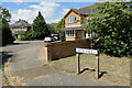
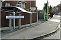
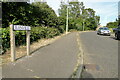
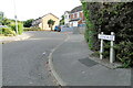
43 photos from this area
Area Information
Key information about the NR33 9JW including its size, population, and administrative classification.
- Area Type
- Postcode
- Area Size
- 1.4 hectares
- Population
- 1201
- Population Density
- 84279 people/km²
House Prices in NR33 9JW
27
Properties
£120,083
Average Sold Price
£27,500
Lowest Price
£360,000
Highest Price
Showing 27 properties
| Address | Type | Beds | Baths | Last Sale Price | Last Sale Date | |
|---|---|---|---|---|---|---|
| 1 Carnoustie Drive, Lowestoft, NR33 9JW | Detached | 5 | 3 | £360,000 | Sep 2024 | |
| 25 Carnoustie Drive, Lowestoft, NR33 9JW | house | 1 | 1 | £116,000 | Apr 2023 | |
| 20 Carnoustie Drive, Lowestoft, NR33 9JW | Terraced | 1 | 1 | £125,000 | Mar 2023 | |
| 19 Carnoustie Drive, Lowestoft, NR33 9JW | Flat | 1 | - | £80,000 | Oct 2021 | |
| 24 Carnoustie Drive, Lowestoft, NR33 9JW | Bungalow | 2 | 1 | £210,000 | Jul 2021 | |
| 4 Carnoustie Drive, Lowestoft, NR33 9JW | house | - | - | £162,000 | Oct 2020 | |
| 9 Carnoustie Drive, Lowestoft, NR33 9JW | Semi-detached | 3 | 1 | £165,000 | Feb 2019 | |
| 28 Carnoustie Drive, Lowestoft, NR33 9JW | house | 1 | 1 | £90,000 | Jun 2018 | |
| 15 Carnoustie Drive, Lowestoft, NR33 9JW | Bungalow | 2 | 1 | £135,000 | Jun 2016 | |
| 6 Carnoustie Drive, Lowestoft, NR33 9JW | Terraced | 2 | 1 | £119,995 | Aug 2015 |
Page 1 of 3
Energy Efficiency in NR33 9JW
Amenities
Schools
| Rank | School | Type | Entry gender | Ages |
|---|
Explore more schools in this area
Go to Schools tabDemographics
Household Size
One person
most common
Accommodation Type
Houses
most common
Tenure
38
majority
Ethnic Group
White
most common
Religion
N/A
most common
Household Composition
N/A
most common
Age
47
median
Adults (30-64 years)
most common
Household Deprivation
N/A
with no deprivation
NS-SEC
20
in Lower managerial occupations
Explore more demographic insights in this area
Go to Demographics tabPlanning
Planning Constraints
- Flood RiskPremium
- Ramsar Wetland SitesPremium
- Area of Outstanding Natural BeautyPremium
- Protected Nature ReservePremium
- Protected WoodlandPremium