Area Overview for NR33 9HS
Photos of NR33 9HS
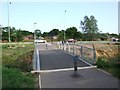
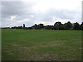
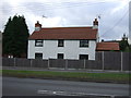
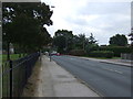
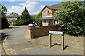
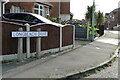
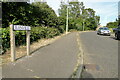
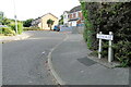
43 photos from this area
Area Information
Key information about the NR33 9HS including its size, population, and administrative classification.
- Area Type
- Postcode
- Area Size
- 1.9 hectares
- Population
- 1377
- Population Density
- 3762 people/km²
House Prices in NR33 9HS
23
Properties
£181,235
Average Sold Price
£42,000
Lowest Price
£360,000
Highest Price
Showing 23 properties
| Address | Type | Beds | Baths | Last Sale Price | Last Sale Date | |
|---|---|---|---|---|---|---|
| 61 Broadwaters Road, Lowestoft, NR33 9HS | Bungalow | 2 | 1 | £255,000 | Dec 2024 | |
| 76 Broadwaters Road, Lowestoft, NR33 9HS | Retail | 2 | 1 | £250,000 | Jun 2022 | |
| 74 Broadwaters Road, Lowestoft, NR33 9HS | Bungalow | - | - | £295,000 | Aug 2021 | |
| 55 Broadwaters Road, Lowestoft, NR33 9HS | Bungalow | 2 | - | £360,000 | Dec 2019 | |
| 70 Broadwaters Road, Lowestoft, NR33 9HS | Bungalow | 3 | 2 | £255,000 | Aug 2018 | |
| 60 Broadwaters Road, Lowestoft, NR33 9HS | Detached | 3 | - | £194,000 | Mar 2016 | |
| 69 Broadwaters Road, Lowestoft, NR33 9HS | Bungalow | 2 | - | £164,995 | Aug 2015 | |
| 82 Broadwaters Road, Lowestoft, NR33 9HS | Bungalow | - | - | £182,500 | Apr 2015 | |
| 53 Broadwaters Road, Lowestoft, NR33 9HS | Detached | - | - | £123,000 | Oct 2012 | |
| 65 Broadwaters Road, Lowestoft, NR33 9HS | Bungalow | - | - | £142,500 | Dec 2011 |
Page 1 of 3
Energy Efficiency in NR33 9HS
Amenities
Schools
| Rank | School | Type | Entry gender | Ages |
|---|
Explore more schools in this area
Go to Schools tabDemographics
Household Size
Two person
most common
Accommodation Type
Houses
most common
Tenure
67
majority
Ethnic Group
White
most common
Religion
N/A
most common
Household Composition
N/A
most common
Age
47
median
Adults (30-64 years)
most common
Household Deprivation
N/A
with no deprivation
NS-SEC
19
in Lower managerial occupations
Explore more demographic insights in this area
Go to Demographics tabPlanning
Planning Constraints
- Flood RiskPremium
- Ramsar Wetland SitesPremium
- Area of Outstanding Natural BeautyPremium
- Protected Nature ReservePremium
- Protected WoodlandPremium