Area Overview for NR33 9ER
Photos of NR33 9ER

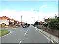
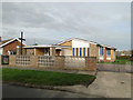
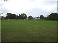
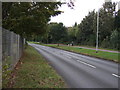
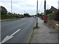
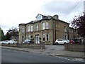
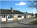
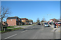
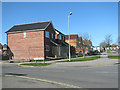
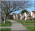
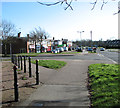
23 photos from this area
Area Information
Key information about the NR33 9ER including its size, population, and administrative classification.
- Area Type
- Postcode
- Area Size
- 3.1 hectares
- Population
- 1416
- Population Density
- 3083 people/km²
House Prices in NR33 9ER
15
Properties
£194,182
Average Sold Price
£47,000
Lowest Price
£305,000
Highest Price
Showing 15 properties
| Address | Type | Beds | Baths | Last Sale Price | Last Sale Date | |
|---|---|---|---|---|---|---|
| 71 Elm Tree Road, Lowestoft, NR33 9ER | Retail | 3 | 1 | £230,000 | Jun 2022 | |
| 57 Elm Tree Road, Lowestoft, NR33 9ER | Bungalow | - | - | £235,000 | Feb 2021 | |
| 69 Elm Tree Road, Lowestoft, NR33 9ER | Bungalow | 3 | 1 | £240,000 | Jan 2021 | |
| 55 Elm Tree Road, Lowestoft, NR33 9ER | house | - | - | £225,000 | Aug 2020 | |
| 67 Elm Tree Road, Lowestoft, NR33 9ER | Semi-detached | 2 | 1 | £210,000 | Oct 2019 | |
| 59 Elm Tree Road, Lowestoft, NR33 9ER | Bungalow | 4 | 1 | £292,500 | Apr 2019 | |
| 51 Elm Tree Road, Lowestoft, NR33 9ER | Semi-detached | 3 | 1 | £181,000 | Dec 2016 | |
| 75 Elm Tree Road, Lowestoft, NR33 9ER | Detached | 3 | - | £305,000 | Sep 2016 | |
| 65 Elm Tree Road, Lowestoft, NR33 9ER | Semi-detached | - | - | £85,500 | Oct 2001 | |
| 47 Elm Tree Road, Lowestoft, NR33 9ER | Detached | - | - | £85,000 | Nov 1997 |
Page 1 of 2
Energy Efficiency in NR33 9ER
Amenities
Schools
| Rank | School | Type | Entry gender | Ages |
|---|
Explore more schools in this area
Go to Schools tabDemographics
Household Size
Two person
most common
Accommodation Type
Houses
most common
Tenure
92
majority
Ethnic Group
White
most common
Religion
N/A
most common
Household Composition
N/A
most common
Age
47
median
Adults (30-64 years)
most common
Household Deprivation
N/A
with no deprivation
NS-SEC
26
in Lower managerial occupations
Explore more demographic insights in this area
Go to Demographics tabPlanning
Planning Constraints
- Flood RiskPremium
- Ramsar Wetland SitesPremium
- Area of Outstanding Natural BeautyPremium
- Protected Nature ReservePremium
- Protected WoodlandPremium