Area Overview for NR33 8UH
Photos of NR33 8UH
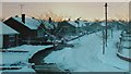
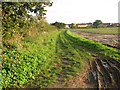
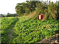
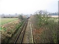
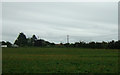
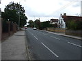
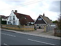
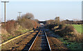
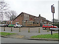
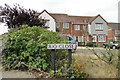
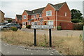
62 photos from this area
Area Information
Key information about the NR33 8UH including its size, population, and administrative classification.
- Area Type
- Postcode
- Area Size
- 6389 m²
- Population
- 1552
- Population Density
- 4352 people/km²
House Prices in NR33 8UH
14
Properties
£91,122
Average Sold Price
£37,952
Lowest Price
£176,000
Highest Price
Showing 14 properties
| Address | Type | Beds | Baths | Last Sale Price | Last Sale Date | |
|---|---|---|---|---|---|---|
| 6 Run Meadow, Lowestoft, NR33 8UH | house | - | - | £160,000 | Dec 2018 | |
| 7 Run Meadow, Lowestoft, NR33 8UH | Semi-detached | 3 | 1 | £140,000 | Nov 2017 | |
| 4 Run Meadow, Lowestoft, NR33 8UH | Semi-detached | 2 | 1 | £115,000 | Aug 2013 | |
| 11 Run Meadow, Lowestoft, NR33 8UH | house | - | - | £176,000 | Jan 2008 | |
| 1 Run Meadow, Lowestoft, NR33 8UH | Detached | 3 | 1 | £142,500 | Apr 2006 | |
| 10 Run Meadow, Lowestoft, NR33 8UH | Terraced | 2 | 1 | £99,500 | Apr 2005 | |
| 9 Run Meadow, Lowestoft, NR33 8UH | Detached | - | - | £68,500 | Jan 2000 | |
| 17 Run Meadow, Lowestoft, NR33 8UH | house | - | - | £78,500 | Dec 1997 | |
| 3 Run Meadow, Lowestoft, NR33 8UH | house | - | - | £59,950 | May 1996 | |
| 15 Run Meadow, Lowestoft, NR33 8UH | Detached | - | - | £61,000 | May 1996 |
Page 1 of 2
Energy Efficiency in NR33 8UH
Amenities
Schools
| Rank | School | Type | Entry gender | Ages |
|---|
Explore more schools in this area
Go to Schools tabDemographics
Household Size
Family (3-5 people)
most common
Accommodation Type
Houses
most common
Tenure
49
majority
Ethnic Group
White
most common
Religion
N/A
most common
Household Composition
N/A
most common
Age
47
median
Adults (30-64 years)
most common
Household Deprivation
N/A
with no deprivation
NS-SEC
21
in Lower managerial occupations
Explore more demographic insights in this area
Go to Demographics tabPlanning
Planning Constraints
- Flood RiskPremium
- Ramsar Wetland SitesPremium
- Area of Outstanding Natural BeautyPremium
- Protected Nature ReservePremium
- Protected WoodlandPremium