Area Overview for NR33 8UG
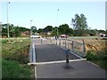
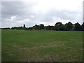
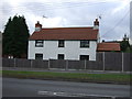
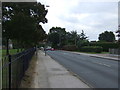
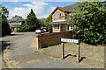
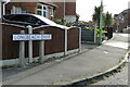
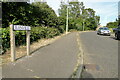
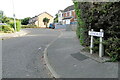
Photos of NR33 8UG
Area Information
NR33 8UG occupies a specific residential cluster in England, covering just 1.3 hectares. This small footprint contains a population of 1,912 people, creating an environment that feels intimate yet organised. Living in NR33 8UG means engaging with a postcode-defined area where every square metre reflects a high density of 152,244 people per square kilometre. The space is almost entirely dedicated to housing within these narrow boundaries, resulting in a tight-knit community atmosphere. Residents here navigate a distinctively compact living experience where the line between public and private space blurs due to the restricted land size. There is no room for sprawling suburbs or large green buffers within the immediate NR33 8UG borders; the focus remains strictly on the built environment that supports the nearly two thousand inhabitants. This concentration defines the character of the neighbourhood, offering a predictable routine for those who adapt to the scale of the settlement. Buyers seeking this location should understand that they are purchasing into a defined slice of the local landscape rather than a broad town or village district. The area size limits expansion, meaning the community has grown to comfortably fill its available 1.3 hectares without significant new construction nearby.
- Area Type
- Postcode
- Area Size
- 1.3 hectares
- Population
- 1912
- Population Density
- 5934 people/km²
The housing market in NR33 8UG is defined by a strong inclination towards private ownership. With 79 per cent of residents being home owners, the area functions as a largely owner-occupied zone rather than a rental market. This statistic indicates that the demand here is driven by people wishing to settle down and build equity in their properties. The accommodation type is exclusively houses, meaning you will not find apartment complexes or shared housing within this specific postcode. This configuration appeals to buyers who require private gardens and separate entrances without the shared living arrangements of flats. Given the small area size of just 1.3 hectares, stock is limited, and competition for available homes in NR33 8UG may be fierce if properties come to the market. The high ownership percentage also suggests that resale values are stable, as owners are less likely to exit the market impulsively. You should approach property searches here with the understanding that inventory will be low and turnover infrequent. The nature of the homes consists of traditional dwellings suitable for families or individuals requiring private living spaces.
House Prices in NR33 8UG
Showing 33 properties
| Address | Type | Beds | Baths | Last Sale Price | Last Sale Date | |
|---|---|---|---|---|---|---|
| 25 Nidderdale, Carlton Colville, NR33 8UG | Semi-detached | 3 | 2 | £260,000 | Nov 2025 | |
| 11 Nidderdale, Carlton Colville, NR33 8UG | Detached | 5 | 2 | £448,000 | Mar 2024 | |
| 15 Nidderdale, Carlton Colville, NR33 8UG | house | - | - | £272,000 | Jan 2021 | |
| 10 Nidderdale, Carlton Colville, NR33 8UG | house | - | - | £188,000 | Jul 2019 | |
| 1 Nidderdale, Carlton Colville, NR33 8UG | Detached | 4 | 2 | £245,000 | Oct 2018 | |
| 22 Nidderdale, Carlton Colville, NR33 8UG | Detached | 3 | 1 | £175,000 | Dec 2017 | |
| 34 Nidderdale, Carlton Colville, NR33 8UG | Semi-detached | 3 | 1 | £160,000 | Nov 2017 | |
| 23 Nidderdale, Carlton Colville, NR33 8UG | Semi-detached | 3 | 1 | £177,500 | Oct 2017 | |
| 16 Nidderdale, Carlton Colville, NR33 8UG | Detached | 4 | 2 | £320,000 | Jul 2017 | |
| 4 Nidderdale, Carlton Colville, NR33 8UG | Detached | 3 | 1 | £199,995 | Jun 2017 |
Energy Efficiency in NR33 8UG
Daily life in NR33 8UG is supported by a practical network of amenities located within easy practical reach. Retail needs are met by five local shops, including Co-op Carlton, Aldi Gateway, and Morrisons Pakefield. These chains provide immediate access to groceries, household essentials, and daily necessities without requiring long journeys into larger towns. There are five railway entrances close by, with notable stations including Entrance3, Oulton Broad South Railway Station, and Entrance1. These rail links offer transport options for those who need to travel beyond the immediate posttown area. For those requiring air travel, Beccles Airport sits within reach, providing scheduled flights for shorter trips. The cluster of five retail outlets ensures you do not need to drive far for most shopping requirements. Residents can walk or use local transport to reach these specific venues comfortably. The presence of both rail and airport options highlights a strategic location that balances local self-sufficiency with regional connectivity. Living in NR33 8UG means having your essential services and transport links organised efficiently around a small residential base.
Amenities
Schools
| Rank | School | Type | Entry gender | Ages |
|---|
Explore more schools in this area
Go to Schools tabDemographics
The community profile for NR33 8UG centres on a balanced demographic with a median age of 47 years. Adults aged between 30 and 64 years form the most common age range, indicating a population that is typically established in careers and families. Home ownership stands at 79 per cent, demonstrating that the vast majority of residents have purchased their properties outright or have substantial equity stakes. This high ownership rate suggests stability, as people are likely to stay for the long term rather than moving frequently. The area predominantly features houses, meaning you will find full detached or semi-detached structures rather than flats or conversions. White residents make up the predominant ethnic group, reflecting the traditional demographic makeup of the surrounding Suffolk region. With 1,912 residents squeezed into a minimal area, the social fabric is likely closely woven, with neighbours knowing each other well. The age distribution implies a community where members have likely raised children and are now in their later working years. This profile contrasts with student hubs or retirement enclaves, pointing instead towards a standard British middle-aged neighbourhood seeking practical, stable housing solutions.
Household Size
Accommodation Type
Tenure
Ethnic Group
Religion
Household Composition
Age
Household Deprivation
NS-SEC
Explore more demographic insights in this area
Go to Demographics tabPlanning
Planning Constraints
- Flood RiskPremium
- Ramsar Wetland SitesPremium
- Area of Outstanding Natural BeautyPremium
- Protected Nature ReservePremium
- Protected WoodlandPremium