Area Overview for NR33 8RN
Photos of NR33 8RN
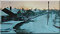
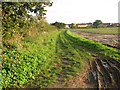
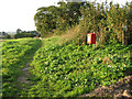
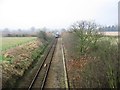
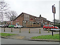
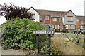
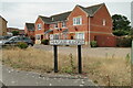
62 photos from this area
Area Information
Key information about the NR33 8RN including its size, population, and administrative classification.
- Area Type
- Postcode
- Area Size
- 2.4 hectares
- Population
- 1462
- Population Density
- 60333 people/km²
House Prices in NR33 8RN
39
Properties
£212,902
Average Sold Price
£89,000
Lowest Price
£375,000
Highest Price
Showing 39 properties
| Address | Type | Beds | Baths | Last Sale Price | Last Sale Date | |
|---|---|---|---|---|---|---|
| 6 The Parklands, Lowestoft, NR33 8RN | house | - | - | £375,000 | Nov 2018 | |
| 21 The Parklands, Lowestoft, NR33 8RN | Detached | 4 | 2 | £266,000 | Oct 2018 | |
| 3 The Parklands, Lowestoft, NR33 8RN | Detached | 3 | 2 | £235,000 | Sep 2018 | |
| 30 The Parklands, Lowestoft, NR33 8RN | Detached | 4 | 3 | £265,000 | Jul 2015 | |
| 28 The Parklands, Lowestoft, NR33 8RN | house | - | - | £279,950 | Jan 2015 | |
| 22 The Parklands, Lowestoft, NR33 8RN | Detached | 4 | 3 | £287,000 | Oct 2014 | |
| 11 The Parklands, Lowestoft, NR33 8RN | house | - | - | £235,000 | Aug 2012 | |
| 17 The Parklands, Lowestoft, NR33 8RN | house | - | - | £249,999 | Jan 2011 | |
| 10 The Parklands, Lowestoft, NR33 8RN | house | - | - | £210,000 | Dec 2009 | |
| 18 The Parklands, Lowestoft, NR33 8RN | Detached | - | - | £250,000 | Jan 2008 |
Page 1 of 4
Energy Efficiency in NR33 8RN
Amenities
Schools
| Rank | School | Type | Entry gender | Ages |
|---|
Explore more schools in this area
Go to Schools tabDemographics
Household Size
N/A
most common
Accommodation Type
N/A
most common
Tenure
N/A
majority
Ethnic Group
N/A
most common
Religion
N/A
most common
Household Composition
N/A
most common
Age
N/A
median
N/A
most common
Household Deprivation
N/A
with no deprivation
NS-SEC
N/A
in Lower managerial occupations
Explore more demographic insights in this area
Go to Demographics tabPlanning
Planning Constraints
- Flood RiskPremium
- Ramsar Wetland SitesPremium
- Area of Outstanding Natural BeautyPremium
- Protected Nature ReservePremium
- Protected WoodlandPremium