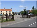
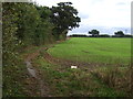
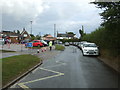
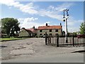
Area Overview for NR33 8JL
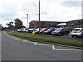
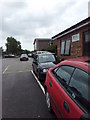
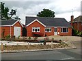
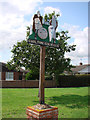
Photos of NR33 8JL


Area Information
Living in NR33 8JL means residing in a compact residential cluster of 9,678 square metres. This specific postcode area in England houses a population of 1,861 people. The high population density of 192,301 people per square kilometre indicates a tightly knit neighbourhood where homes are situated close to one another. You will find that daily life here is defined by a strong sense of locality within a very small physical footprint. The area functions as a distinct household unit rather than a sprawling district. Residents enjoy direct access to specific services while benefiting from the intimacy of a secluded plot. This setting appeals to those who prefer a defined community boundary over expansive urban sprawl. The average resident here understands the character of a concentrated housing cluster. While the space is small, the community cohesion often compensates for the limited physical area. You receive immediate proximity to local amenities without needing to travel far for basic needs. The area operates efficiently as a single micro-hub for its inhabitants.
- Area Type
- Postcode
- Area Size
- 9678 m²
- Population
- 1861
- Population Density
- 192301 people/km²
The property market in NR33 8JL reflects the status of a home-owner society. With 68% of residents achieving home ownership, the local housing focus remains on single-family dwellings. The accommodation type data confirms that houses form the backbone of the property stock. This means you are unlikely to find flats or converted maisonettes dominating the streets. Instead, you will encounter detached, semi-detached, or terraced houses typical of this postcode. Such an environment often commands higher property values relative to rental yields in the wider region. Buyers looking for a permanent residence will appreciate the lower turnover rates associated with high ownership figures. The market here serves established families rather than young professionals seeking short-term rentals. You face less competition from investors flipping properties quickly. The character of the neighbourhood is preserved because owners have a vested interest in long-term improvements.
House Prices in NR33 8JL
Showing 28 properties
| Address | Type | Beds | Baths | Last Sale Price | Last Sale Date | |
|---|---|---|---|---|---|---|
| 20 Carlton Square, Carlton Colville, NR33 8JL | house | - | - | £195,000 | Aug 2021 | |
| 15 Carlton Square, Carlton Colville, NR33 8JL | house | 3 | 1 | £220,000 | Apr 2021 | |
| 27 Carlton Square, Carlton Colville, NR33 8JL | Semi-detached | 2 | 1 | £169,000 | Nov 2020 | |
| 9 Carlton Square, Carlton Colville, NR33 8JL | house | 2 | 2 | £128,000 | Jul 2017 | |
| 26 Carlton Square, Carlton Colville, NR33 8JL | house | 2 | 2 | £120,000 | Dec 2015 | |
| 18 Carlton Square, Carlton Colville, NR33 8JL | Semi-detached | 3 | - | £129,000 | Dec 2015 | |
| 8 Carlton Square, Carlton Colville, NR33 8JL | Semi-detached | 3 | - | £119,000 | Nov 2013 | |
| 23 Carlton Square, Carlton Colville, NR33 8JL | house | 3 | - | £125,000 | Sep 2013 | |
| 3 Carlton Square, Carlton Colville, NR33 8JL | house | - | - | £124,995 | Apr 2007 | |
| 6 Carlton Square, Carlton Colville, NR33 8JL | Semi-detached | - | - | £27,280 | Feb 2001 |
Energy Efficiency in NR33 8JL
Daily life in NR33 8JL offers convenient access to essential shops and rail links. You have five retail options within practical reach, including Co-op Carlton, Morrisons Pakefield, and Aldi Gateway. These venues provide necessary groceries and household essentials without requiring extensive travel. Commuters can choose from five rail facilities nearby, such as Oulton Broad South Railway Station. These stations act as the main artery for travelling beyond the immediate neighbourhood. One airport, Beccles Airport, sits within reach of the linear town. This proximity offers occasional flight options for business or leisure travel. Your weekly shopping runs are manageable, and work commutes are structured around specific railway entrances. The local amenities ensure that basic needs are met efficiently. You rely on these five retail outlets and five rail points for your routine activities.
Amenities
Schools
| Rank | School | Type | Entry gender | Ages |
|---|
Explore more schools in this area
Go to Schools tabDemographics
The community in NR33 8JL centres on a mature demographic profile with a median age of 47 years. The most common age range consists of adults between 30 and 64 years. This snapshot suggests the area attracts families with school-age children or individuals similarly situated in their career prime. Home ownership is the dominant living arrangement, with 68% of residents owning their homes outright or with a mortgage. This figure indicates a stable, long-term community rather than a transient rental market. The predominant ethnic group is White, which shapes the cultural character of the neighbourhood. Accommodation types are primarily houses, meaning you do not need to navigate the complexities of living in an apartment block. The absence of high-rise living contributes to the quiet, traditional nature of the street scene. You will find that neighbours here have likely lived in these houses for many years. This ownership stability often translates into well-maintained properties and established community bonds. The demographic data presents a clear picture of a settled, homeowners-heavy environment.
Household Size
Accommodation Type
Tenure
Ethnic Group
Religion
Household Composition
Age
Household Deprivation
NS-SEC
Explore more demographic insights in this area
Go to Demographics tabPlanning
Planning Constraints
- Flood RiskPremium
- Ramsar Wetland SitesPremium
- Area of Outstanding Natural BeautyPremium
- Protected Nature ReservePremium
- Protected WoodlandPremium