Area Overview for NR33 8GU
Photos of NR33 8GU
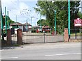
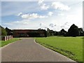
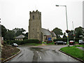
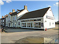
43 photos from this area
Area Information
Key information about the NR33 8GU including its size, population, and administrative classification.
- Area Type
- Postcode
- Area Size
- 8793 m²
- Population
- 2912
- Population Density
- 431 people/km²
House Prices in NR33 8GU
22
Properties
£155,122
Average Sold Price
£55,250
Lowest Price
£322,500
Highest Price
Showing 22 properties
| Address | Type | Beds | Baths | Last Sale Price | Last Sale Date | |
|---|---|---|---|---|---|---|
| 8 Mast Close, Carlton Colville, NR33 8GU | house | - | - | £183,500 | Jun 2025 | |
| 30 Mast Close, Carlton Colville, NR33 8GU | Detached | 4 | 2 | £308,000 | Mar 2025 | |
| 10 Mast Close, Carlton Colville, NR33 8GU | house | 2 | 1 | £190,000 | Aug 2022 | |
| 26 Mast Close, Carlton Colville, NR33 8GU | Retail | 4 | 2 | £322,500 | Apr 2022 | |
| 20 Mast Close, Carlton Colville, NR33 8GU | Semi-detached | 3 | 1 | £203,000 | Dec 2020 | |
| 3 Mast Close, Carlton Colville, NR33 8GU | Semi-detached | 3 | - | £174,000 | Nov 2018 | |
| 9 Mast Close, Carlton Colville, NR33 8GU | Detached | 3 | - | £179,995 | Oct 2014 | |
| 18 Mast Close, Carlton Colville, NR33 8GU | house | 3 | - | £153,250 | Jul 2014 | |
| 28 Mast Close, Carlton Colville, NR33 8GU | house | - | - | £180,000 | Jun 2013 | |
| 24 Mast Close, Carlton Colville, NR33 8GU | house | - | - | £108,000 | Jun 2011 |
Page 1 of 3
Energy Efficiency in NR33 8GU
Amenities
Schools
| Rank | School | Type | Entry gender | Ages |
|---|
Explore more schools in this area
Go to Schools tabDemographics
Household Size
Two person
most common
Accommodation Type
Houses
most common
Tenure
83
majority
Ethnic Group
White
most common
Religion
N/A
most common
Household Composition
N/A
most common
Age
47
median
Adults (30-64 years)
most common
Household Deprivation
N/A
with no deprivation
NS-SEC
31
in Lower managerial occupations
Explore more demographic insights in this area
Go to Demographics tabPlanning
Planning Constraints
- Flood RiskPremium
- Ramsar Wetland SitesPremium
- Area of Outstanding Natural BeautyPremium
- Protected Nature ReservePremium
- Protected WoodlandPremium