Area Overview for NR33 8FA
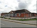
Photos of NR33 8FA

Area Information
The postcode area of NR33 8FA represents a compact residential cluster covering only 3.1 hectares within England. This small footprint supports a population of 2,912 people, creating a tightly knit community with a density of 431 people per square kilometre. The setting is distinctly suburban and domestic, focusing almost entirely on residential use rather than commercial expansion. Life here revolves around the immediate neighbourhood, where residents rely on nearby towns for broader shopping and social needs. The area functions as a quiet haven, prioritising space and tranquility over high-rise density or urban bustle. You will find a environment defined by its manageable scale, where routes to local.High Streets are short and direct. Daily life involves a strong connection to the ground, with homes situated in a way that fosters a clear sense of locality. The small size of the postcode means that news travels quickly and community events often bring a significant portion of the population together. This is a place where the single-digit hectare limit shapes the rhythm of existence, ensuring that you remain close to your neighbours while having easy access to the wider region.
- Area Type
- Postcode
- Area Size
- 3.1 hectares
- Population
- 2912
- Population Density
- 431 people/km²
The housing market in NR33 8FA is defined by a mature, owner-occupied stock comprising almost entirely of houses. With 83% of homes in the area owned by residents, the rental sector represents a small fraction of the total market. This dynamic is typical of older residential clusters where properties have been passed down or purchased over several decades. If you are looking to buy homes in NR33 8FA, you will primarily encounter freehold houses rather than flats or apartments. The area size of 3.1 hectares limits the supply of new builds, reinforcing the character of established residential streets. This high level of homeownership often correlates with stable property values and a slower pace of change compared to high-density urban centres. Sellers in this postcode tend to be motivated and settled, as they have likely lived in their properties for many years. For investors, the opportunity to find rental properties here is limited compared to other parts of Norfolk, but for buyers seeking a settled community, the market offers a consistent inventory of residential homes.
House Prices in NR33 8FA
Showing 17 properties
| Address | Type | Beds | Baths | Last Sale Price | Last Sale Date | |
|---|---|---|---|---|---|---|
| Four Acres, 17 Secrets Close, Carlton Colville, NR33 8FA | Bungalow | 4 | 3 | - | - | |
| Secret Cottage, 8 Secrets Close, Carlton Colville, NR33 8FA | Detached | - | - | - | - | |
| 13 Secrets Close, Carlton Colville, NR33 8FA | Terraced | - | - | - | - | |
| 11 Secrets Close, Carlton Colville, NR33 8FA | Terraced | - | - | - | - | |
| 15 Secrets Close, Carlton Colville, NR33 8FA | Terraced | - | - | - | - | |
| 2 Secrets Close, Carlton Colville, NR33 8FA | Terraced | - | - | - | - | |
| 6 Secrets Close, Carlton Colville, NR33 8FA | house | - | - | - | - | |
| 12 Secrets Close, Carlton Colville, NR33 8FA | house | - | - | - | - | |
| 5 Secrets Close, Carlton Colville, NR33 8FA | Terraced | - | - | - | - | |
| 1 Secrets Close, Carlton Colville, NR33 8FA | Terraced | - | - | - | - |
Energy Efficiency in NR33 8FA
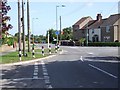
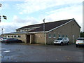
Daily life in NR33 8FA benefits from proximity to a range of retail and transport hubs. Local shopping needs are met by five retail outlets, including Co-op Carlton, Morrisons Pakefield, and Aldi Gateway. These specific venues provide groceries and essentials within a practical reach without requiring a long commute. For those travelling further afield, rail connections are available through five nearby facilities, including Oulton Broad South Railway Station and other entrances. This network facilitates access to larger towns and cities outside the immediate postcode. Travel needs are also supported by Beccles Airport, located nearby. Access to local transport and air travel options complements the quiet residential nature of the area. You can enjoy a peaceful suburban routine while maintaining efficient links to regional transport networks. The availability of Co-op, Morrisons, and Aldi ensures that household shopping remains a convenient part of your weekly schedule.
Amenities
Schools
Families with children in NR33 8FA have access to several educational institutions nearby. Grove Primary School serves as the main local option and holds a 'good' Ofsted rating, providing a reliable foundation for younger pupils. For secondary and special educational needs, two other options exist within reach. The Everitt Academy operates as a special school, catering to students with specific learning requirements. Similarly, Sunrise Academy is another special school that supports students with diverse needs. This mix of a mainstream primary and special provision academies means that the education provision is tailored to specific learning pathways rather than offering a full spectrum of comprehensive secondary Choices. Parents looking for mainstream secondary education with a general curriculum may need to look further afield, as both The Everitt Academy and Sunrise Academy focus on special educational needs. When considering schools near NR33 8FA, you must align your child's needs with the specific type and rating of these nearby institutions.
| Rank | School | Type | Entry gender | Ages |
|---|
Explore more schools in this area
Go to Schools tabDemographics
The people of NR33 8FA form a mature community with a median age of 47 years. The most common age range consists of adults between 30 and 64, indicating a demographic that has typically raised families and now enjoys a stable level of income. Homeownership stands at 83%, which is exceptionally high for a residential area in this country. This figure suggests that the vast majority of residents own their property outright or with a significant amount of equity, shaping a community with deep roots rather than a transient rental population. Accommodation types are exclusively houses, providing a uniform living standard across the postcode. The predominant ethnic group is white, reflecting a traditional and established character for the neighbourhood. With three-quarters of households owning their homes, there is a scarcity of private rentals available. This high ownership rate means that families here are likely to stay for the long term, creating a stable environment for children and pets.
Household Size
Accommodation Type
Tenure
Ethnic Group
Religion
Household Composition
Age
Household Deprivation
NS-SEC
Explore more demographic insights in this area
Go to Demographics tabPlanning
Planning Constraints
- Flood RiskPremium
- Ramsar Wetland SitesPremium
- Area of Outstanding Natural BeautyPremium
- Protected Nature ReservePremium
- Protected WoodlandPremium