Area Overview for NR33 8ES
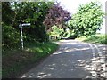
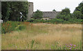
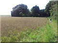
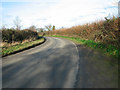
Photos of NR33 8ES

Area Information
Living in NR33 8ES means residing within a residential cluster of 3.0 hectares where 2,346 people call their homes. This postcode represents a distinct pocket of rural life in Suffolk, characterised by low density and a tightly knit residential fabric. With a population density of 38 people per square kilometre, the area feels spacious and quiet compared to larger towns. The location balances isolation with accessibility, situated near amenities in Beccles and coastal villages while maintaining its own character as a small community. Residents here experience a slower pace of life that appeals to those seeking space without total remoteness. The area is defined by its residential nature, with housing spread across a landscape that values privacy. Daily life typically involves a commute to nearby hubs, yet the immediate neighbourhood offers a sense of stability and established roots. Prospective buyers often appreciate the clear boundaries of ownership in an area marked by consistent, traditional living patterns. The environment supports a tranquil existence, far removed from urban congestion. ### The community in NR33 8ES is dominated by adults between the ages of 30 and 64, reflecting a mature demographic profile. The median age stands at 47, which paints a picture of a stable family environment rather than a young, transient population. Nearly 68% of dwellings are owner-occupied, suggesting a high level of financial investment and long-term commitment from residents. This strong sense of proprietorship contributes to the area's stability, as homeowners tend to stay put through changing economic cycles. The predominant ethnic group is White, aligning with the broader historical context of rural Suffolk settlements. Most housing in the area consists of houses, reinforcing the suburban or semi-rural character of the neighbourhood. This demographic concentration indicates a community focused on established households rather than student housing or high-tempo transience. You will find families managing homes that they do not plan to sell quickly. ### The housing stock in NR33 8ES is overwhelmingly comprised of houses, with 68% of properties held by their owners. This high rate of ownership suggests that the market is driven by families and individuals who have purchased into the area rather than landlords renting out units. The sheer volume of self-owned homes points to a stable environment where buyers are likely to remain for many years. When looking at homes in this postcode, you will find that the majority of inventory suits owner-occupiers seeking to build equity rather than tenants seeking short-term leases. The nature of the area as a small residential cluster means that supply is limited, potentially driving competition for specific properties within the 3.0-hectare boundary. Buyers here should approach the market with an understanding that stock moves slowly. This dynamic contrasts sharply with high-rental areas where turnover is frequent and volatility is higher. The dominance of owner-occupied status creates a predictable market rhythm that favours long-term planning. ### For families considering NR33 8ES, there are three primary educational options nearby. The area is served by Brampton CofE Primary School and Brampton Church of England Primary School, both operating under the primary sector. Ofsted has rated Brampton Church of England Primary School as good, offering a proven standard of education for local children. The Old School functions as an independent school, providing a distinct alternative for parents seeking private education for their offspring. This mix of state-funded primary institutions and an independent option gives residents flexibility in choosing the right learning environment. When evaluating schools near this area, you have access to both religious and secular independent choices within walking or short driving distance. Parents often weigh the ofsted rating of the state school against the curriculum and fees of the independent option. The proximity of these institutions ensures that families can keep children close to home while accessing varied educational approaches. ### Digital connectivity in NR33 8ES is moderate, which may influence your decision if you rely heavily on internet access for work or leisure. Your mobile phone signal will score 79 out of 100, indicating generally good coverage across the residential cluster. However, fixed broadband presents a more significant consideration, with a quality score of 59 out of 100. This rating suggests that high-speed, low-latency connections may not be guaranteed everywhere within the 3.0-hectare area. Residents who work from home full-time should test speeds thoroughly before committing to a purchase. The lower broadband score means that video conferencing or large file uploads might experience occasional interruptions compared to urban neighbours. While mobile data works well for on-the-go communication, stationary internet use carries some inherent limitations. You must balance the need for reliable connectivity against the benefit of a rural lifestyle. The gap between mobile and fixed performance is a specific factor to consider when weighing the convenience of modern digital living here against the quiet of the countryside. ### Residents of NR33 8ES enjoy convenient access to essential services and leisure activities without needing to travel far from their homes. Within practical reach, you will find five retail outlets including a Spar, Co-op Kessingland, and Morrisons Pakefield, ensuring groceries and daily essentials are close by. If you require air travel, Beccles Airport is located nearby, providing a specific transport link for leisure or business flights. The area also offers five railway stations in its vicinity, with specific entrances and Oulton Broad South Railway Station facilitating easy train travel to Suffolk Towns. This network of amenities means you do not need to commute to a larger city for basic shopping or travel logistics. The presence of multiple supermarket brands allows you to compare prices and product ranges as you please. Local transport hubs integrate seamlessly into daily life, reducing the pressure of long commutes. You can rely on these established venues to meet your weekly needs efficiently. ### Safety in NR33 8ES offers a generally reassuring profile, particularly regarding crime and protected landscapes. The crime risk assessment shows a low threat level with a safety score of 80 out of 100. This indicates that the neighbourhood experiences below-average crime rates, making it a relatively secure place for families with children or elderly residents. Environmental planning constraints reveal a critical consideration regarding water security. Flood risk coverage is high, with a score of 51.89 out of 100. This level of risk means you must carefully review insurance options and property drainage before moving in. Conversely, the area clears planning constraints regarding Ramsar wetland sites, protected nature reserves, and protected woodland, all showing pass marks with zero risk scores linked to these specific designations. The Area of Outstanding Natural Beauty status triggers a warning level, which is a standard planning designation rather than a safety hazard. Overall, the crime environment is benign, but the potential for flooding requires realistic preparation for any future property maintenance or insurance negotiations. ### Who typically lives in this area and what is the community like?The population centres on adults aged 30 to 64, with a median age of 47. Eighty-eight percent of the 2,346 residents are part of established households. High home ownership at 68% reflects a community of people who have put down roots rather than transient renters. What schools are available for children in NR33 8ES?Families have access to two state primary schools, Brampton CofE Primary School and Brampton Church of England Primary School, alongside The Old School, which is an independent institution. Brampton Church of England Primary School holds a good Ofsted rating, offering a solid choice for state education. How reliable is the internet connection for working from home?Mobile coverage is rated as good with a score of 79 out of 100. However, fixed broadband is weaker, scoring only 59 out of 100. Homebuyers relying on high-speed internet for full-time work should verify speeds with providers, as the lower score indicates potential limitations for demanding online tasks. Is the area safe regarding crime and environmental risks?Coffee crime risks are low, reflected in a safety score of 80 out of 100, which places the area below the national average for criminal incidents. However, flood risk is a critical factor with a score of 51.89 out of 100, meaning high coverage of flood-prone zones. Residents must weigh the low crime rate against the necessity of strong flood protection measures.
- Area Type
- Postcode
- Area Size
- 3.0 hectares
- Population
- 2346
- Population Density
- 38 people/km²
The housing stock in NR33 8ES is overwhelmingly comprised of houses, with 68% of properties held by their owners. This high rate of ownership suggests that the market is driven by families and individuals who have purchased into the area rather than landlords renting out units. The sheer volume of self-owned homes points to a stable environment where buyers are likely to remain for many years. When looking at homes in this postcode, you will find that the majority of inventory suits owner-occupiers seeking to build equity rather than tenants seeking short-term leases. The nature of the area as a small residential cluster means that supply is limited, potentially driving competition for specific properties within the 3.0-hectare boundary. Buyers here should approach the market with an understanding that stock moves slowly. This dynamic contrasts sharply with high-rental areas where turnover is frequent and volatility is higher. The dominance of owner-occupied status creates a predictable market rhythm that favours long-term planning. ### For families considering NR33 8ES, there are three primary educational options nearby. The area is served by Brampton CofE Primary School and Brampton Church of England Primary School, both operating under the primary sector. Ofsted has rated Brampton Church of England Primary School as good, offering a proven standard of education for local children. The Old School functions as an independent school, providing a distinct alternative for parents seeking private education for their offspring. This mix of state-funded primary institutions and an independent option gives residents flexibility in choosing the right learning environment. When evaluating schools near this area, you have access to both religious and secular independent choices within walking or short driving distance. Parents often weigh the ofsted rating of the state school against the curriculum and fees of the independent option. The proximity of these institutions ensures that families can keep children close to home while accessing varied educational approaches. ### Digital connectivity in NR33 8ES is moderate, which may influence your decision if you rely heavily on internet access for work or leisure. Your mobile phone signal will score 79 out of 100, indicating generally good coverage across the residential cluster. However, fixed broadband presents a more significant consideration, with a quality score of 59 out of 100. This rating suggests that high-speed, low-latency connections may not be guaranteed everywhere within the 3.0-hectare area. Residents who work from home full-time should test speeds thoroughly before committing to a purchase. The lower broadband score means that video conferencing or large file uploads might experience occasional interruptions compared to urban neighbours. While mobile data works well for on-the-go communication, stationary internet use carries some inherent limitations. You must balance the need for reliable connectivity against the benefit of a rural lifestyle. The gap between mobile and fixed performance is a specific factor to consider when weighing the convenience of modern digital living here against the quiet of the countryside. ### Residents of NR33 8ES enjoy convenient access to essential services and leisure activities without needing to travel far from their homes. Within practical reach, you will find five retail outlets including a Spar, Co-op Kessingland, and Morrisons Pakefield, ensuring groceries and daily essentials are close by. If you require air travel, Beccles Airport is located nearby, providing a specific transport link for leisure or business flights. The area also offers five railway stations in its vicinity, with specific entrances and Oulton Broad South Railway Station facilitating easy train travel to Suffolk Towns. This network of amenities means you do not need to commute to a larger city for basic shopping or travel logistics. The presence of multiple supermarket brands allows you to compare prices and product ranges as you please. Local transport hubs integrate seamlessly into daily life, reducing the pressure of long commutes. You can rely on these established venues to meet your weekly needs efficiently. ### Safety in NR33 8ES offers a generally reassuring profile, particularly regarding crime and protected landscapes. The crime risk assessment shows a low threat level with a safety score of 80 out of 100. This indicates that the neighbourhood experiences below-average crime rates, making it a relatively secure place for families with children or elderly residents. Environmental planning constraints reveal a critical consideration regarding water security. Flood risk coverage is high, with a score of 51.89 out of 100. This level of risk means you must carefully review insurance options and property drainage before moving in. Conversely, the area clears planning constraints regarding Ramsar wetland sites, protected nature reserves, and protected woodland, all showing pass marks with zero risk scores linked to these specific designations. The Area of Outstanding Natural Beauty status triggers a warning level, which is a standard planning designation rather than a safety hazard. Overall, the crime environment is benign, but the potential for flooding requires realistic preparation for any future property maintenance or insurance negotiations. ### Who typically lives in this area and what is the community like?The population centres on adults aged 30 to 64, with a median age of 47. Eighty-eight percent of the 2,346 residents are part of established households. High home ownership at 68% reflects a community of people who have put down roots rather than transient renters. What schools are available for children in NR33 8ES?Families have access to two state primary schools, Brampton CofE Primary School and Brampton Church of England Primary School, alongside The Old School, which is an independent institution. Brampton Church of England Primary School holds a good Ofsted rating, offering a solid choice for state education. How reliable is the internet connection for working from home?Mobile coverage is rated as good with a score of 79 out of 100. However, fixed broadband is weaker, scoring only 59 out of 100. Homebuyers relying on high-speed internet for full-time work should verify speeds with providers, as the lower score indicates potential limitations for demanding online tasks. Is the area safe regarding crime and environmental risks?Coffee crime risks are low, reflected in a safety score of 80 out of 100, which places the area below the national average for criminal incidents. However, flood risk is a critical factor with a score of 51.89 out of 100, meaning high coverage of flood-prone zones. Residents must weigh the low crime rate against the necessity of strong flood protection measures.
House Prices in NR33 8ES
Showing 4 properties
| Address | Type | Beds | Baths | Last Sale Price | Last Sale Date | |
|---|---|---|---|---|---|---|
| 2, Tunns Cottages, The Street, Rushmere, NR33 8ES | Cottage | 2 | - | - | - | |
| Arch Cottage, The Street, Rushmere, NR33 8ES | house | - | - | - | - | |
| Corner Cottage, The Street, Rushmere, NR33 8ES | house | - | - | - | - | |
| 3, Tunns Cottages, The Street, Rushmere, NR33 8ES | house | - | - | - | - |
Energy Efficiency in NR33 8ES
Residents of NR33 8ES enjoy convenient access to essential services and leisure activities without needing to travel far from their homes. Within practical reach, you will find five retail outlets including a Spar, Co-op Kessingland, and Morrisons Pakefield, ensuring groceries and daily essentials are close by. If you require air travel, Beccles Airport is located nearby, providing a specific transport link for leisure or business flights. The area also offers five railway stations in its vicinity, with specific entrances and Oulton Broad South Railway Station facilitating easy train travel to Suffolk Towns. This network of amenities means you do not need to commute to a larger city for basic shopping or travel logistics. The presence of multiple supermarket brands allows you to compare prices and product ranges as you please. Local transport hubs integrate seamlessly into daily life, reducing the pressure of long commutes. You can rely on these established venues to meet your weekly needs efficiently. ### Safety in NR33 8ES offers a generally reassuring profile, particularly regarding crime and protected landscapes. The crime risk assessment shows a low threat level with a safety score of 80 out of 100. This indicates that the neighbourhood experiences below-average crime rates, making it a relatively secure place for families with children or elderly residents. Environmental planning constraints reveal a critical consideration regarding water security. Flood risk coverage is high, with a score of 51.89 out of 100. This level of risk means you must carefully review insurance options and property drainage before moving in. Conversely, the area clears planning constraints regarding Ramsar wetland sites, protected nature reserves, and protected woodland, all showing pass marks with zero risk scores linked to these specific designations. The Area of Outstanding Natural Beauty status triggers a warning level, which is a standard planning designation rather than a safety hazard. Overall, the crime environment is benign, but the potential for flooding requires realistic preparation for any future property maintenance or insurance negotiations. ### Who typically lives in this area and what is the community like?The population centres on adults aged 30 to 64, with a median age of 47. Eighty-eight percent of the 2,346 residents are part of established households. High home ownership at 68% reflects a community of people who have put down roots rather than transient renters. What schools are available for children in NR33 8ES?Families have access to two state primary schools, Brampton CofE Primary School and Brampton Church of England Primary School, alongside The Old School, which is an independent institution. Brampton Church of England Primary School holds a good Ofsted rating, offering a solid choice for state education. How reliable is the internet connection for working from home?Mobile coverage is rated as good with a score of 79 out of 100. However, fixed broadband is weaker, scoring only 59 out of 100. Homebuyers relying on high-speed internet for full-time work should verify speeds with providers, as the lower score indicates potential limitations for demanding online tasks. Is the area safe regarding crime and environmental risks?Coffee crime risks are low, reflected in a safety score of 80 out of 100, which places the area below the national average for criminal incidents. However, flood risk is a critical factor with a score of 51.89 out of 100, meaning high coverage of flood-prone zones. Residents must weigh the low crime rate against the necessity of strong flood protection measures.
Amenities
Schools
For families considering NR33 8ES, there are three primary educational options nearby. The area is served by Brampton CofE Primary School and Brampton Church of England Primary School, both operating under the primary sector. Ofsted has rated Brampton Church of England Primary School as good, offering a proven standard of education for local children. The Old School functions as an independent school, providing a distinct alternative for parents seeking private education for their offspring. This mix of state-funded primary institutions and an independent option gives residents flexibility in choosing the right learning environment. When evaluating schools near this area, you have access to both religious and secular independent choices within walking or short driving distance. Parents often weigh the ofsted rating of the state school against the curriculum and fees of the independent option. The proximity of these institutions ensures that families can keep children close to home while accessing varied educational approaches. ### Digital connectivity in NR33 8ES is moderate, which may influence your decision if you rely heavily on internet access for work or leisure. Your mobile phone signal will score 79 out of 100, indicating generally good coverage across the residential cluster. However, fixed broadband presents a more significant consideration, with a quality score of 59 out of 100. This rating suggests that high-speed, low-latency connections may not be guaranteed everywhere within the 3.0-hectare area. Residents who work from home full-time should test speeds thoroughly before committing to a purchase. The lower broadband score means that video conferencing or large file uploads might experience occasional interruptions compared to urban neighbours. While mobile data works well for on-the-go communication, stationary internet use carries some inherent limitations. You must balance the need for reliable connectivity against the benefit of a rural lifestyle. The gap between mobile and fixed performance is a specific factor to consider when weighing the convenience of modern digital living here against the quiet of the countryside. ### Residents of NR33 8ES enjoy convenient access to essential services and leisure activities without needing to travel far from their homes. Within practical reach, you will find five retail outlets including a Spar, Co-op Kessingland, and Morrisons Pakefield, ensuring groceries and daily essentials are close by. If you require air travel, Beccles Airport is located nearby, providing a specific transport link for leisure or business flights. The area also offers five railway stations in its vicinity, with specific entrances and Oulton Broad South Railway Station facilitating easy train travel to Suffolk Towns. This network of amenities means you do not need to commute to a larger city for basic shopping or travel logistics. The presence of multiple supermarket brands allows you to compare prices and product ranges as you please. Local transport hubs integrate seamlessly into daily life, reducing the pressure of long commutes. You can rely on these established venues to meet your weekly needs efficiently. ### Safety in NR33 8ES offers a generally reassuring profile, particularly regarding crime and protected landscapes. The crime risk assessment shows a low threat level with a safety score of 80 out of 100. This indicates that the neighbourhood experiences below-average crime rates, making it a relatively secure place for families with children or elderly residents. Environmental planning constraints reveal a critical consideration regarding water security. Flood risk coverage is high, with a score of 51.89 out of 100. This level of risk means you must carefully review insurance options and property drainage before moving in. Conversely, the area clears planning constraints regarding Ramsar wetland sites, protected nature reserves, and protected woodland, all showing pass marks with zero risk scores linked to these specific designations. The Area of Outstanding Natural Beauty status triggers a warning level, which is a standard planning designation rather than a safety hazard. Overall, the crime environment is benign, but the potential for flooding requires realistic preparation for any future property maintenance or insurance negotiations. ### Who typically lives in this area and what is the community like?The population centres on adults aged 30 to 64, with a median age of 47. Eighty-eight percent of the 2,346 residents are part of established households. High home ownership at 68% reflects a community of people who have put down roots rather than transient renters. What schools are available for children in NR33 8ES?Families have access to two state primary schools, Brampton CofE Primary School and Brampton Church of England Primary School, alongside The Old School, which is an independent institution. Brampton Church of England Primary School holds a good Ofsted rating, offering a solid choice for state education. How reliable is the internet connection for working from home?Mobile coverage is rated as good with a score of 79 out of 100. However, fixed broadband is weaker, scoring only 59 out of 100. Homebuyers relying on high-speed internet for full-time work should verify speeds with providers, as the lower score indicates potential limitations for demanding online tasks. Is the area safe regarding crime and environmental risks?Coffee crime risks are low, reflected in a safety score of 80 out of 100, which places the area below the national average for criminal incidents. However, flood risk is a critical factor with a score of 51.89 out of 100, meaning high coverage of flood-prone zones. Residents must weigh the low crime rate against the necessity of strong flood protection measures.
| Rank | School | Type | Entry gender | Ages |
|---|
Explore more schools in this area
Go to Schools tabDemographics
The community in NR33 8ES is dominated by adults between the ages of 30 and 64, reflecting a mature demographic profile. The median age stands at 47, which paints a picture of a stable family environment rather than a young, transient population. Nearly 68% of dwellings are owner-occupied, suggesting a high level of financial investment and long-term commitment from residents. This strong sense of proprietorship contributes to the area's stability, as homeowners tend to stay put through changing economic cycles. The predominant ethnic group is White, aligning with the broader historical context of rural Suffolk settlements. Most housing in the area consists of houses, reinforcing the suburban or semi-rural character of the neighbourhood. This demographic concentration indicates a community focused on established households rather than student housing or high-tempo transience. You will find families managing homes that they do not plan to sell quickly. ### The housing stock in NR33 8ES is overwhelmingly comprised of houses, with 68% of properties held by their owners. This high rate of ownership suggests that the market is driven by families and individuals who have purchased into the area rather than landlords renting out units. The sheer volume of self-owned homes points to a stable environment where buyers are likely to remain for many years. When looking at homes in this postcode, you will find that the majority of inventory suits owner-occupiers seeking to build equity rather than tenants seeking short-term leases. The nature of the area as a small residential cluster means that supply is limited, potentially driving competition for specific properties within the 3.0-hectare boundary. Buyers here should approach the market with an understanding that stock moves slowly. This dynamic contrasts sharply with high-rental areas where turnover is frequent and volatility is higher. The dominance of owner-occupied status creates a predictable market rhythm that favours long-term planning. ### For families considering NR33 8ES, there are three primary educational options nearby. The area is served by Brampton CofE Primary School and Brampton Church of England Primary School, both operating under the primary sector. Ofsted has rated Brampton Church of England Primary School as good, offering a proven standard of education for local children. The Old School functions as an independent school, providing a distinct alternative for parents seeking private education for their offspring. This mix of state-funded primary institutions and an independent option gives residents flexibility in choosing the right learning environment. When evaluating schools near this area, you have access to both religious and secular independent choices within walking or short driving distance. Parents often weigh the ofsted rating of the state school against the curriculum and fees of the independent option. The proximity of these institutions ensures that families can keep children close to home while accessing varied educational approaches. ### Digital connectivity in NR33 8ES is moderate, which may influence your decision if you rely heavily on internet access for work or leisure. Your mobile phone signal will score 79 out of 100, indicating generally good coverage across the residential cluster. However, fixed broadband presents a more significant consideration, with a quality score of 59 out of 100. This rating suggests that high-speed, low-latency connections may not be guaranteed everywhere within the 3.0-hectare area. Residents who work from home full-time should test speeds thoroughly before committing to a purchase. The lower broadband score means that video conferencing or large file uploads might experience occasional interruptions compared to urban neighbours. While mobile data works well for on-the-go communication, stationary internet use carries some inherent limitations. You must balance the need for reliable connectivity against the benefit of a rural lifestyle. The gap between mobile and fixed performance is a specific factor to consider when weighing the convenience of modern digital living here against the quiet of the countryside. ### Residents of NR33 8ES enjoy convenient access to essential services and leisure activities without needing to travel far from their homes. Within practical reach, you will find five retail outlets including a Spar, Co-op Kessingland, and Morrisons Pakefield, ensuring groceries and daily essentials are close by. If you require air travel, Beccles Airport is located nearby, providing a specific transport link for leisure or business flights. The area also offers five railway stations in its vicinity, with specific entrances and Oulton Broad South Railway Station facilitating easy train travel to Suffolk Towns. This network of amenities means you do not need to commute to a larger city for basic shopping or travel logistics. The presence of multiple supermarket brands allows you to compare prices and product ranges as you please. Local transport hubs integrate seamlessly into daily life, reducing the pressure of long commutes. You can rely on these established venues to meet your weekly needs efficiently. ### Safety in NR33 8ES offers a generally reassuring profile, particularly regarding crime and protected landscapes. The crime risk assessment shows a low threat level with a safety score of 80 out of 100. This indicates that the neighbourhood experiences below-average crime rates, making it a relatively secure place for families with children or elderly residents. Environmental planning constraints reveal a critical consideration regarding water security. Flood risk coverage is high, with a score of 51.89 out of 100. This level of risk means you must carefully review insurance options and property drainage before moving in. Conversely, the area clears planning constraints regarding Ramsar wetland sites, protected nature reserves, and protected woodland, all showing pass marks with zero risk scores linked to these specific designations. The Area of Outstanding Natural Beauty status triggers a warning level, which is a standard planning designation rather than a safety hazard. Overall, the crime environment is benign, but the potential for flooding requires realistic preparation for any future property maintenance or insurance negotiations. ### Who typically lives in this area and what is the community like?The population centres on adults aged 30 to 64, with a median age of 47. Eighty-eight percent of the 2,346 residents are part of established households. High home ownership at 68% reflects a community of people who have put down roots rather than transient renters. What schools are available for children in NR33 8ES?Families have access to two state primary schools, Brampton CofE Primary School and Brampton Church of England Primary School, alongside The Old School, which is an independent institution. Brampton Church of England Primary School holds a good Ofsted rating, offering a solid choice for state education. How reliable is the internet connection for working from home?Mobile coverage is rated as good with a score of 79 out of 100. However, fixed broadband is weaker, scoring only 59 out of 100. Homebuyers relying on high-speed internet for full-time work should verify speeds with providers, as the lower score indicates potential limitations for demanding online tasks. Is the area safe regarding crime and environmental risks?Coffee crime risks are low, reflected in a safety score of 80 out of 100, which places the area below the national average for criminal incidents. However, flood risk is a critical factor with a score of 51.89 out of 100, meaning high coverage of flood-prone zones. Residents must weigh the low crime rate against the necessity of strong flood protection measures.
Household Size
Accommodation Type
Tenure
Ethnic Group
Religion
Household Composition
Age
Household Deprivation
NS-SEC
Explore more demographic insights in this area
Go to Demographics tabPlanning
Planning Constraints
- Flood RiskPremium
- Ramsar Wetland SitesPremium
- Area of Outstanding Natural BeautyPremium
- Protected Nature ReservePremium
- Protected WoodlandPremium