Area Overview for NR33 7BT
Photos of NR33 7BT
Area Information
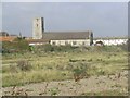
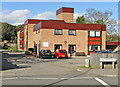
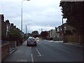
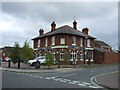
Postcode NR33 7BT defines a specific residential cluster in Norfolk covering just 1.7 hectares. This small footprint contains 1,547 residents, creating a tightly knit community where neighbours know one another. The area sits within the broader Pakefield neighbourhood, offering a tranquil environment away from the busiest roads yet close enough for essential services. Living in NR33 7BT means enjoying a bourgeois environment characterised by houses rather than high-density flats. The low population density suggests a quiet pace of life, ideal for those seeking space without significant isolation. You will find yourself surrounded by established homes with a high level of tenure security, as the majority of households own their properties outright or with a mortgage. This postcode serves as a gateway to coastal living, connecting homeowners to the wider region while maintaining a distinct local identity. The compact size of the area means that daily routines are efficient, with short travel times to retailers and schools nearby. For anyone considering homes in NR33 7BT, the combination of a contained residential zone and immediate access to amenities creates a practical and appealing living situation.
- Area Type
- Postcode
- Area Size
- 1.7 hectares
- Population
- 1547
- Population Density
- 2276 people/km²
The housing stock in NR33 7BT is almost exclusively comprised of houses, with no data suggesting a presence of flats or apartments within this specific postcode. A staggering 79% of residents are homeowners, which signals a market dominated by owner-occupied property rather than the private rental sector. If you are looking to buy homes in NR33 7BT, you are entering an area where possession and legacy matter significantly to the existing population. This high ownership rate usually means that properties are well-maintained and that the local infrastructure supports long-term habitation. The small geographic size of 1.7 hectares limits the volume of available listings, suggesting a boutique market rather than a sprawling estate. Buyers can expect to find family-sized homes suited to the median age bracket of 47 years. Because the area lacks rented stock, price fluctuations may be driven by local supply constraints rather than investment demand. Prospective buyers should consider that the neighbourhood is not designed for high-volume turnover. The dominance of houses aligns with the preferences of older adults and families, meaning you will likely encounter single-, double-, or double-family dwellings. This consistency ensures that £ values remain relatively stable compared to mixed-use areas with detached flats.
House Prices in NR33 7BT
Showing 29 properties
| Address | Type | Beds | Baths | Last Sale Price | Last Sale Date | |
|---|---|---|---|---|---|---|
| Siesta, Saxon Road, Lowestoft, NR33 7BT | Detached | 4 | 3 | £600,000 | Aug 2025 | |
| 38 Saxon Road, Lowestoft, NR33 7BT | Terraced | 4 | 1 | £320,000 | May 2025 | |
| 50 Saxon Road, Lowestoft, NR33 7BT | Semi-detached | 2 | 1 | £256,000 | May 2025 | |
| 36 Saxon Road, Lowestoft, NR33 7BT | Semi-detached | 3 | 1 | £200,000 | Sep 2023 | |
| 32 Saxon Road, Lowestoft, NR33 7BT | Semi-detached | 3 | 2 | £315,000 | Feb 2023 | |
| 52 Saxon Road, Lowestoft, NR33 7BT | Bungalow | - | - | £210,000 | Feb 2022 | |
| 54 Saxon Road, Lowestoft, NR33 7BT | Bungalow | 2 | 1 | £188,050 | Jun 2021 | |
| Stella Maris, 93A Saxon Road, Lowestoft, NR33 7BT | Detached | 4 | 2 | £360,000 | Jul 2019 | |
| 46 Saxon Road, Lowestoft, NR33 7BT | Bungalow | - | - | £160,000 | Dec 2016 | |
| Cartref, Saxon Road, Lowestoft, NR33 7BT | Semi-detached | 3 | 1 | £164,000 | Oct 2016 |
Energy Efficiency in NR33 7BT
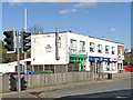
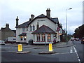
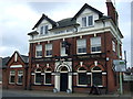
Daily life in NR33 7BT is supported by a practical selection of amenities within practical reach. Retail needs are met by five key locations: Co-op Pakefield, Aldi Gateway, and Morrisons Pakefield form the local shopping spine. A visit to Aldi Gateway or Morrisons Pakefield provides access to weekly groceries and household essentials without needing to travel far. For rail travel, five stations or entrance points are nearby, including Oulton Broad South Railway Station, which connects residents to Norwich and the wider national network. There is also air travel available via Beccles Airport, offering a convenient option for short-haul holidays or business flights. This convenience means you can shop weekly essentials or catch an intercity train without changing your routine. The density of these five railway entrances suggests a well-connected micro-network around the area. You will find that dining, leisure, and parks are integrated into the broader Pakefield sphere, even if specific venues are not named beyond the major retailers. The presence of three major supermarket chains ensures you never lack for fresh produce or budget options. Living in NR33 7BT means balancing the quiet of a small postcode with the immediate utility of five dedicated retail and transport hubs.
Amenities
Schools
Education provision for NR33 7BT residents is centred on Pakefield Primary School. This institution serves as the sole educational facility mentioned within the immediate vicinity of the postcode. The school operates as a primary institution, educating pupils from the earliest years of schooling through to the end of compulsory education before they transfer to secondary locations. Crucially, Pakefield Primary School holds an Ofsted rating of good, placing it in the upper quartile of the performance spectrum in England. There is no secondary school listed within your immediate reach, meaning older children in the 1515 age group of your neighbours will commute to other towns for further education. For families considering living in NR33 7BT, the presence of one good primary school provides a solid foundation for young children. However, the absence of a nearby secondary option requires planning for school runs as your children progress. The school location suggests integration with the local Pakefield community, as children will mix with the residents of the surrounding rural spread. You are looking at a standard primary education model where local catchment areas dictate admission. While the area lacks a secondary provision, the quality assurance provided by the 'good' rating indicates that the standard of care and instruction meets government expectations.
| Rank | School | Type | Entry gender | Ages |
|---|
Explore more schools in this area
Go to Schools tabDemographics
The community within NR33 7BT is defined by an established demographic profile. The median age stands at 47 years, with adults in the 30 to 64-year range being the most common age group. This indicates a mature population that has likely settled down in the locality, moving away from the transient student or young professional markets found elsewhere. Home ownership is overwhelmingly the norm, with 79% of residents owning their properties. This figure underscores the stability of the neighbourhood, as owners tend to invest in maintenance and longevity of their homes. The predominant ethnic group is white, reflecting the traditional character of rural Norfolk settlements. Almost all accommodation within the postcode consists of houses, confirming that you will not find terraced row living or large apartment blocks here. This homogenous housing stock caters specifically to families and individuals seeking detached or semi-detached living arrangements. The high ownership rate suggests local ties run deep, as residents are less likely to move frequently. Living in NR33 7BT therefore involves engaging with a stable cohort of homeowners who have put down roots in a specific, identifiable area.
Household Size
Accommodation Type
Tenure
Ethnic Group
Religion
Household Composition
Age
Household Deprivation
NS-SEC
Explore more demographic insights in this area
Go to Demographics tabPlanning
Planning Constraints
- Flood RiskPremium
- Ramsar Wetland SitesPremium
- Area of Outstanding Natural BeautyPremium
- Protected Nature ReservePremium
- Protected WoodlandPremium